MyTopo
Roscoe South Dakota US Topo Map
Couldn't load pickup availability
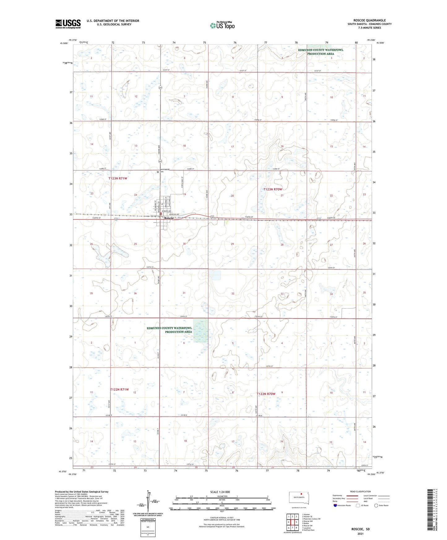
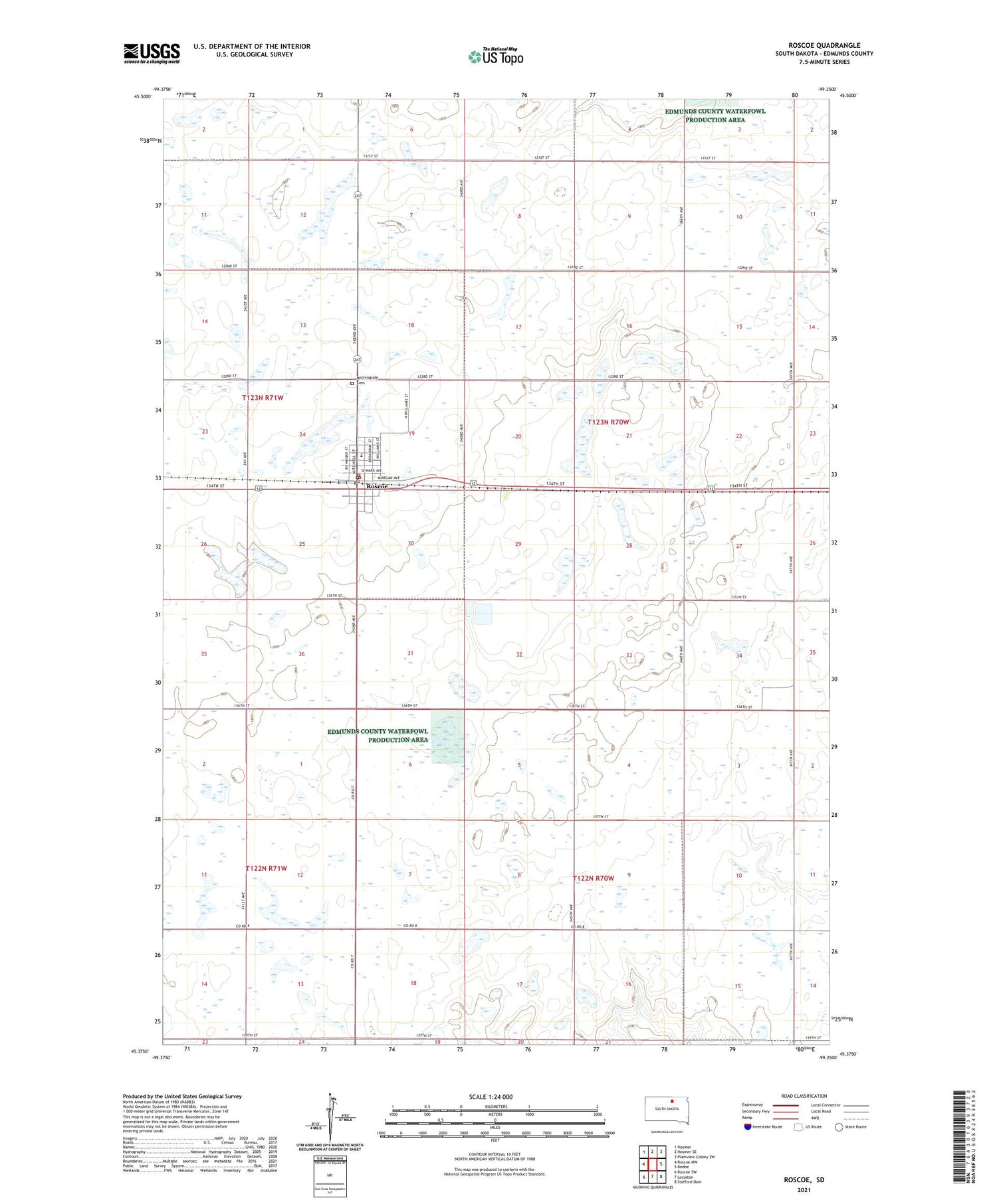
2021 topographic map quadrangle Roscoe in the state of South Dakota. Scale: 1:24000. Based on the newly updated USGS 7.5' US Topo map series, this map is in the following counties: Edmunds. The map contains contour data, water features, and other items you are used to seeing on USGS maps, but also has updated roads and other features. This is the next generation of topographic maps. Printed on high-quality waterproof paper with UV fade-resistant inks.
Quads adjacent to this one:
West: Roscoe NW
Northwest: Hosmer
North: Hosmer SE
Northeast: Plainview Colony SW
East: Beebe
Southeast: Stafford Dam
South: Loyalton
Southwest: Roscoe SW
Contains the following named places: City of Roscoe, Edmunds Central Elementary School, Edmunds Central High School, Edmunds Central Library, Edmunds Central Middle School, Morningside Cemetery, Roscoe, Roscoe City Hall, Roscoe Post Office, Roscoe Volunteer Fire Department, Township of Bryant, Township of Montpelier, ZIP Code: 57471