MyTopo
Sears Dam South Dakota US Topo Map
Couldn't load pickup availability
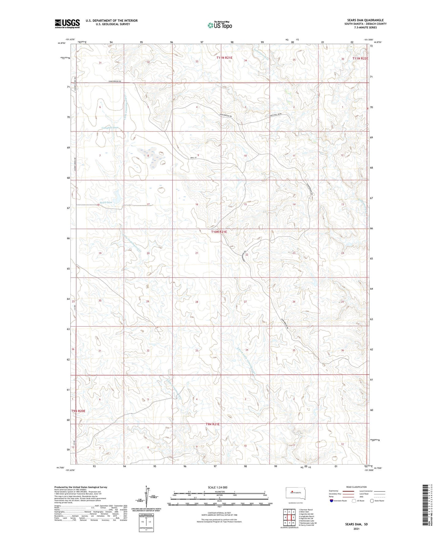
2021 topographic map quadrangle Sears Dam in the state of South Dakota. Scale: 1:24000. Based on the newly updated USGS 7.5' US Topo map series, this map is in the following counties: Ziebach. The map contains contour data, water features, and other items you are used to seeing on USGS maps, but also has updated roads and other features. This is the next generation of topographic maps. Printed on high-quality waterproof paper with UV fade-resistant inks.
Quads adjacent to this one:
West: Longbrake Ranch
Northwest: Diermier Ranch
North: Miller Dam
Northeast: High Elk Hill NW
East: High Elk Hill SW
Southeast: Cherry Creek NW
South: Rattlesnake Lake NE
Southwest: Rattlesnake Lake
Contains the following named places: C Bennett Dam, Campbell Dam, Holmes Ranch, Knight Ranch, Mitchell Ranch, R Fields Number 4 Dam, R Fields Number 5 Dam, Sears Dam, Sunnybrook Church, Unorganized Territory of South Ziebach, W Holmes Number 1 Dam, W Holmes Number 2 Dam, Wall Ranch