MyTopo
Wessington South Dakota US Topo Map
Couldn't load pickup availability
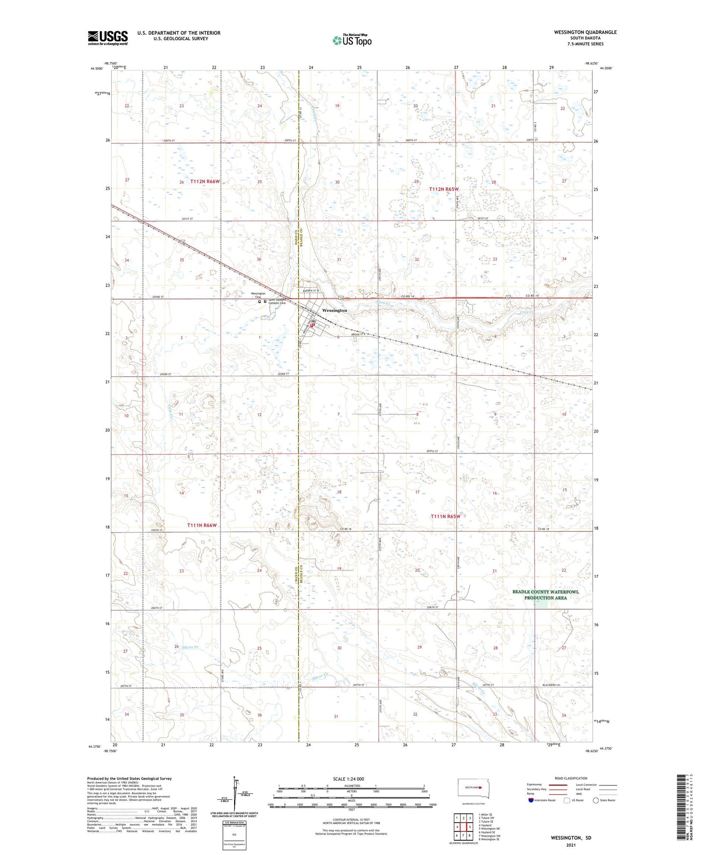
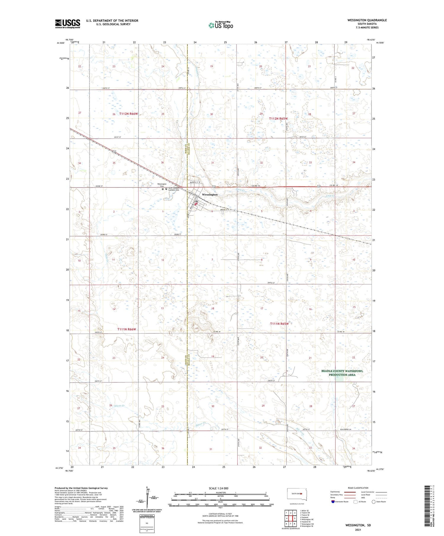
2021 topographic map quadrangle Wessington in the state of South Dakota. Scale: 1:24000. Based on the newly updated USGS 7.5' US Topo map series, this map is in the following counties: Beadle, Hand. The map contains contour data, water features, and other items you are used to seeing on USGS maps, but also has updated roads and other features. This is the next generation of topographic maps. Printed on high-quality waterproof paper with UV fade-resistant inks.
Quads adjacent to this one:
West: Vayland
Northwest: Miller SE
North: Tulare SW
Northeast: Tulare SE
East: Wessington NE
Southeast: Wessington SE
South: Wessington SW
Southwest: Vayland SE
Contains the following named places: Bothwell School, City of Wessington, Franklin School, Pearl Creek, Rogers School, Saint Josephs Catholic Cemetery, Township of Wessington, Wessington, Wessington Ambulance Service, Wessington Cemetery, Wessington City Hall, Wessington Fire Department, Wessington Post Office, Wessington Public Library, Wessington Rural Fire Department, ZIP Code: 57381