MyTopo
Appleton Tennessee US Topo Map
Couldn't load pickup availability
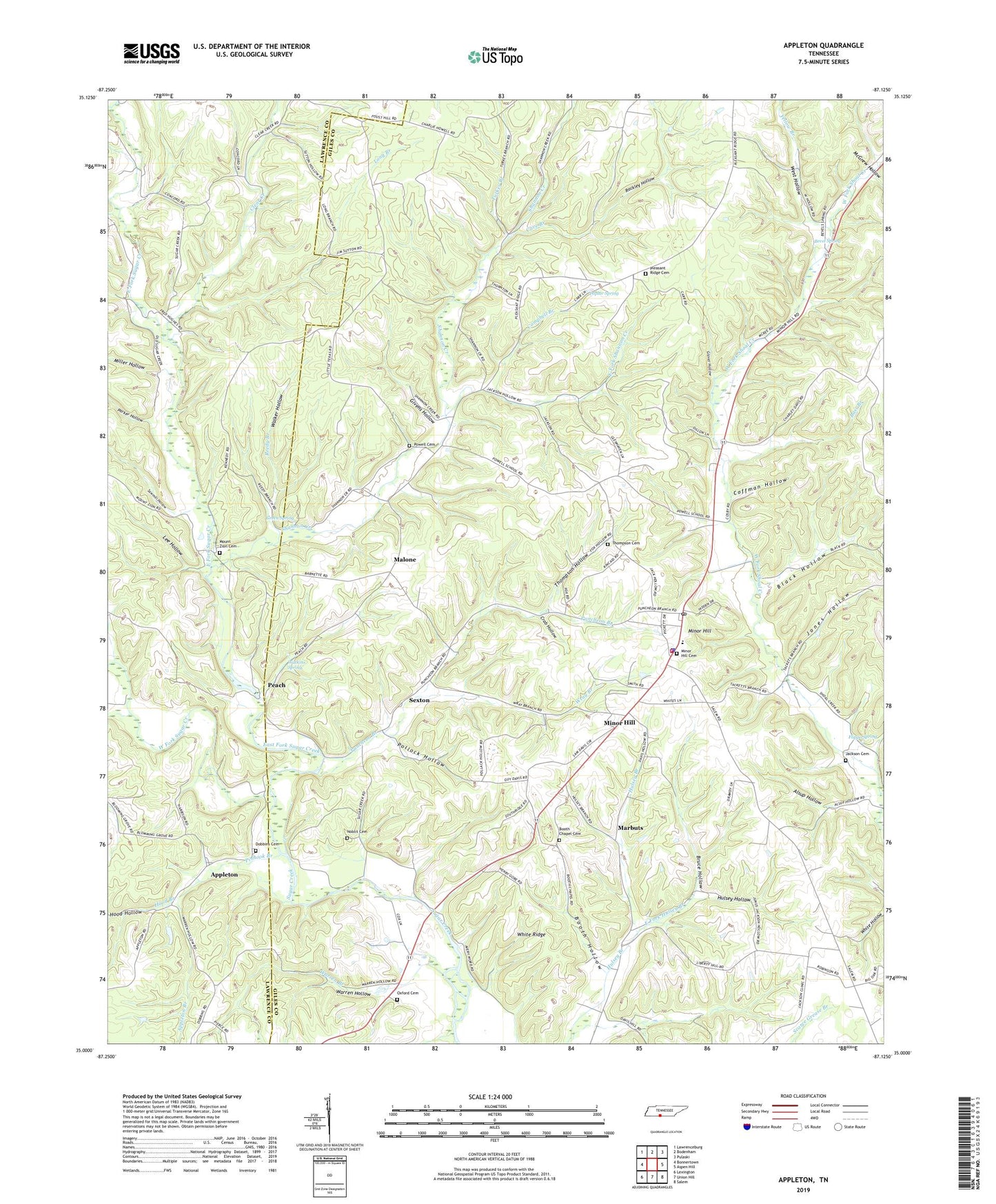
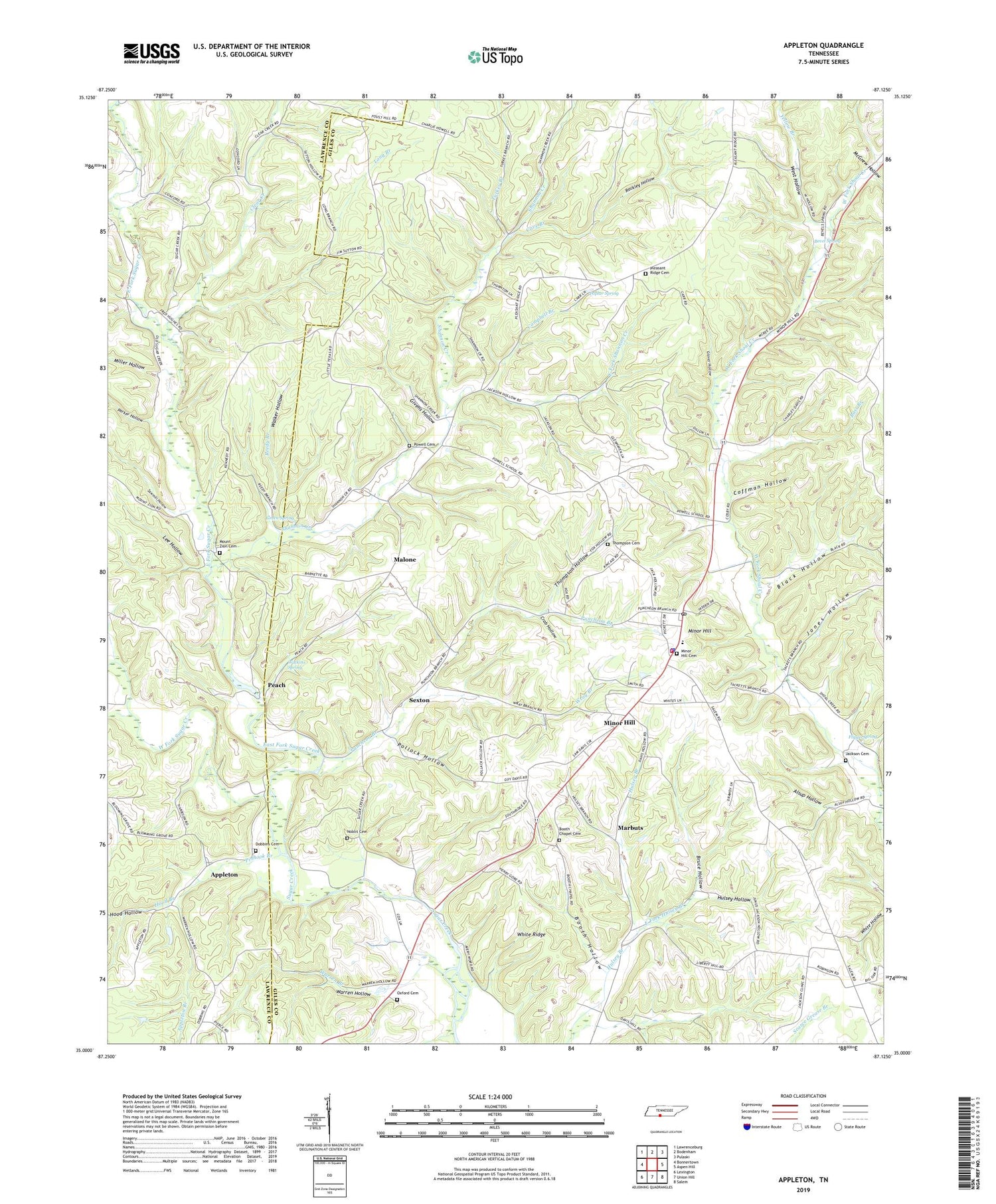
2019 topographic map quadrangle Appleton in the state of Tennessee. Scale: 1:24000. Based on the newly updated USGS 7.5' US Topo map series, this map is in the following counties: Giles, Lawrence. The map contains contour data, water features, and other items you are used to seeing on USGS maps, but also has updated roads and other features. This is the next generation of topographic maps. Printed on high-quality waterproof paper with UV fade-resistant inks.
Quads adjacent to this one:
West: Bonnertown
Northwest: Lawrenceburg
North: Bodenham
Northeast: Pulaski
East: Aspen Hill
Southeast: Salem
South: Union Hill
Southwest: Lexington
Contains the following named places: Alsup Hollow, Appleton, Appleton Church, Appleton School, Bass Branch, Bevel Spring, Black Hollow, Booth Chapel, Booth Chapel Cemetery, Booth Hollow, Bruce Hollow, Bullington Store, Campbell Branch, Cave Branch, City of Minor Hill, Clear Creek, Coffman Hollow, Commissioner District 2, Concord School, Crab Hollow, Dobbins Cemetery, East Fork Hulsey Branch, East Fork Shannon Creek, East Fork Sugar Creek, Flippo Spring, Givens Hollow, Glover Hollow, Green Spring, Haw, Hood Branch, Hood Hollow, Hulsey Hollow, Jackson Cemetery, Jones Hollow, Lee Hollow, Liberty Chapel, Liberty Hill School, Long Branch, Malone, Marbuts, McGrew Hollow, Miller Hollow, Minor Hill, Minor Hill Cemetery, Minor Hill Division, Minor Hill First Baptist Church, Minor Hill Police Department, Minor Hill Post Office, Minor Hill School, Minor Hill Volunteer Fire Department, Mount Zion Cemetery, Mount Zion Church, New Hope Branch, Noblit Cemetery, Oxford Cemetery, Parker Hollow, Peach, Pinhook Branch, Pleasant Ridge Cemetery, Pleasant Ridge Church, Pollock Hollow, Poplar Spring, Powell Cemetery, Powell School, Puncheon Branch, Puncheon Church, Puncheon School, Rackley Hollow, Reedy Branch, Sam Davis Monument, Sawmill Hollow, Sexton, Shannon Creek, Sugar Spring, Tanyard Branch, Thomas Store, Thompson Cemetery, Thompson Hollow, Thorne Store, Turkey Branch, Walker Hollow, Warren Hollow, Watkins Spring, West Fork Sugar Creek, West Hollow, White Ridge, Williams Store, Wray Branch, Yellow Branch, Zion School, ZIP Codes: 38460, 38473