MyTopo
Bolivar West Tennessee US Topo Map
Couldn't load pickup availability
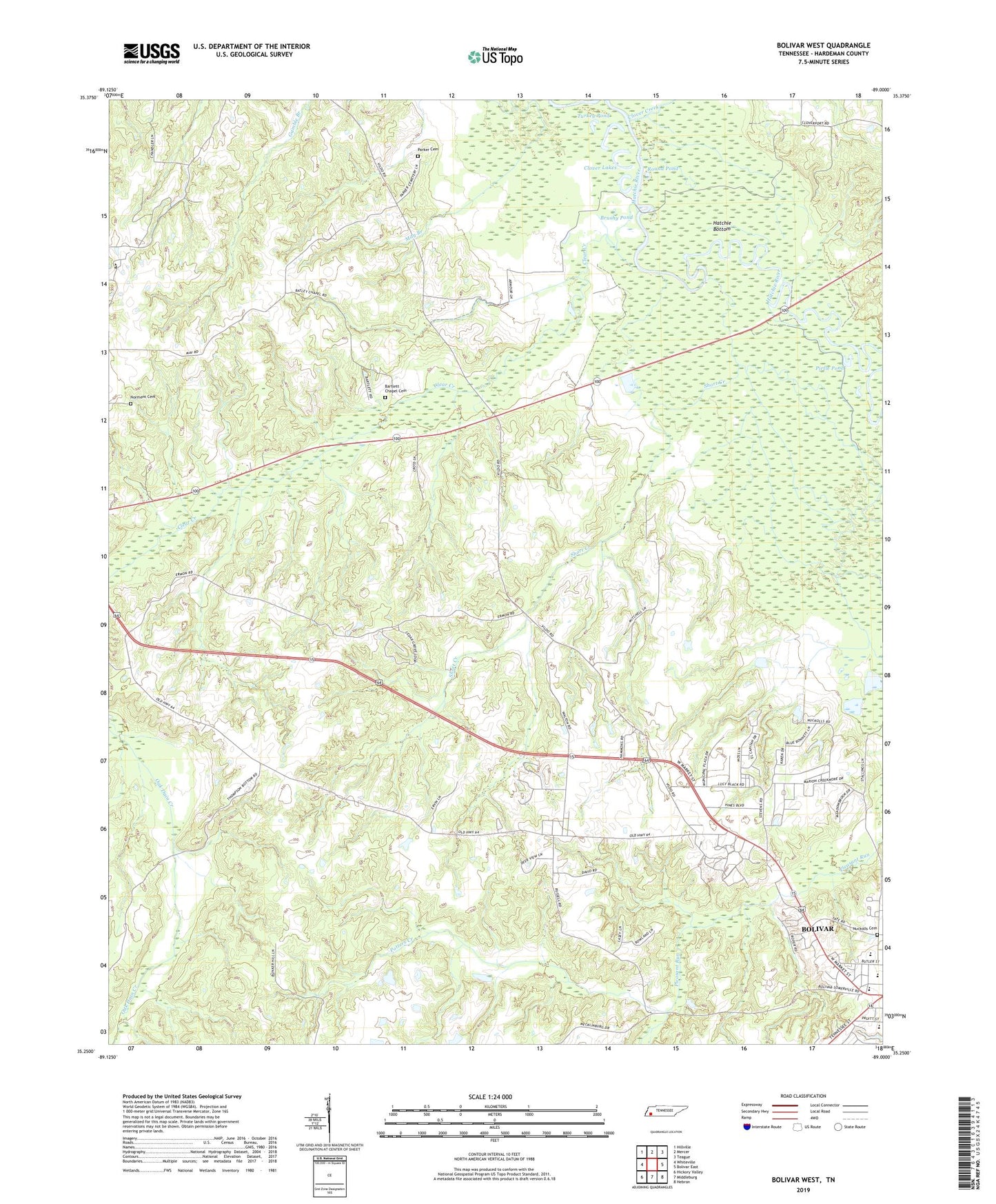
2019 topographic map quadrangle Bolivar West in the state of Tennessee. Scale: 1:24000. Based on the newly updated USGS 7.5' US Topo map series, this map is in the following counties: Hardeman. The map contains contour data, water features, and other items you are used to seeing on USGS maps, but also has updated roads and other features. This is the next generation of topographic maps. Printed on high-quality waterproof paper with UV fade-resistant inks.
Quads adjacent to this one:
West: Whiteville
Northwest: Hillville
North: Mercer
Northeast: Teague
East: Bolivar East
Southeast: Hebron
South: Middleburg
Southwest: Hickory Valley
Contains the following named places: Bartlett Chapel, Bartlett Chapel Cemetery, Bethelehem Baptist Church, Bethlehem Church, Bethlehem School, Bolivar Church of Christ, Bolivar Elementary School, Bolivar Junior High School, Brushy Pond, Central High School, City of Bolivar, Clear Creek, Clover Creek, Clover Lakes, Commissioner District 1, Green Grove Church, Green Grove School, Hardeman County Golf Course, Hardeman County Landfill, Norment Cemetery, Nuckolls Cemetery, Oak Dain Creek, Parker Cemetery, Parrans Chapel, Pirtle Pond, Potters Creek, Round Pond, Saint Marys Catholic Church, Short Creek, Turkey Pond, Western Mental Health Institute