MyTopo
Sweetwater Tennessee US Topo Map
Couldn't load pickup availability
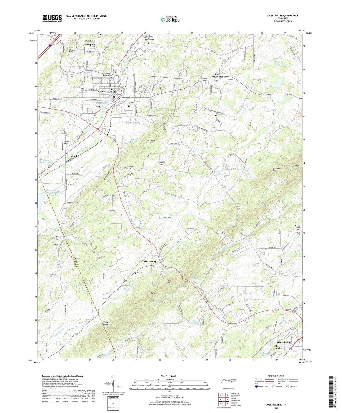
2019 topographic map quadrangle Sweetwater in the state of Tennessee. Scale: 1:24000. Based on the newly updated USGS 7.5' US Topo map series, this map is in the following counties: Monroe, McMinn. The map contains contour data, water features, and other items you are used to seeing on USGS maps, but also has updated roads and other features. This is the next generation of topographic maps. Printed on high-quality waterproof paper with UV fade-resistant inks.
Quads adjacent to this one:
West: Niota
Northwest: Pattie Gap
North: Philadelphia
Northeast: Loudon
East: Madisonville
Southeast: Mount Vernon
South: Englewood
Southwest: Athens
Contains the following named places: Alta Vista Presbyterian Church, Ballard Mill Lead Mine Pond, Ballard Mill Settlement Dam, Bell Spring, Blackoak Ridge, Browder Memorial United Methodist Church, Brown Elementary School, Burls Chapel Freewill Baptist Church, Cannon Spring, Christianburg, Christianburg Baptist Church, Christianburg School, Christianburg Volunteer Fire Department, City of Sweetwater, Commissioner District 1, Craighead Caverns, Craighead Lake, Dickey Cemetery, Dugan Spring, East Sweetwater, Evalika School, Ewing Mine, Fairview Tabernacle, First Assembly of God Church, First Baptist Church of Sweetwater, First Presbyterian Church, First United Church of Christ, Forkner Chapel, Forkners Chapel Cemetery, Gaines School, Greenbriar Cemetery, Heiskell Cemetery, Heiskell Mine, High Point School, Hiwassee Knobs, Howard Spring, Kile Springs, Kilpatrick Spring, Kinser Pond, Lee Chapel Church, Liberality Church, Liberality School, Madisonville Lookout Tower, Monroe County Airport, Mount Bethel Baptist Church, New Bethany Church, North Point Cumberland Presbyterian Church, North Sweetwater Baptist Church, Northpoint, Oakland Church, Outpost Mission Church, Place for the Gospel Baptist Church, Roy Cemetery, Roy Knob, Safety Hollow, Saint Paul Church, Sequoyah Estates, Sharps Chapel School, Sherril Heights, Sweetwater, Sweetwater Church of Christ, Sweetwater Church of God, Sweetwater Church of the Nazarene, Sweetwater City Hall, Sweetwater Creek Watershed Dam Number Fifteen, Sweetwater Creek Watershed Dam Number One, Sweetwater Creek Watershed Number One Reservoir, Sweetwater Division, Sweetwater Elementary School, Sweetwater Fire Department, Sweetwater Fire Department Station 1, Sweetwater High School, Sweetwater Hospital, Sweetwater Industrial Park, Sweetwater Junior High School, Sweetwater Police Department, Sweetwater Post Office, Sweetwater Public Library, Sweetwater United Methodist Church, Sweetwater Valley Memorial Park, Tennessee Military Institute, Veterans Camp, Vintage Field, Watson Chapel, WDEH-AM (Sweetwater), WDEH-FM (Sweetwater), West View Cemetery, Wood, WRKQ-AM (Madisonville), ZIP Code: 37874