MyTopo
Antelope Creek NE Texas US Topo Map
Couldn't load pickup availability
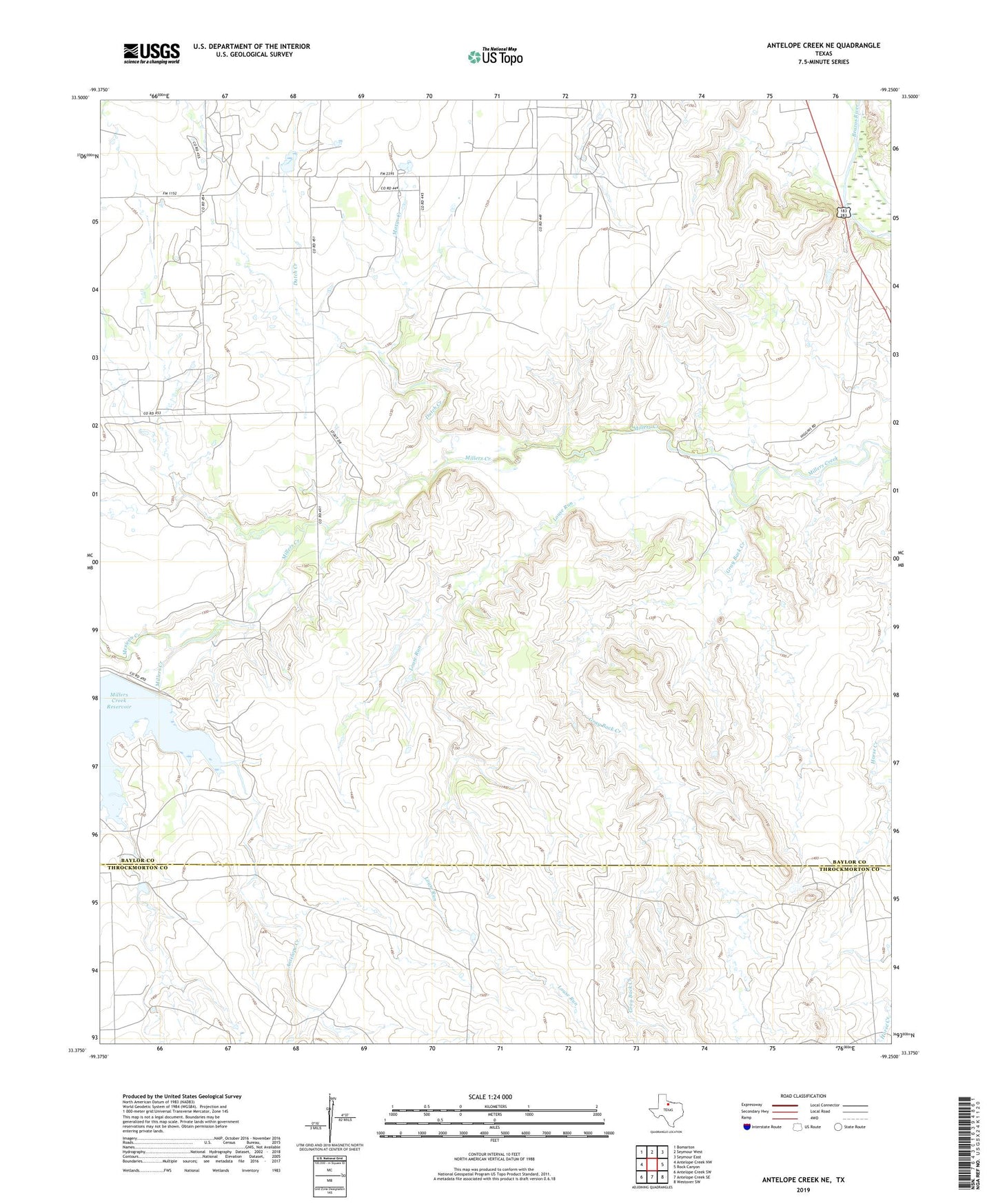
2019 topographic map quadrangle Antelope Creek NE in the state of Texas. Scale: 1:24000. Based on the newly updated USGS 7.5' US Topo map series, this map is in the following counties: Baylor, Throckmorton. The map contains contour data, water features, and other items you are used to seeing on USGS maps, but also has updated roads and other features. This is the next generation of topographic maps. Printed on high-quality waterproof paper with UV fade-resistant inks.
Quads adjacent to this one:
West: Antelope Creek NW
Northwest: Bomarton
North: Seymour West
Northeast: Seymour East
East: Rock Canyon
Southeast: Westover SW
South: Antelope Creek SE
Southwest: Antelope Creek SW
Contains the following named places: Antelope Creek, Dutch Creek, Gray Back Creek, Louse Run, Marys Creek, Mexican Creek, Millers Creek Dam