MyTopo
Brackettville Texas US Topo Map
Couldn't load pickup availability
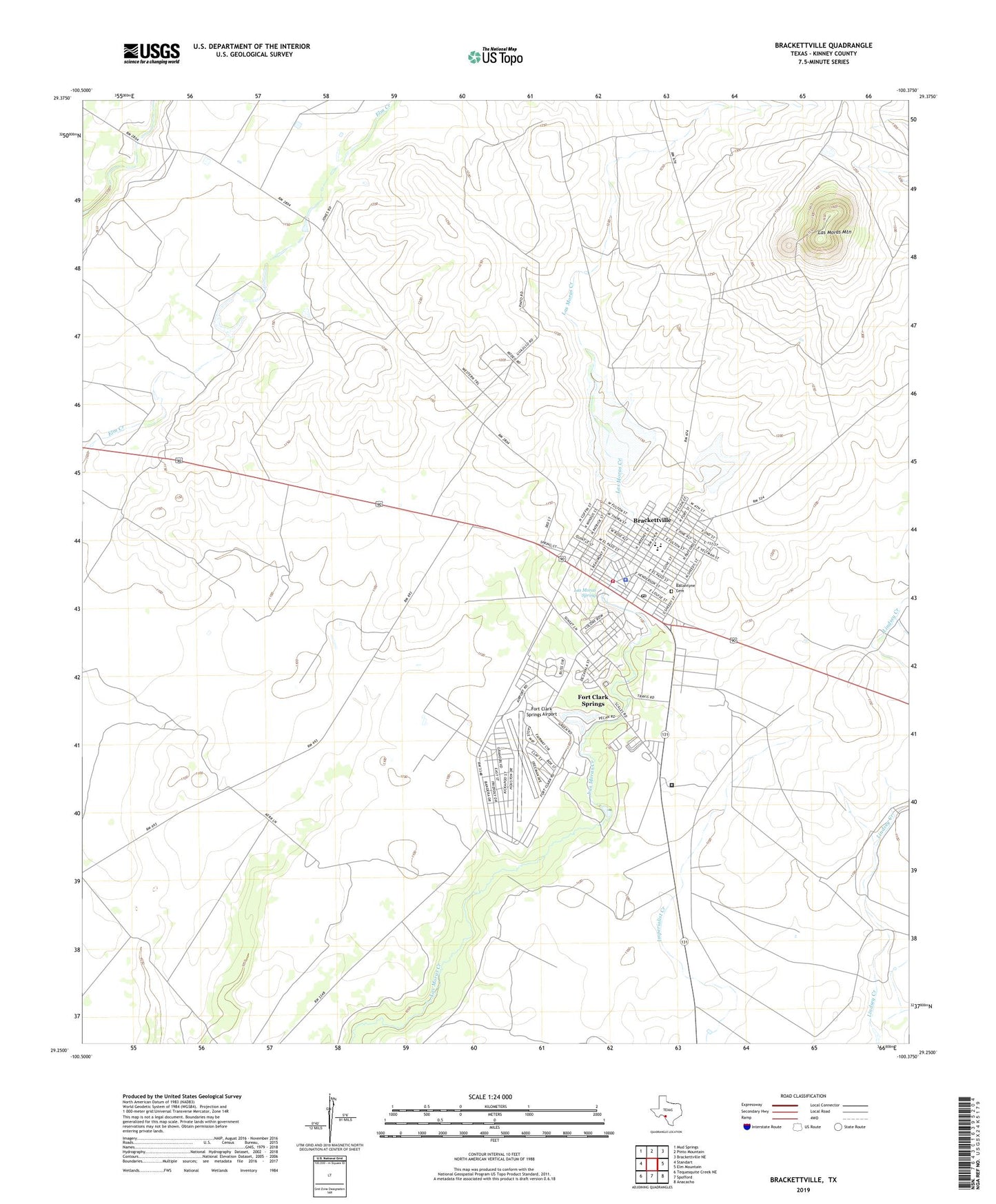
2019 topographic map quadrangle Brackettville in the state of Texas. Scale: 1:24000. Based on the newly updated USGS 7.5' US Topo map series, this map is in the following counties: Kinney. The map contains contour data, water features, and other items you are used to seeing on USGS maps, but also has updated roads and other features. This is the next generation of topographic maps. Printed on high-quality waterproof paper with UV fade-resistant inks.
Quads adjacent to this one:
West: Standart
Northwest: Mud Springs
North: Pinto Mountain
Northeast: Brackettville NE
East: Elm Mountain
Southeast: Anacacho
South: Spofford
Southwest: Tequesquite Creek NE
Contains the following named places: Ballantyne Cemetery, Brackettville, Brackettville City Hall, Brackettville Division, Brackettville Post Office, Brackettville Volunteer Fire Department, Carver School, City of Brackettville, Fort Clark Historic District, Fort Clark Springs, Fort Clark Springs Airport, Fort Clark Springs Census Designated Place, Kinney County, Kinney County Cemetery, Kinney County Constable's Office, Kinney County Detention Center, Kinney County Emergency Medical Services, Kinney County Sheriff's Office, Las Moras Mountain, Las Moras Spring, Masonic Cemetery, Old Fort Clark Guardhouse Museum, Saint Mary Magdalene Catholic Cemetery, Seminole Indian Scout Cemetery, Soil Conservation Service Site 1 Dam, Soil Conservation Service Site 1 Reservoir, Soil Conservation Service Site 2 Dam, Soil Conservation Service Site 2 Reservoir, United States Border Patrol Station, Veterans of Foreign Wars Cemetery