MyTopo
Chupadera Creek Texas US Topo Map
Couldn't load pickup availability
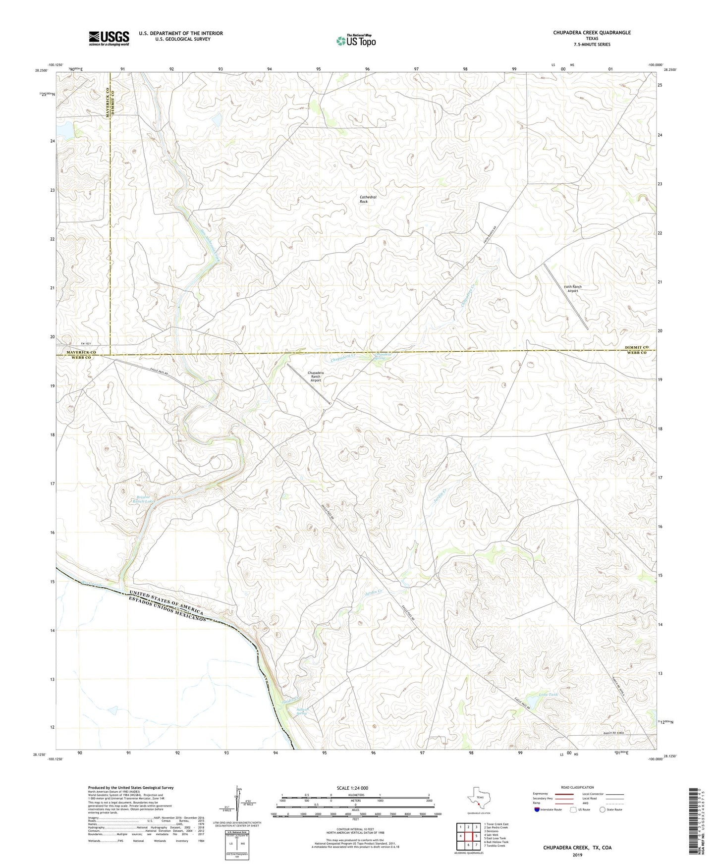
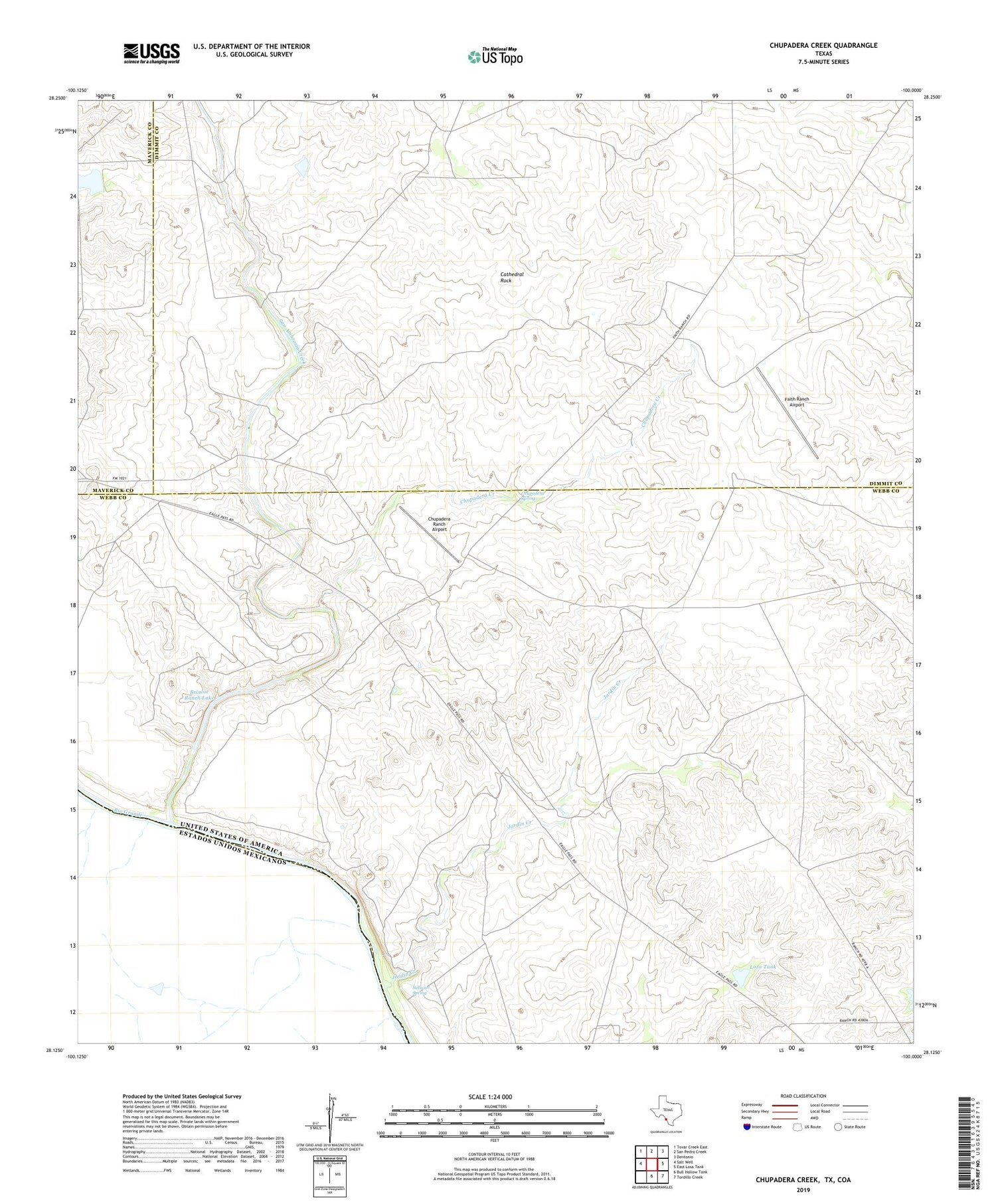
2019 topographic map quadrangle Chupadera Creek in the state of Texas. Scale: 1:24000. Based on the newly updated USGS 7.5' US Topo map series, this map is in the following counties: Webb, Dimmit, Maverick. The map contains contour data, water features, and other items you are used to seeing on USGS maps, but also has updated roads and other features. This is the next generation of topographic maps. Printed on high-quality waterproof paper with UV fade-resistant inks.
Quads adjacent to this one:
West: Salt Well
Northwest: Tovar Creek East
North: San Pedro Creek
Northeast: Dentonio
East: East Losa Tank
Southeast: Tordillo Creek
South: Bull Hollow Tank
Contains the following named places: Briscoe Ranch Dam, Briscoe Ranch Lake, Cathedral Rock, Chupadera Creek, Chupadera Ranch, Chupadera Ranch Airport, Chupadera Spring, Faith Ranch Airport, Jardin Creek, Loza Tank, San Ambrosia Creek, Sullivan Spring