
MyTopo
Citrus City Texas US Topo Map
Couldn't load pickup availability
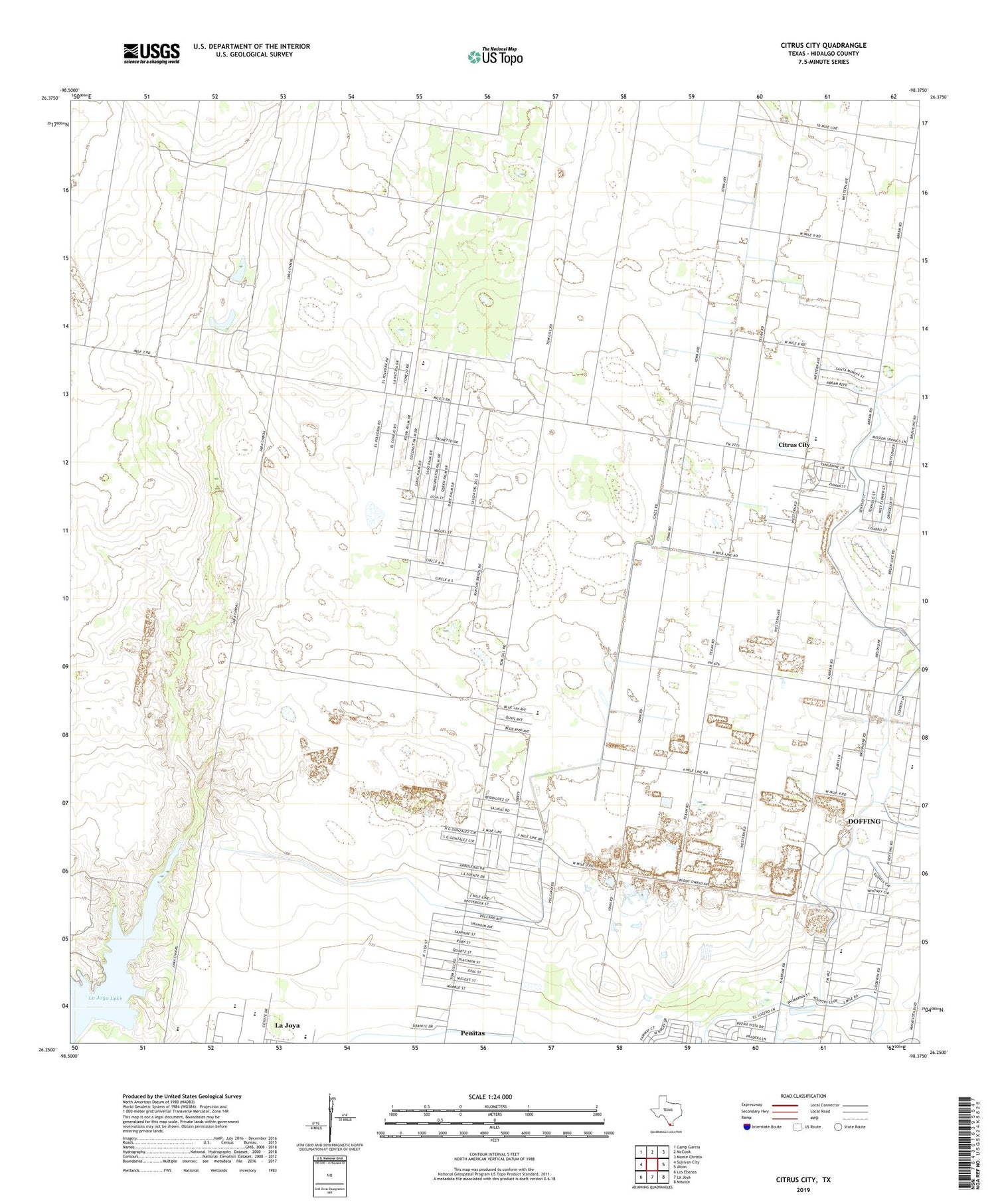
2019 topographic map quadrangle Citrus City in the state of Texas. Scale: 1:24000. Based on the newly updated USGS 7.5' US Topo map series, this map is in the following counties: Hidalgo. The map contains contour data, water features, and other items you are used to seeing on USGS maps, but also has updated roads and other features. This is the next generation of topographic maps. Printed on high-quality waterproof paper with UV fade-resistant inks.
Quads adjacent to this one:
West: Sullivan City
Northwest: Camp Garcia
North: McCook
Northeast: Monte Christo
East: Alton
Southeast: Mission
South: La Joya
Southwest: Los Ebanos
Contains the following named places: Abram North Colonia, Acevedo Number 3 Colonia, Basham Number 12 Colonia, Basham Number 13 Colonia, Basham Number 16 Colonia, Celso Colonia, Citrus City, Citrus City Census Designated Place, City of La Joya, City of Penitas, Daniel Ozuna Colonia, Doffing, Doffing Census Designated Place, El Flaco Chiquito Colonia, El Veleno Ranch, Elodia R Chapa Elementary School, Enrique Bazan Colonia, Goodwin Heights Number 1 Colonia, Henry B Gonzales Elementary School, Hidalgo County Water District Number 16, Jimmy Carter High School, Juarez - Lincoln High School, Kountry Hill Estates Colonia, La Joya Creek, La Joya Dam, La Joya Lake, La Joya Senior High School, La Lomita Mission, La Morita Windmill, La Paloma Site Colonia, Lorenzo de Zavala Middle School, Mary K Acres Colonia, Munoz Estates Colonia, Orleander Estates Colonia, Palmarina Colonia, Puerta Blanca Colonia, Ramona Colonia, Reina Colonia, Salida del Sol Estates Census Designated Place, Salida del Sol Estates Colonia, Santa Rita Ranch, Sullivan City Division, Tabasco Oil and Gas Field, Western Estates Number 1 Colonia, ZIP Code: 78576


