
MyTopo
Cuervo Creek Texas US Topo Map
Couldn't load pickup availability
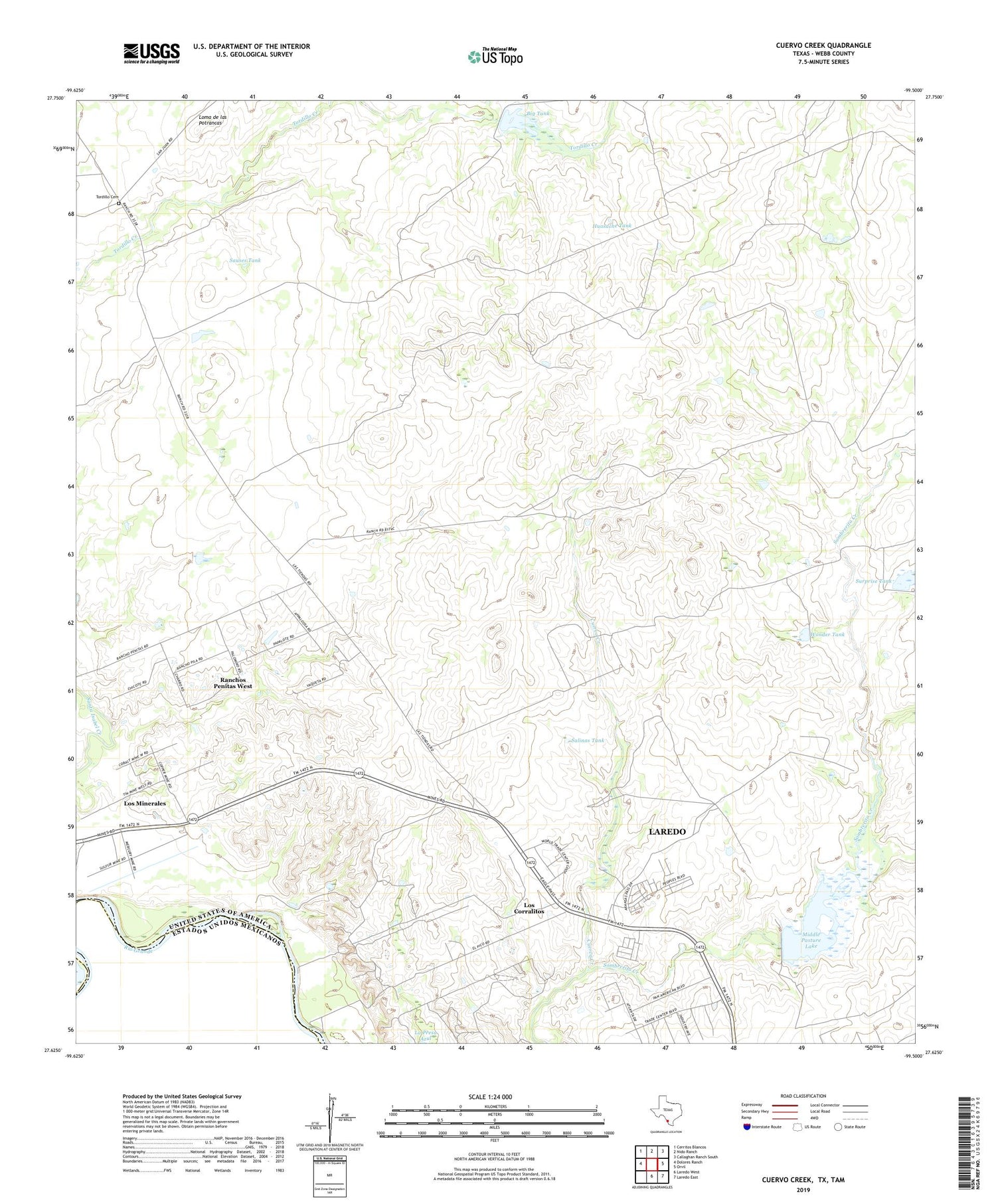
2019 topographic map quadrangle Cuervo Creek in the state of Texas. Scale: 1:24000. Based on the newly updated USGS 7.5' US Topo map series, this map is in the following counties: Webb. The map contains contour data, water features, and other items you are used to seeing on USGS maps, but also has updated roads and other features. This is the next generation of topographic maps. Printed on high-quality waterproof paper with UV fade-resistant inks.
Quads adjacent to this one:
West: Dolores Ranch
Northwest: Cerritos Blancos
North: Nido Ranch
Northeast: Callaghan Ranch South
East: Orvil
Southeast: Laredo East
South: Laredo West
Contains the following named places: Antonio Santos Colonia, Big Tank, Cuervo Creek, Huasache Tank, Loma de las Potrancas, Los Corralitos Census Designated Place, Los Corralitos Colonia, Los Minerales Census Designated Place, Los Minerales Colonia, Middle Pasture Lake, Middle Pasture Lake Dam, Old Ranch Windmill, Ranchos Penitas West, Ranchos Penitas West Census Designated Place, Retama Lake Dam, Retama Ranch, Salinas Tank, Santa Elena Ranch, Sauses Tank, Surprise Tank, Tiendas Windmill, Tordillo Cemetery, Wonder Tank


