MyTopo
Dalhart West Texas US Topo Map
Couldn't load pickup availability
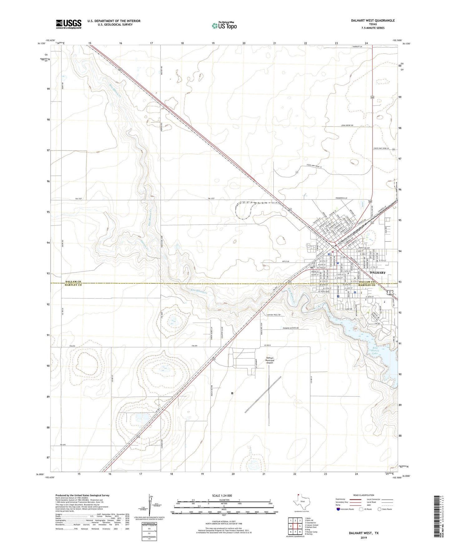
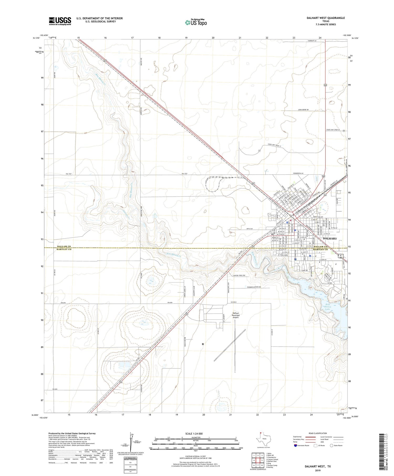
2019 topographic map quadrangle Dalhart West in the state of Texas. Scale: 1:24000. Based on the newly updated USGS 7.5' US Topo map series, this map is in the following counties: Dallam, Hartley. The map contains contour data, water features, and other items you are used to seeing on USGS maps, but also has updated roads and other features. This is the next generation of topographic maps. Printed on high-quality waterproof paper with UV fade-resistant inks.
Quads adjacent to this one:
West: Canyon School
Northwest: Bolin
North: Bolin NE
Northeast: Chamberlin
East: Dalhart East
Southeast: Hartley
South: Pardue Camp
Southwest: King
Contains the following named places: Allyn Finch Intermediate School, Antioch Baptist Church, Calvary Assembly of God Church, Carrizo Creek, Central United Methodist Church, City of Dalhart, Coon Memorial Hospital, Coon Memorial Hospital and Home, Dalhart, Dalhart Army Air Field, Dalhart City Hall, Dalhart Elementary School, Dalhart Emergency Medical Services, Dalhart Intermediate School, Dalhart Junior High School, Dalhart Municipal Airport, Dalhart Police Department, Dalhart Post Office, Dalhart Volunteer Fire Department, Dallam - Hartley County Jail, Dallam County Sheriff's Office, First Presbyterian Church, Hartley County Sheriff's Office, KXIT-AM (Dalhart), KXIT-FM (Dalhart), Lake Rita Blanca State Park Trail, Lakeview United Methodist Church, Lincoln Street Baptist Church, Memorial Park Cemetery, New Light Baptist Church, Rita Blanca Lake, Rita Blanca State Park, Saint Anthonys Catholic Church, Seventh Day Adventist Church, Texas Department of Criminal Justice Dalhart Unit, XIT Secondary School, ZIP Code: 79022