MyTopo
Del Rio SE Texas US Topo Map
Couldn't load pickup availability
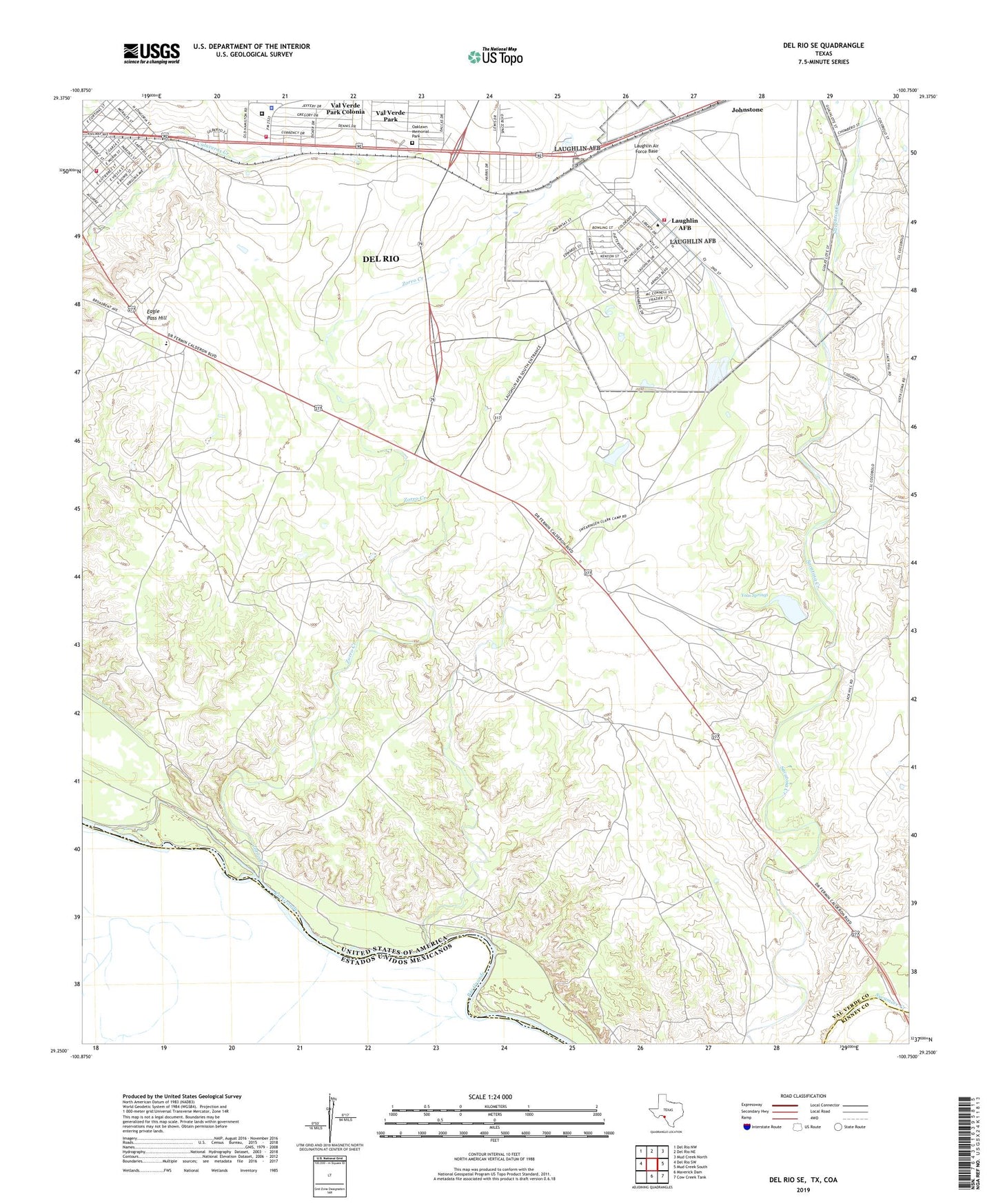
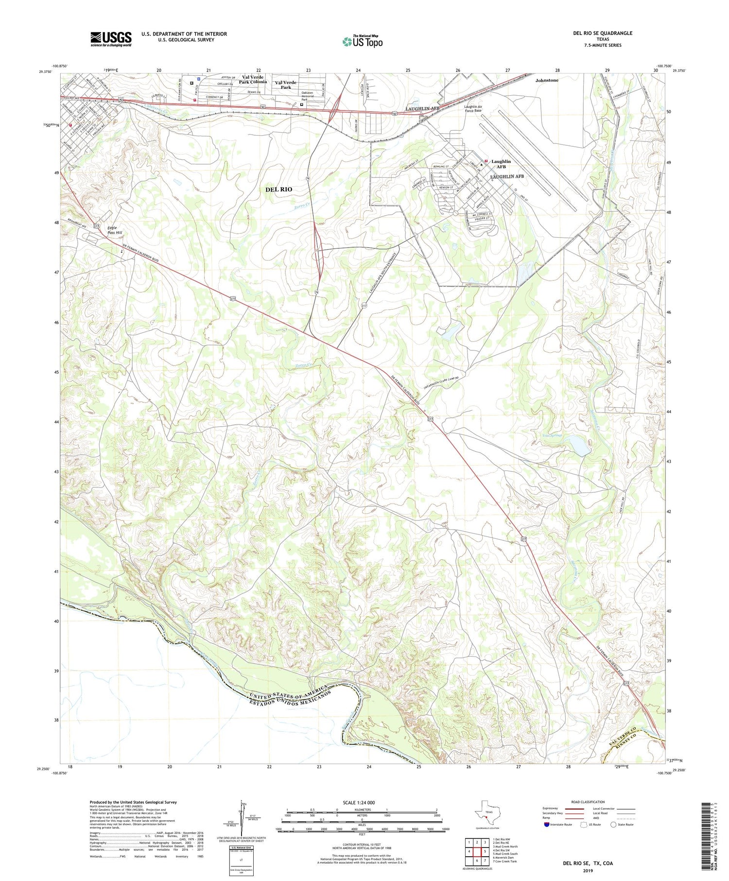
2019 topographic map quadrangle Del Rio SE in the state of Texas. Scale: 1:24000. Based on the newly updated USGS 7.5' US Topo map series, this map is in the following counties: Val Verde, Kinney. The map contains contour data, water features, and other items you are used to seeing on USGS maps, but also has updated roads and other features. This is the next generation of topographic maps. Printed on high-quality waterproof paper with UV fade-resistant inks.
Quads adjacent to this one:
West: Del Rio SW
Northwest: Del Rio NW
North: Del Rio NE
Northeast: Mud Creek North
East: Mud Creek South
Southeast: Cow Creek Tank
South: Maverick Dam
Contains the following named places: 47th Medical Group Laughlin Air Force Base, 78843, Amistad Ambulance Transports, Del Rio Fire and Rescue Station 3, Eagle Pass Hill, KWMC-AM (Del Rio), Laughlin Air Force Base, Laughlin Air Force Base Census Designated Place, Oaklawn Memorial Park, United States Border Patrol Station, Val Verde County Rural Volunteer Fire Department Station 2, Val Verde County Sheriff's Office, Val Verde Park, Val Verde Park Census Designated Place, Val Verde Park Colonia, Val Verde Park Number 2 Colonia, Yoas Springs, Zorro Creek