MyTopo
Denver City Texas US Topo Map
Couldn't load pickup availability
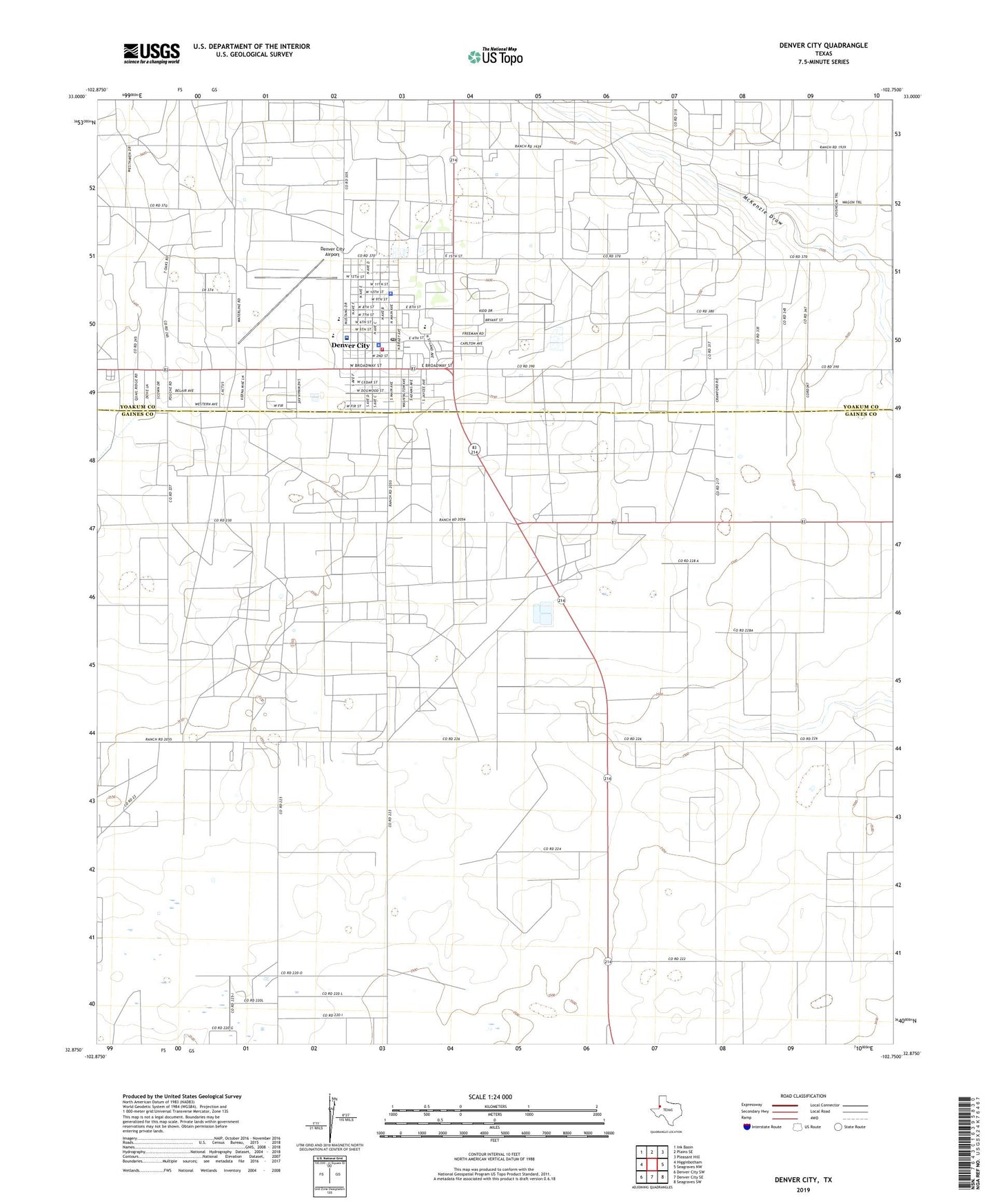
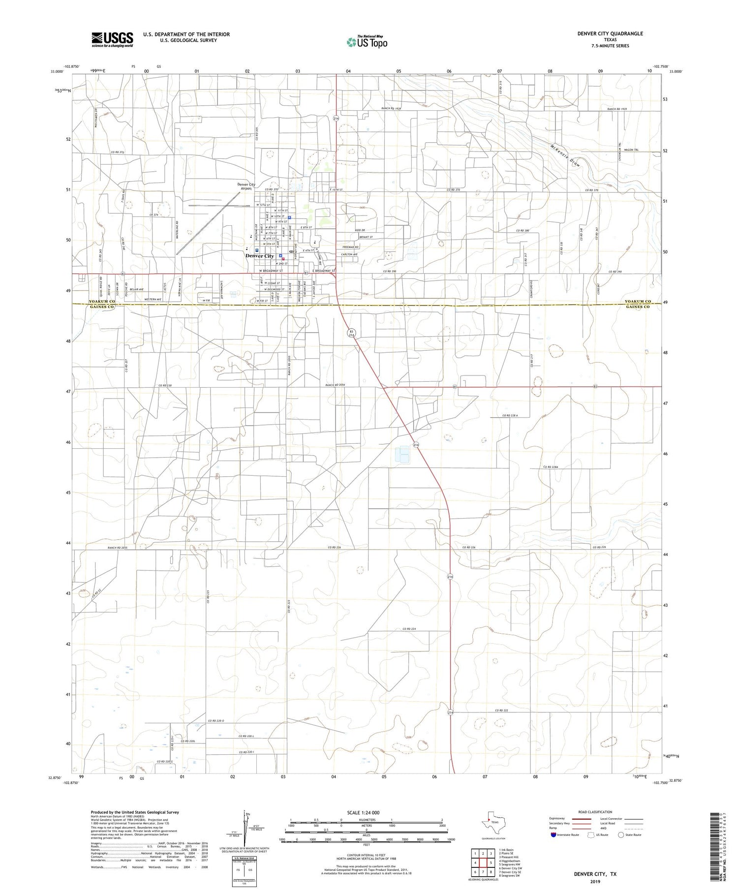
2019 topographic map quadrangle Denver City in the state of Texas. Scale: 1:24000. Based on the newly updated USGS 7.5' US Topo map series, this map is in the following counties: Gaines, Yoakum. The map contains contour data, water features, and other items you are used to seeing on USGS maps, but also has updated roads and other features. This is the next generation of topographic maps. Printed on high-quality waterproof paper with UV fade-resistant inks.
Quads adjacent to this one:
West: Higginbotham
Northwest: Ink Basin
North: Plains SE
Northeast: Pleasant Hill
East: Seagraves NW
Southeast: Seagraves SW
South: Denver City SE
Southwest: Denver City SW
Contains the following named places: Abundant Life Fellowship, Bethel Baptist Church, Church of the Nazarene, Denver City, Denver City Airport, Denver City City Hall, Denver City Emergency Medical Service, Denver City Fire Marshal's Office, Denver City High School, Denver City Historical Museum, Denver City Intermediate School, Denver City Junior High School, Denver City Memorial Park, Denver City Police Department, Denver City Post Office, Denver City Volunteer Fire Department, El Calvario Assembly of God Church, Excalibur Adult Education School, Faith Baptist Church, Kelley Elementary School, Mustang Stadium, Saint Williams Catholic Church, Town of Denver City, Trinity Baptist Church, Yoakum County Hospital, Yoakum County Sheriff's Office Substation, ZIP Code: 79323