
MyTopo
Dolores Ranch Texas US Topo Map
Couldn't load pickup availability
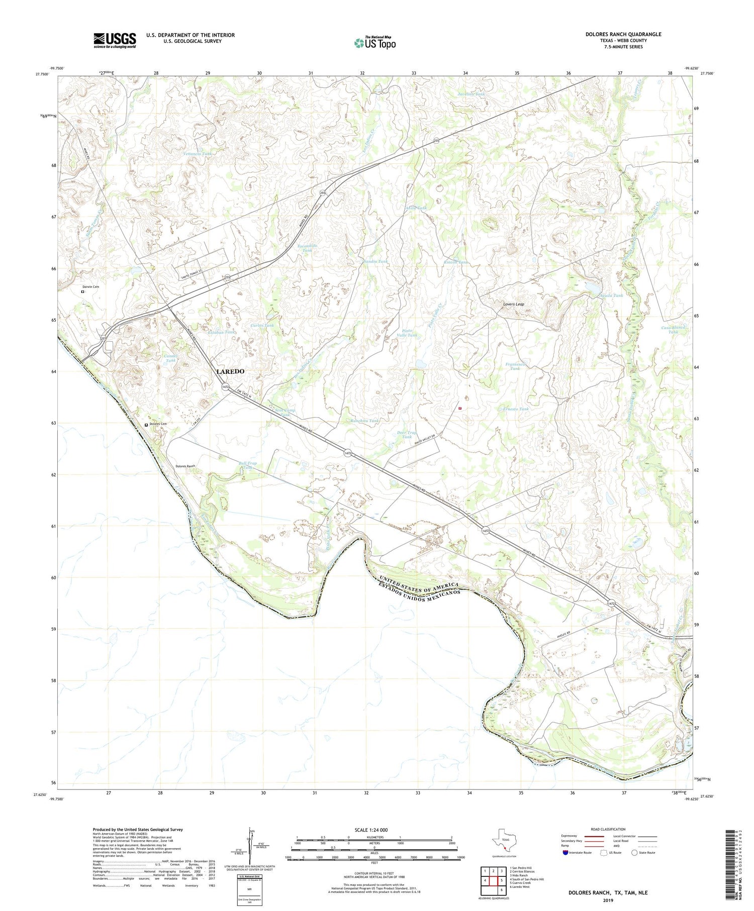
2019 topographic map quadrangle Dolores Ranch in the state of Texas. Scale: 1:24000. Based on the newly updated USGS 7.5' US Topo map series, this map is in the following counties: Webb. The map contains contour data, water features, and other items you are used to seeing on USGS maps, but also has updated roads and other features. This is the next generation of topographic maps. Printed on high-quality waterproof paper with UV fade-resistant inks.
Quads adjacent to this one:
West: South of San Pedro Hill
Northwest: San Pedro Hill
North: Cerritos Blancos
Northeast: Nido Ranch
East: Cuervo Creek
Southeast: Laredo West
Contains the following named places: Aguila Tank, Anita Tank, Bull Trap Tank, Cannel Tank, Carlos Tank, Casa Blanca Tank, Darwin Cemetery, Deer Trap Tank, Dolores Cemetery, Dolores Ranch, Ernesto Tank, Escondido Tank, Estaban Tank, Fransesca Tank, Islitas, Javelina Tank, KGNS-TV (Laredo), Laredo Fire Department Station 13, Los Indios Creek, Lovers Leap, Pinto Valle Creek, Pinto Valle Tank, Ranchita Tank, Rincon Tank, Sandia Tank, Santa Isabel Creek, Scot Camp Tank, Tasita Tank, Tejones Creek, Tordillo Creek, United States Border Patrol Station, Venancio Tank


