MyTopo
Eagle Pass SW Texas US Topo Map
Couldn't load pickup availability
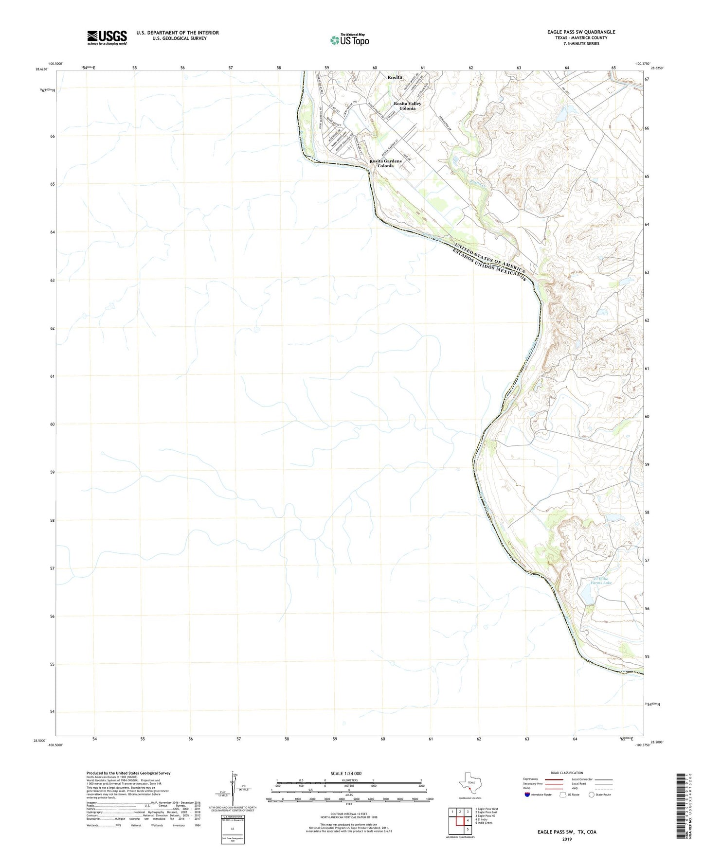
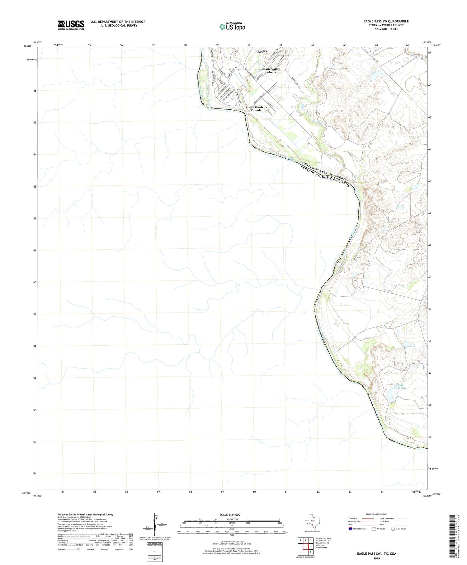
2019 topographic map quadrangle Eagle Pass SW in the state of Texas. Scale: 1:24000. Based on the newly updated USGS 7.5' US Topo map series, this map is in the following counties: Maverick. The map contains contour data, water features, and other items you are used to seeing on USGS maps, but also has updated roads and other features. This is the next generation of topographic maps. Printed on high-quality waterproof paper with UV fade-resistant inks.
Quads adjacent to this one:
Northwest: Eagle Pass West
North: Eagle Pass East
Northeast: Eagle Pass NE
East: El Indio
Southeast: Indio Creek
Contains the following named places: El Indio Farms Lake, El Indio Farms Lake Dam, Florentino Ramos Colonia, Kickapoo Reservation, La Rosita Ranch, Loma Linda Number 3 Colonia, Loma Linda Ranchettes Colonia, M Frank Farm, Riverside Acres Colonia, Rosita Census Designated Place, Rosita Creek, Rosita Gardens Colonia, Rosita Valley Colonia, Victoriano Hernandez Colonia, W D Ranch Lake, W D Ranch Lake Dam