MyTopo
Easton Texas US Topo Map
Couldn't load pickup availability
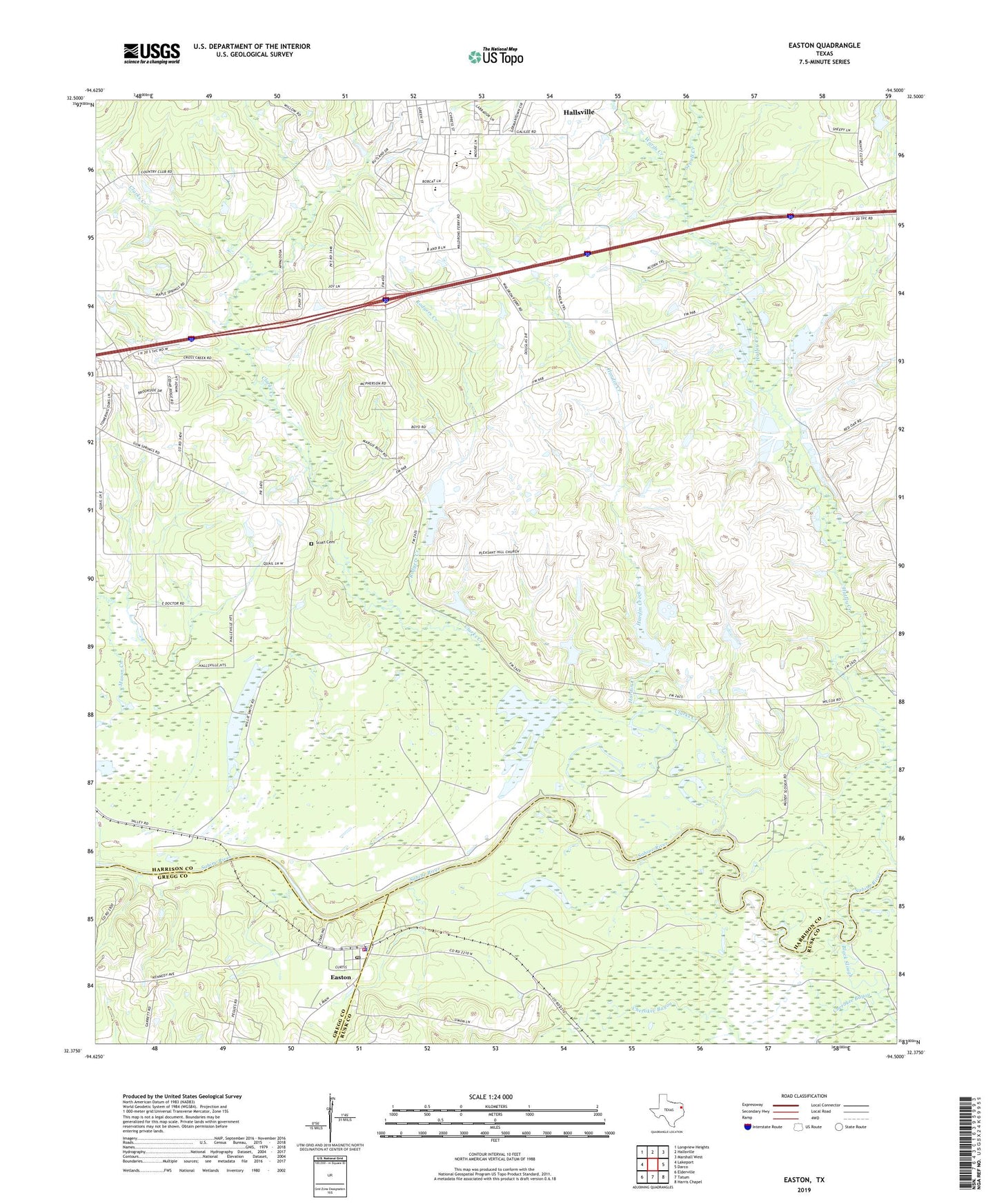
2019 topographic map quadrangle Easton in the state of Texas. Scale: 1:24000. Based on the newly updated USGS 7.5' US Topo map series, this map is in the following counties: Harrison, Rusk, Gregg. The map contains contour data, water features, and other items you are used to seeing on USGS maps, but also has updated roads and other features. This is the next generation of topographic maps. Printed on high-quality waterproof paper with UV fade-resistant inks.
Quads adjacent to this one:
West: Lakeport
Northwest: Longview Heights
North: Hallsville
Northeast: Marshall West
East: Darco
Southeast: Harris Chapel
South: Tatum
Southwest: Elderville
Contains the following named places: Black Slough, Bobcat Stadium, Cherokee Bayou, City of Easton, Clarks Creek, Easton, Easton City Hall, Easton Police Department, Easton Post Office, Easton Volunteer Fire Department, Galilee School, Golden Hill Church, Hallsville Division, Hardin Creek, Hatley Memorial Church, Pleasant Hill Church, Rodgers Creek, Scott Cemetery, Sewell Creek, Sweet Home Church, Wards Creek, ZIP Code: 75641