MyTopo
Golden Ranch Texas US Topo Map
Couldn't load pickup availability
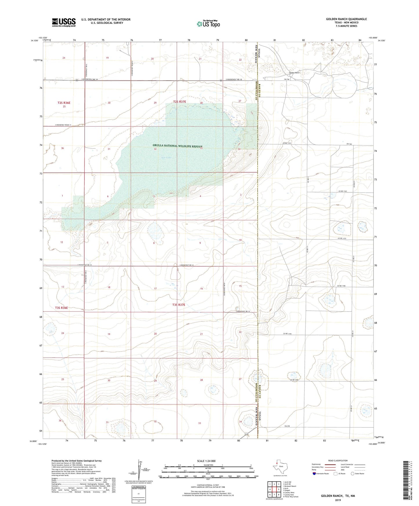
2019 topographic map quadrangle Golden Ranch in the states of New Mexico, Texas. Scale: 1:24000. Based on the newly updated USGS 7.5' US Topo map series, this map is in the following counties: Bailey, Roosevelt. The map contains contour data, water features, and other items you are used to seeing on USGS maps, but also has updated roads and other features. This is the next generation of topographic maps. Printed on high-quality waterproof paper with UV fade-resistant inks.
Quads adjacent to this one:
West: Arch
Northwest: Arch NW
North: Arch NE
Northeast: Birdwell Ranch
East: Stegall
Southeast: Three Way School
South: Causey East
Southwest: Causey West
Contains the following named places: 10117 Water Well, 10124 Water Well, 10125 Water Well, 10126 Water Well, 10127 Water Well, 10128 Water Well, 10963 Water Well, 10964 Water Well, 10965 Water Well, 10966 Water Well, 10967 Water Well, 10968 Water Well, 10969 Water Well, 11019 Water Well, 11026 Water Well, 11027 Water Well, 11028 Water Well, 11029 Water Well, 11030 Water Well, 11031 Water Well, 11032 Water Well, 11033 Water Well, 11034 Water Well, 11035 Water Well, 11613 Water Well, 11630 Water Well, 11720 Water Well, 11743 Water Well, 12196 Water Well, 12201 Water Well, 12211 Water Well, 12212 Water Well, 12239 Water Well, 12403 Water Well, 12412 Water Well, 12413 Water Well, 12514 Water Well, 12517 Water Well, 12680 Water Well, 12687 Water Well, 12698 Water Well, Golden Ranch, Grulla National Wildlife Refuge, Nickles Ranch, P-3293-S-2 Water Well, Portales Valley, Salt Lake