MyTopo
Grandfalls Texas US Topo Map
Couldn't load pickup availability
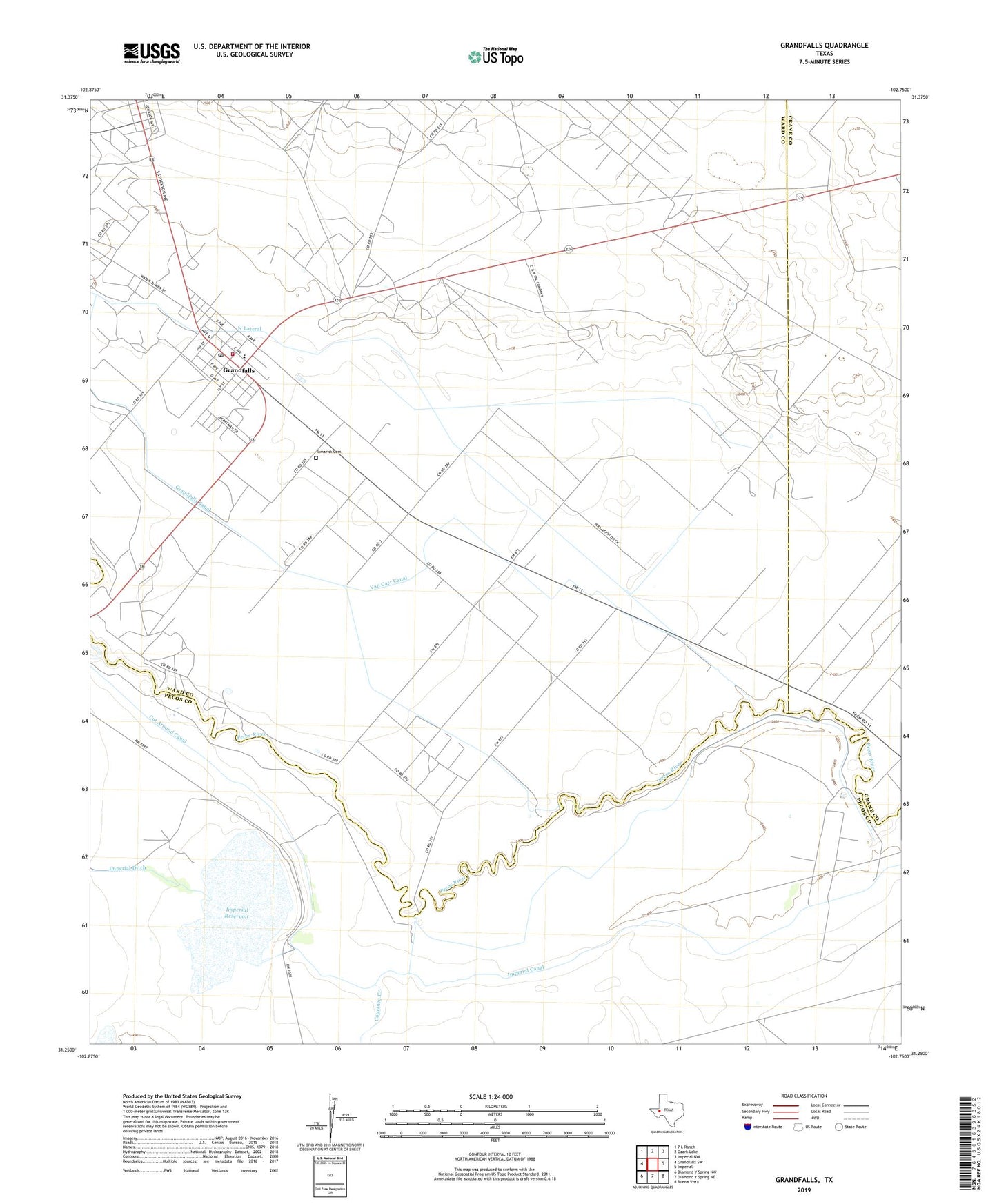
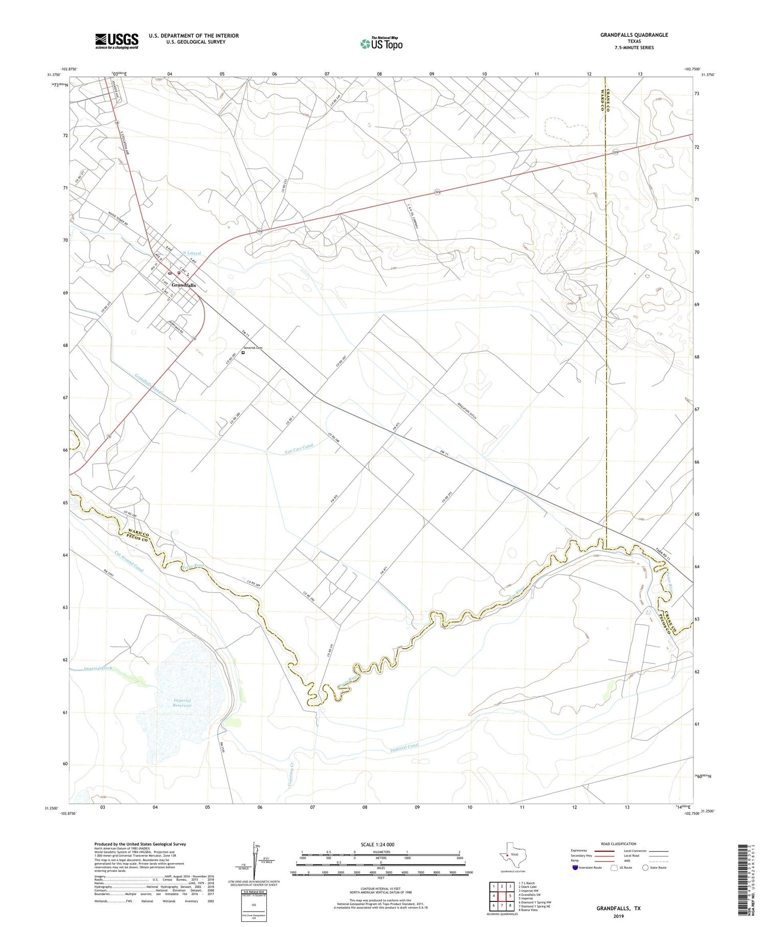
2019 topographic map quadrangle Grandfalls in the state of Texas. Scale: 1:24000. Based on the newly updated USGS 7.5' US Topo map series, this map is in the following counties: Ward, Pecos, Crane. The map contains contour data, water features, and other items you are used to seeing on USGS maps, but also has updated roads and other features. This is the next generation of topographic maps. Printed on high-quality waterproof paper with UV fade-resistant inks.
Quads adjacent to this one:
West: Grandfalls SW
Northwest: 7 L Ranch
North: Ozark Lake
Northeast: Imperial NW
East: Imperial
Southeast: Buena Vista
South: Diamond Y Spring NE
Southwest: Diamond Y Spring NW
Contains the following named places: Courtney Creek, Cut Around Canal, Grandfalls, Grandfalls - Royalty School, Grandfalls Canal, Grandfalls City Hall, Grandfalls Post Office, Grandfalls Volunteer Fire Department, Imperial Canal, Imperial Dam, Imperial Reservoir, North Lateral, Payton Oil Field, Royalty, Shipley Oil Field, South Lateral, Tamarisk Cemetery, Town of Grandfalls, Van Carr Canal, ZIP Code: 79742