MyTopo
Helotes Texas US Topo Map
Couldn't load pickup availability
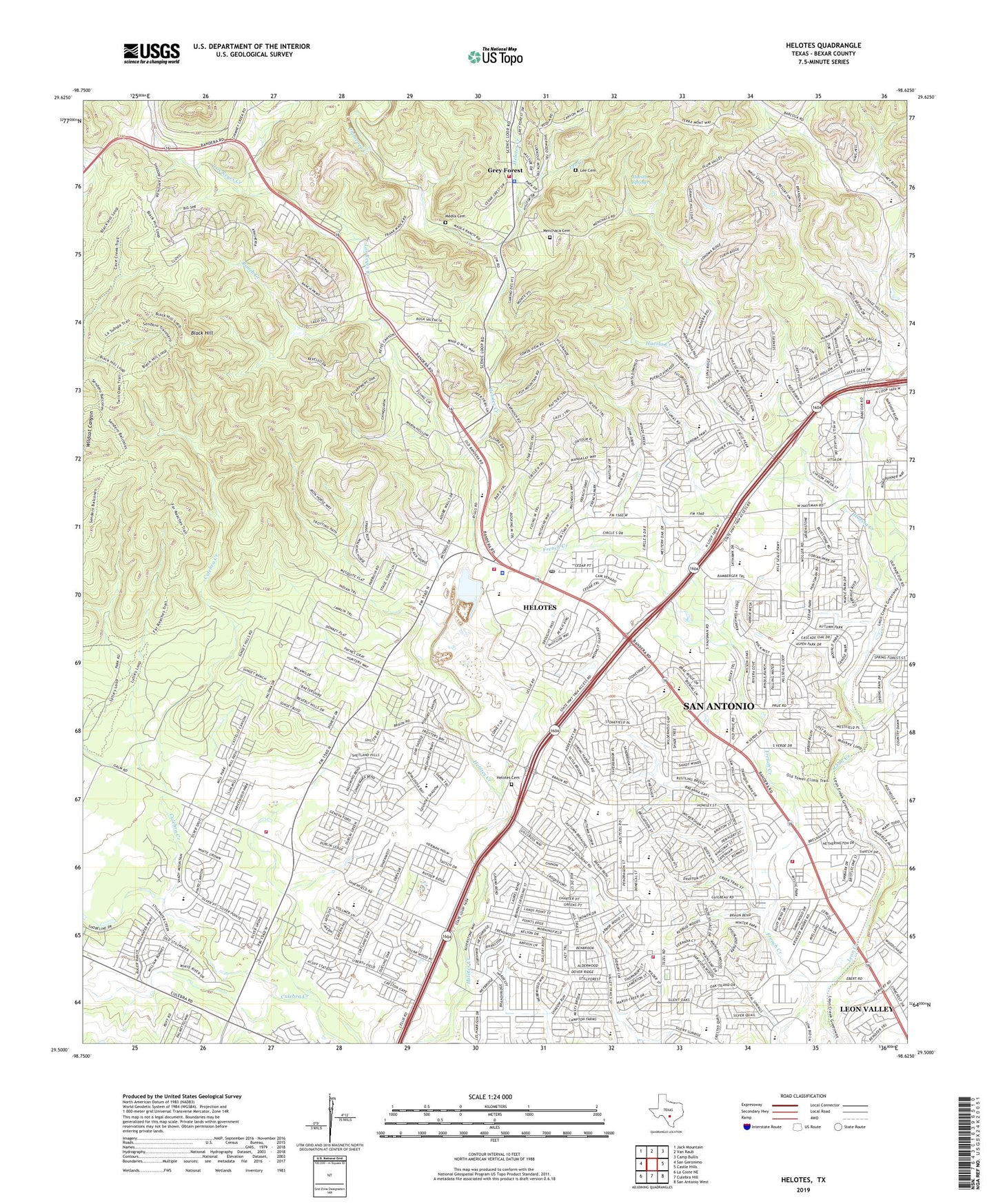
2019 topographic map quadrangle Helotes in the state of Texas. Scale: 1:24000. Based on the newly updated USGS 7.5' US Topo map series, this map is in the following counties: Bexar. The map contains contour data, water features, and other items you are used to seeing on USGS maps, but also has updated roads and other features. This is the next generation of topographic maps. Printed on high-quality waterproof paper with UV fade-resistant inks.
Quads adjacent to this one:
West: San Geronimo
Northwest: Jack Mountain
North: Van Raub
Northeast: Camp Bullis
East: Castle Hills
Southeast: San Antonio West
South: Culebra Hill
Southwest: La Coste NE
Contains the following named places: Bandera Pointe Shopping Center, Bandera Road Community Church, Bethany Primitive Baptist Church, Bexar County Constable's Office Precinct 2, Black Hill, Brauchle Elementary School, Braun Station Elementary School, Children's World Learning Center, Chimenea Creek, Chisholm Hall, City of Grey Forest, City of Helotes, Coke Stevenson Middle School, Fernandez Elementary School, First United Pentecostal Church, Fortress Church, Frech Creek Park, Grace Christian School, Grey Forest, Grey Forest Police Department, Grey Forest Volunteer Fire Department, Helotes, Helotes Cemetery, Helotes Elementary School, Helotes Fire Department, Helotes Police Department, Helotes Post Office, Helotes Quarry, House of Refuge Christian Center, Huesta Creek, Huesta Springs, James Carson Elementary School, Jefferson Middle School, KAJA-FM (San Antonio), KCYY-FM (San Antonio), KFHM-AM (San Antonio), KHCE-TV (San Antonio), Kids of the Kingdom Church, Kids World Day Care Center, Kindercare Learning Centers, Kingdom Hall of Jehovahs Witnesses, KPAC-FM (San Antonio), KSTX-FM (San Antonio), Latin American Bible Institute, Lee Cemetery, Lee Creek, Leon Creek Greenway Park, Los Reyes Creek, Medla Cemetery, Menchaca Cemetery, Nazarene Tezel Oaks Church, Nichols Elementary School, Northminster Presbyterian Church, Northwest Community Evangelical Free Church, Northwest Crossing Elementary School, Northwest Hills United Methodist Church, Northwest Park Baptist Church, Our Lady of the Atonement Catholic Church, Ranch Creek, River of Life Small Group Christian Church, Saint Anthony Claret Catholic Church, Saint Anthonys Catholic Student Center, San Antonio Baseball Field - University of Texas, San Antonio Fire Department Station 34, San Antonio Fire Department Station 41, San Antonio Fire Department Station 49, San Antonio Northwest Division, Schnabel Park, Scobee Elementary School, Sterling Oaks Shopping Center, Steubing Elementary School, Stevenson Middle School, Stinson Middle School, The Church of Jesus Christ of Latter Day Saints, True Vine Independent Baptist South West Mission Church, West Bexar Division, World Center, WZ Burke Elementary School, Zion Church, Zion Lutheran Church of Helote Church, ZIP Codes: 78023, 78250, 78254, 78256