MyTopo
Imperial Texas US Topo Map
Couldn't load pickup availability
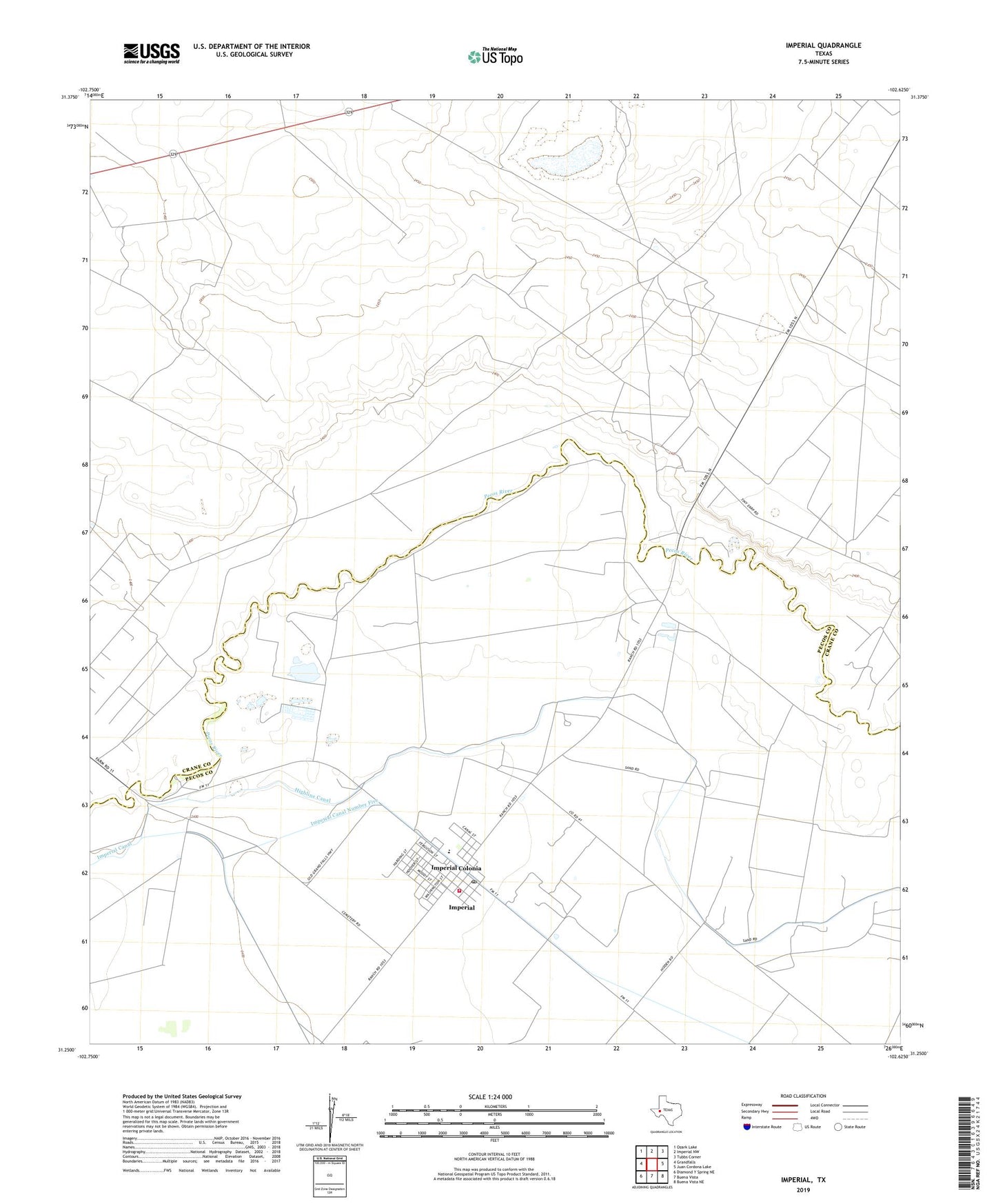
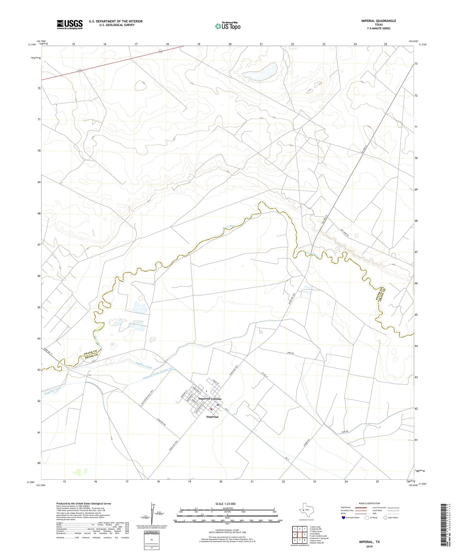
2019 topographic map quadrangle Imperial in the state of Texas. Scale: 1:24000. Based on the newly updated USGS 7.5' US Topo map series, this map is in the following counties: Crane, Pecos. The map contains contour data, water features, and other items you are used to seeing on USGS maps, but also has updated roads and other features. This is the next generation of topographic maps. Printed on high-quality waterproof paper with UV fade-resistant inks.
Quads adjacent to this one:
West: Grandfalls
Northwest: Ozark Lake
North: Imperial NW
Northeast: Tubbs Corner
East: Juan Cordona Lake
Southeast: Buena Vista NE
South: Buena Vista
Southwest: Diamond Y Spring NE
Contains the following named places: Abell City, Abell Oil and Gas Field, Atapco Oil Field, Buena Vista School, Horsehead Crossing, Imperial, Imperial Census Designated Place, Imperial Colonia, Imperial Fire Department, Imperial Post Office, Imperial Volunteer Emergency Medical Services, Malicky Oil Field, Tucker Oil Field