
MyTopo
Lake Como Texas US Topo Map
Couldn't load pickup availability
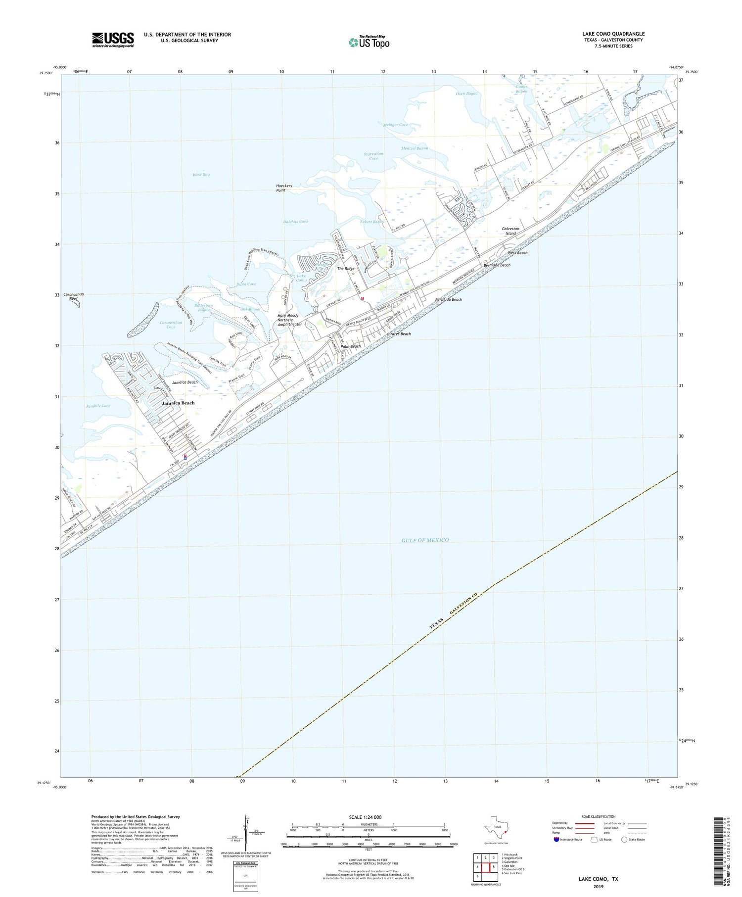
2019 topographic map quadrangle Lake Como in the state of Texas. Scale: 1:24000. Based on the newly updated USGS 7.5' US Topo map series, this map is in the following counties: Galveston. The map contains contour data, water features, and other items you are used to seeing on USGS maps, but also has updated roads and other features. This is the next generation of topographic maps. Printed on high-quality waterproof paper with UV fade-resistant inks.
Quads adjacent to this one:
West: Sea Isle
Northwest: Hitchcock
North: Virginia Point
Northeast: Galveston
East: Galveston OE S
Southwest: San Luis Pass
Contains the following named places: Bermuda Beach, Butterowe Bayou, Carancahua Cove, Carancahua Reef, City of Jamaica Beach, Dalehite Cove, Dana Cove, Eckert Bayou, Galveston County Health District - Galveston County Emergency Medical Service Station 4, Galveston Division, Galveston Fire Department Station 7, Galveston Island, Galveston Island State Park, Galveston Island State Park Trail, Ganas Bayou, Gangs Bayou, Hoeckers Point, Jamaica Beach, Jamaica Beach City Hall, Jamaica Beach Police Department, Jamaica Beach Volunteer Fire Department, Jumbile Cove, Lafitte Grove, Lake Como, Mary Moody Northern Amphitheater, Mary Star of the Sea Church, Melager Cove, Mentzel Bayou, Nottingham, Oak Bayou, Oxen Bayou, Palm Beach, Pirates Beach, Pirates Beach Marina, Pirates Cove, Sand Castle Beach Pocket Park 2, Sea Gull Shores Beach Pocket Park 1, Sea Shell Beach Pocket Park 3, Spanish Grant North, Spanish Grant South, Starvation Cove, The Ridge, West Beach, West Isle Church, West Isle Presbyterian Church


