MyTopo
Loop Texas US Topo Map
Couldn't load pickup availability
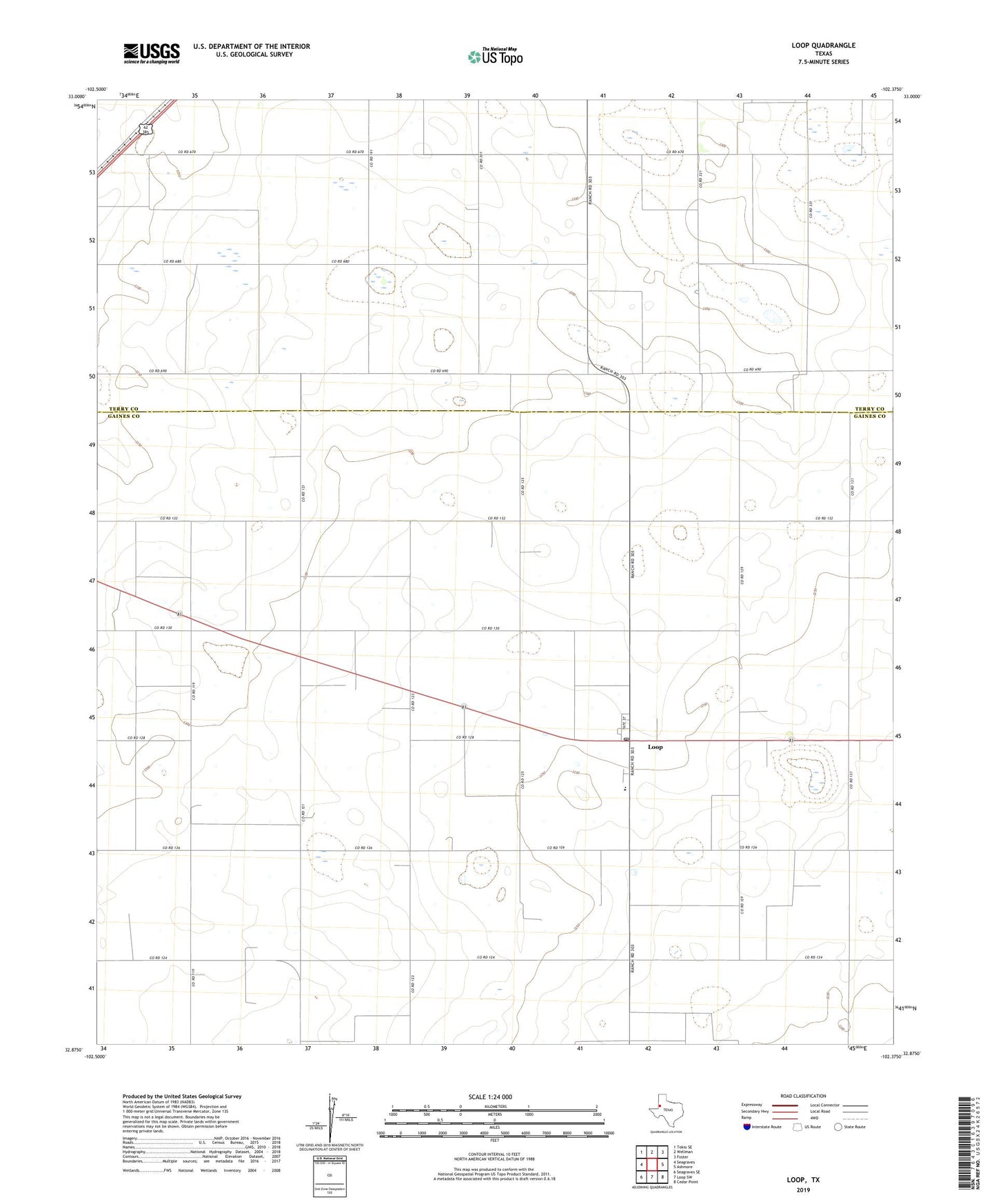
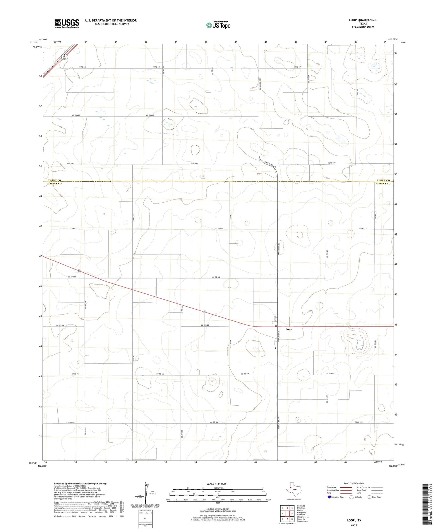
2019 topographic map quadrangle Loop in the state of Texas. Scale: 1:24000. Based on the newly updated USGS 7.5' US Topo map series, this map is in the following counties: Gaines, Terry. The map contains contour data, water features, and other items you are used to seeing on USGS maps, but also has updated roads and other features. This is the next generation of topographic maps. Printed on high-quality waterproof paper with UV fade-resistant inks.
Quads adjacent to this one:
West: Seagraves
Northwest: Tokio SE
North: Wellman
Northeast: Foster
East: Ashmore
Southeast: Cedar Point
South: Loop SW
Southwest: Seagraves SE
Contains the following named places: Hockley County Memorial Library, Loop, Loop Cemetery, Loop Census Designated Place, Loop Post Office, Loop School