MyTopo
Memphis Texas US Topo Map
Couldn't load pickup availability
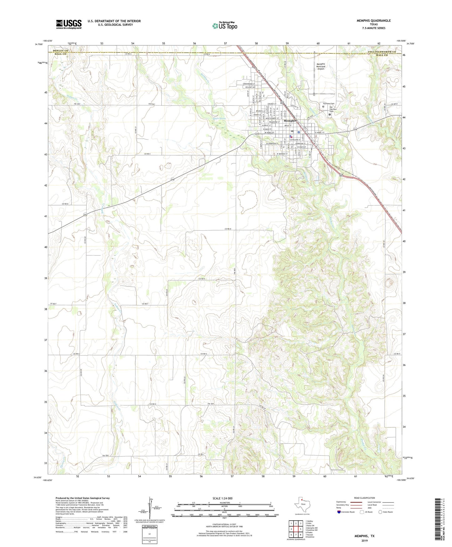
2019 topographic map quadrangle Memphis in the state of Texas. Scale: 1:24000. Based on the newly updated USGS 7.5' US Topo map series, this map is in the following counties: Hall, Donley, Collingsworth. The map contains contour data, water features, and other items you are used to seeing on USGS maps, but also has updated roads and other features. This is the next generation of topographic maps. Printed on high-quality waterproof paper with UV fade-resistant inks.
Quads adjacent to this one:
West: Memphis NW
Northwest: Hedley
North: Giles
Northeast: Rolla SW
East: Estelline NW
Southeast: Estelline
South: Parnell
Southwest: Plaska
Contains the following named places: Austin Elementary School, Austin School, Berkley Creek, Church of Christ, Church Westside Fellowship, City of Memphis, Fairview Cemetery, Hall County Emergency Medical Services, Hall County Heritage Hall, Hall County Hospital, Hall County Jail, Hall County Sheriff's Office, KLSR-AM (Memphis), KLSR-FM (Memphis), Memphis, Memphis City Hall, Memphis Division, Memphis Fire Department, Memphis High School, Memphis Middle School, Memphis Municipal Airport, Memphis Police Department, Memphis Post Office, Milam Spring, Morningside School, Mount Pleasant Baptist Church, New Mount Zion Baptist Church, Old Fairview Cemetery, Sacred Heart Catholic Church, Travis Baptist Church, Travis Elementary School, Travis School