MyTopo
Noelke Texas US Topo Map
Couldn't load pickup availability
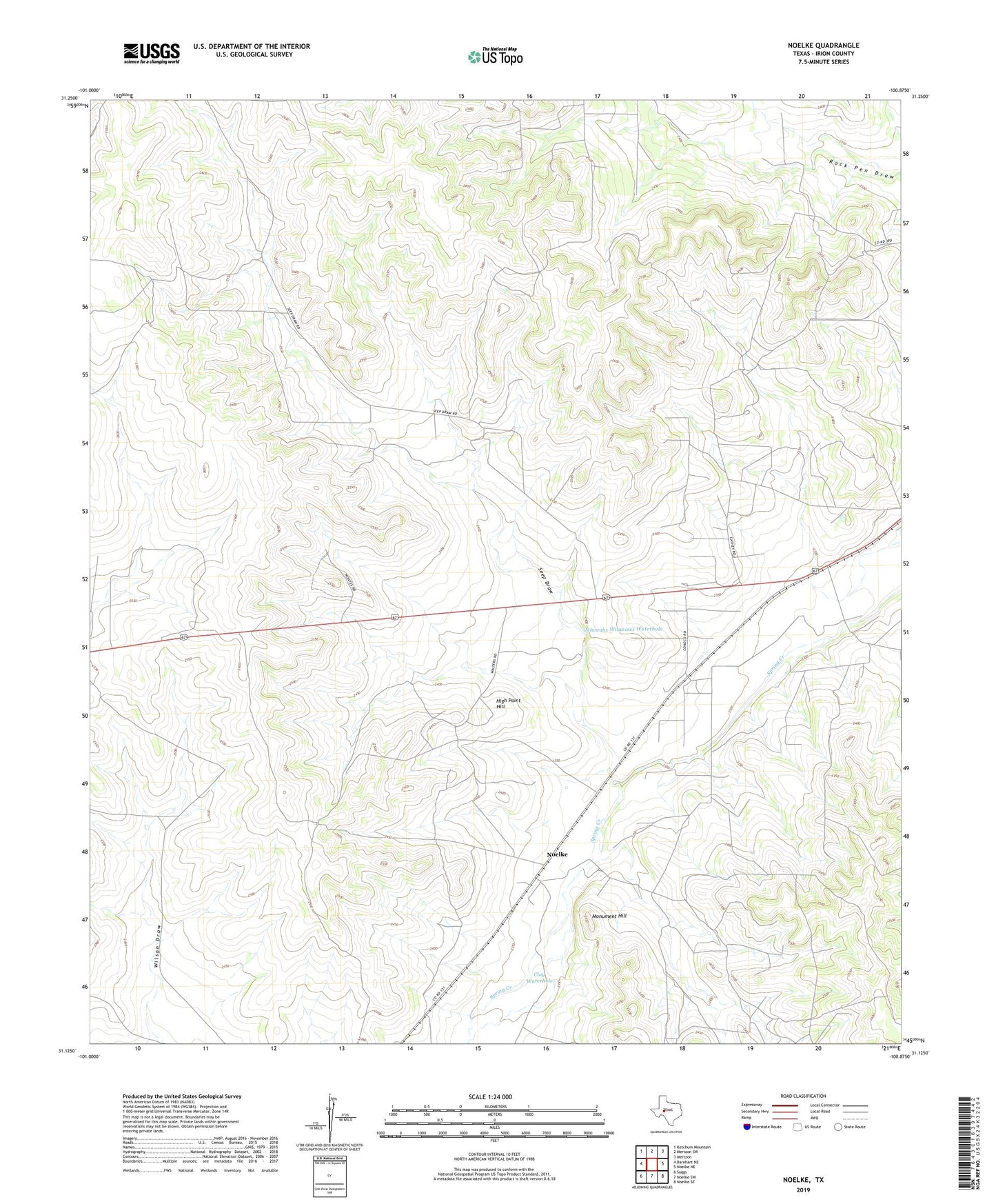
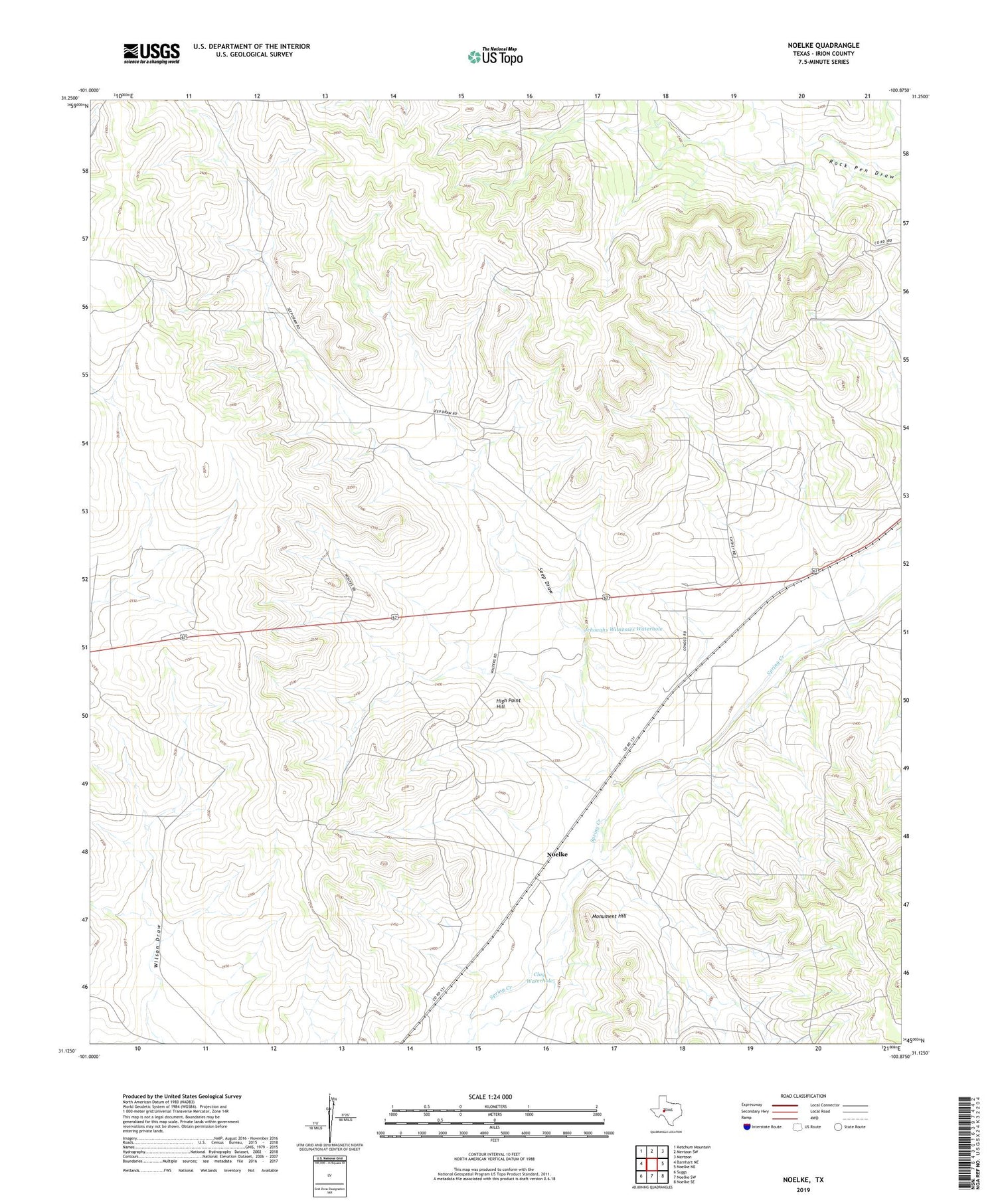
2019 topographic map quadrangle Noelke in the state of Texas. Scale: 1:24000. Based on the newly updated USGS 7.5' US Topo map series, this map is in the following counties: Irion. The map contains contour data, water features, and other items you are used to seeing on USGS maps, but also has updated roads and other features. This is the next generation of topographic maps. Printed on high-quality waterproof paper with UV fade-resistant inks.
Quads adjacent to this one:
West: Barnhart NE
Northwest: Ketchum Mountain
North: Mertzon SW
Northeast: Mertzon
East: Noelke NE
Southeast: Noelke SE
South: Noelke SW
Southwest: Suggs
Contains the following named places: Carter Windmill, Chosey Windmill, Clay Waterhole, High Point Hill, Highway Windmill, Jehovahs Witnesses Waterhole, Lower Gillis Windmill, Mertzon Oil Field, Mertzon South Division, Monument Hill, Noelke, Oil Well Windmill, Seep Draw, Twentyfoot Windmill, Upper Gillis Windmill, Upper Vinson Windmill, Wilson Windmill