
MyTopo
Ozona Texas US Topo Map
Couldn't load pickup availability
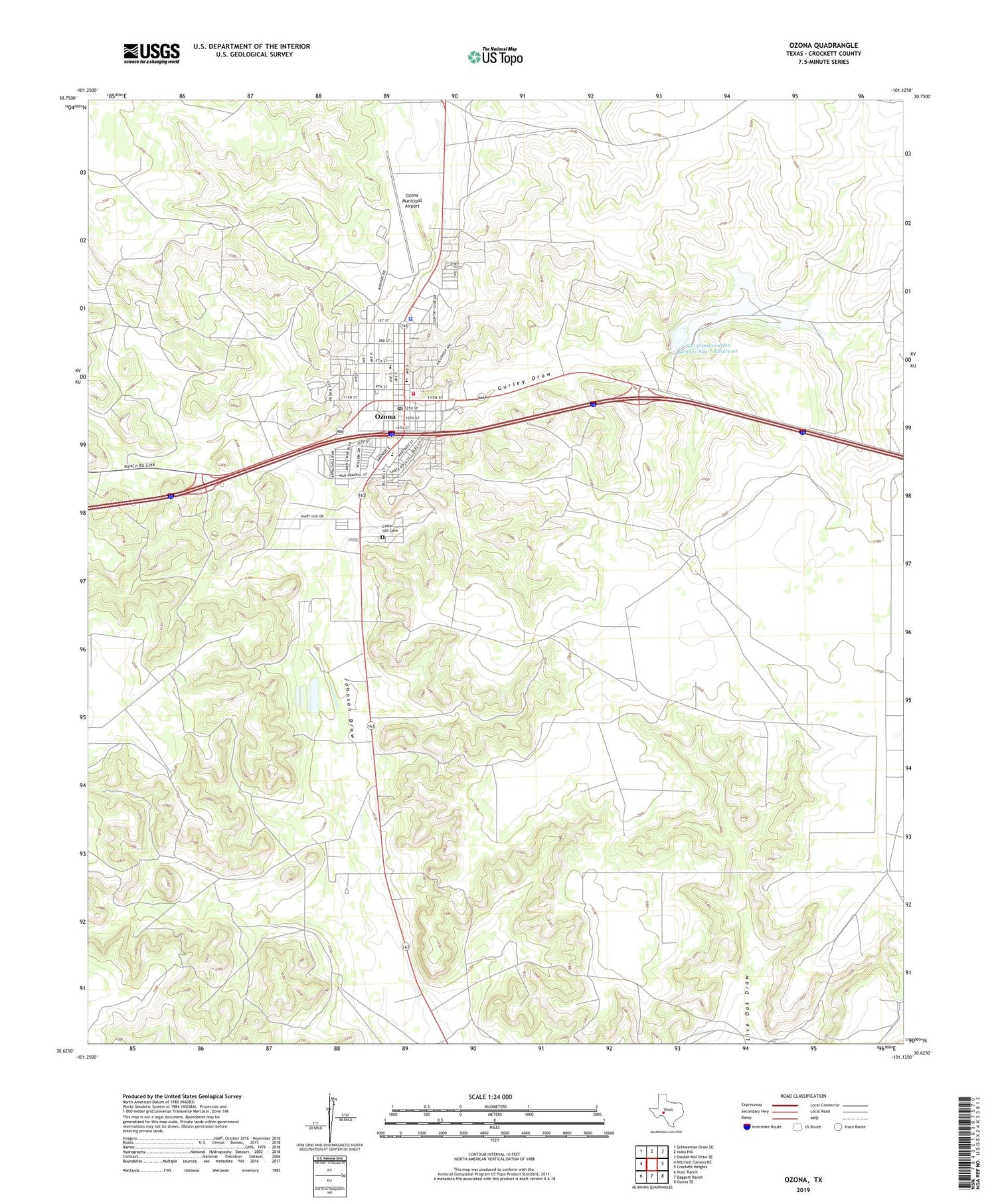
2019 topographic map quadrangle Ozona in the state of Texas. Scale: 1:24000. Based on the newly updated USGS 7.5' US Topo map series, this map is in the following counties: Crockett. The map contains contour data, water features, and other items you are used to seeing on USGS maps, but also has updated roads and other features. This is the next generation of topographic maps. Printed on high-quality waterproof paper with UV fade-resistant inks.
Quads adjacent to this one:
West: Mitchell Canyon NE
Northwest: Schneeman Draw SE
North: Indio Hill
Northeast: Double Mill Draw SE
East: Crockett Heights
Southeast: Ozona SE
South: Baggett Ranch
Southwest: Hunt Ranch
Contains the following named places: Cedar Hill Cemetery, Crockett County Emergency Medical Services, Crockett County Sheriff's Office, East Crockett Division, Gurley Draw, KYXX-FM (Ozona), Ozona, Ozona Census Designated Place, Ozona Country Club, Ozona Elementary School, Ozona Gas and Oil Field, Ozona High School, Ozona Middle School, Ozona Municipal Airport, Ozona Post Office, Ozona Volunteer Fire Department, Soil Conservation Service Site 7 Dam, Soil Conservation Service Site 7 Reservoir


