MyTopo
Paducah Texas US Topo Map
Couldn't load pickup availability
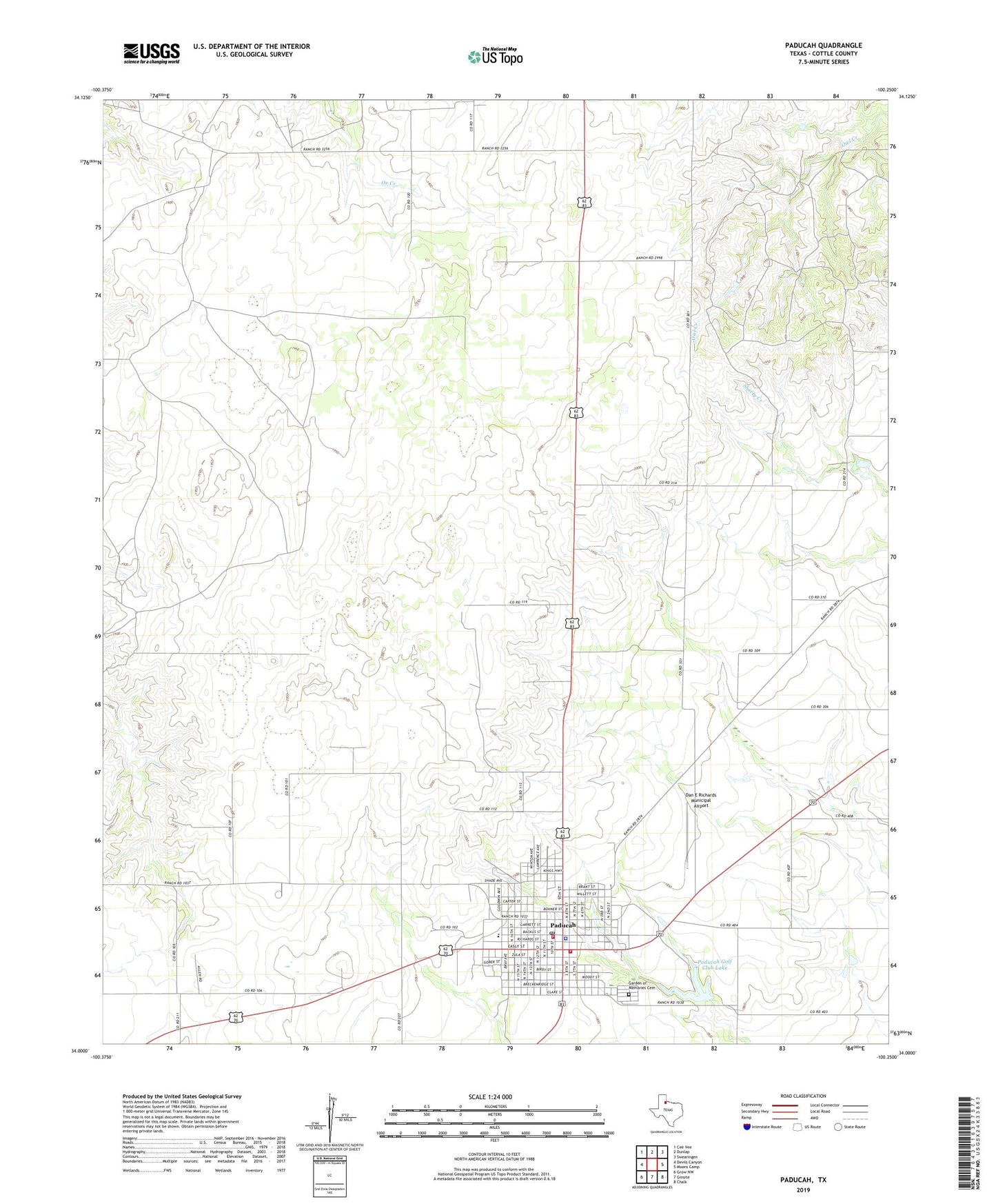
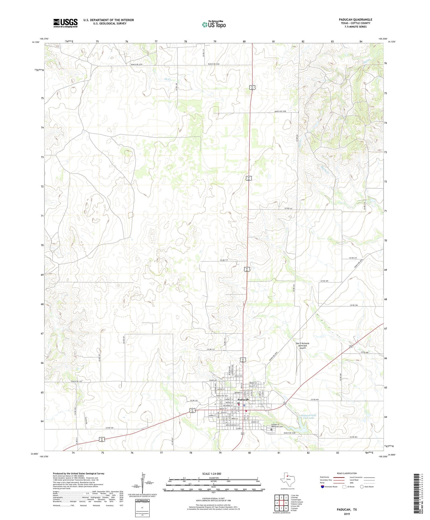
2019 topographic map quadrangle Paducah in the state of Texas. Scale: 1:24000. Based on the newly updated USGS 7.5' US Topo map series, this map is in the following counties: Cottle. The map contains contour data, water features, and other items you are used to seeing on USGS maps, but also has updated roads and other features. This is the next generation of topographic maps. Printed on high-quality waterproof paper with UV fade-resistant inks.
Quads adjacent to this one:
West: Devils Canyon
Northwest: Cee Vee
North: Dunlap
Northeast: Swearingen
East: Moons Camp
Southeast: Chalk
South: Ginsite
Southwest: Grow NW
Contains the following named places: City County Heritage Museum, Cottle County, Cottle County Jail, Cottle County Sheriff's Office, Dan E Richards Municipal Airport, Fairberry Windmill, Garden of Memories Cemetery, Goodwin Elementary School, O X Trap Windmill, Paducah, Paducah Airport, Paducah Ambulance Service, Paducah City Hall, Paducah Golf Club Dam, Paducah Golf Club Lake, Paducah High School, Paducah Post Office, Paducah Volunteer Fire Department, Paducah Volunteer Fire Department Station 1, Town of Paducah