MyTopo
Prairie Hill Texas US Topo Map
Couldn't load pickup availability
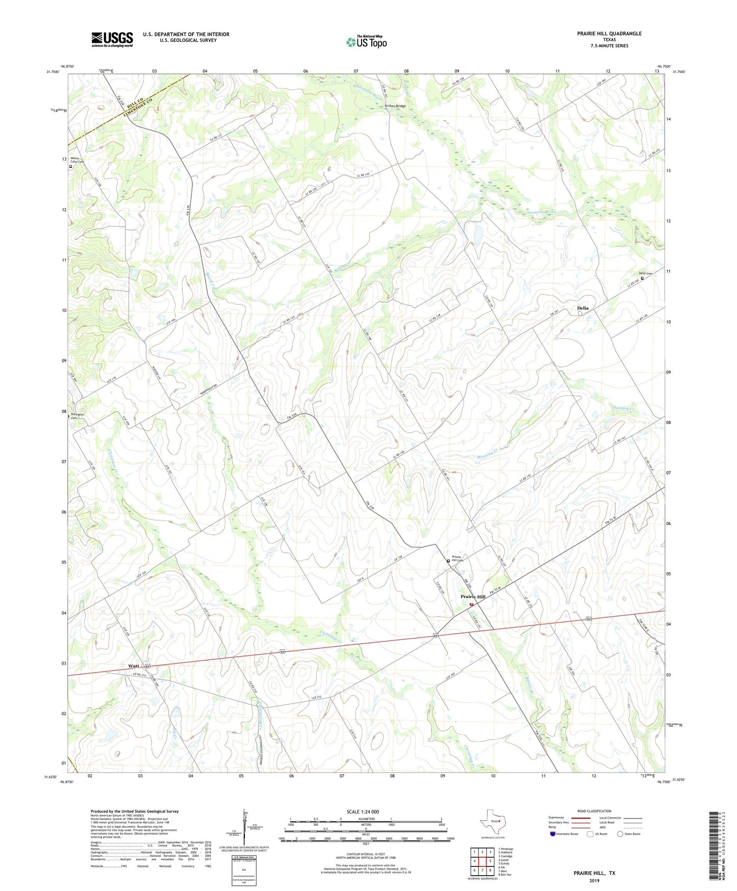
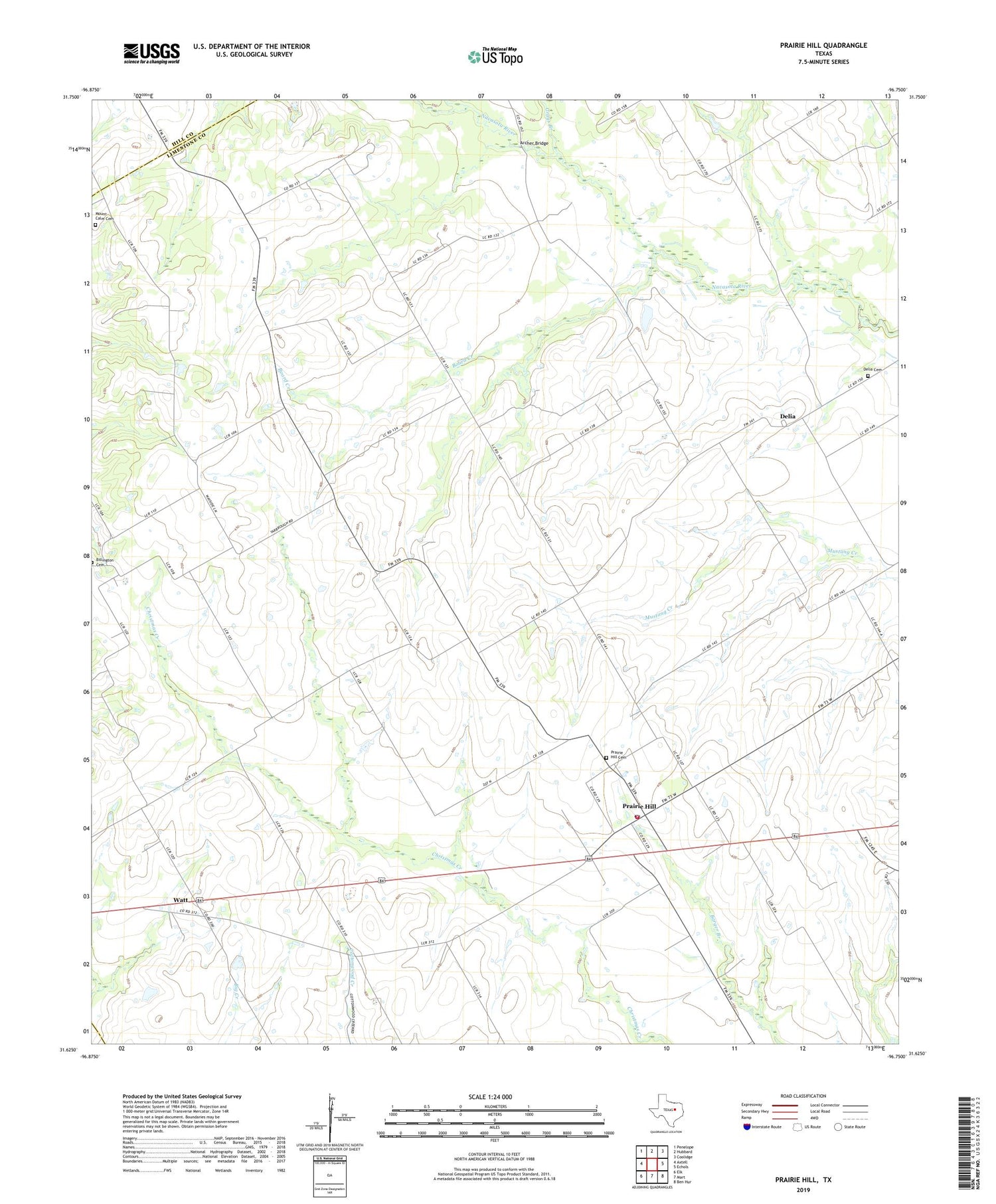
2019 topographic map quadrangle Prairie Hill in the state of Texas. Scale: 1:24000. Based on the newly updated USGS 7.5' US Topo map series, this map is in the following counties: Limestone, Hill, McLennan. The map contains contour data, water features, and other items you are used to seeing on USGS maps, but also has updated roads and other features. This is the next generation of topographic maps. Printed on high-quality waterproof paper with UV fade-resistant inks.
Quads adjacent to this one:
West: Axtell
Northwest: Penelope
North: Hubbard
Northeast: Coolidge
East: Echols
Southeast: Ben Hur
South: Mart
Southwest: Elk
Contains the following named places: American Truck Driving School, Archer Bridge, Billington Cemetery, Board Creek, Delia, Delia Cemetery, Grays Branch, Mount Antioch Church, Mount Calm Cemetery, Prairie Hill, Prairie Hill Air Force Auxiliary Airfield, Prairie Hill Cemetery, Prairie Hill Division, Prairie Hill Post Office, Prairie Hill Volunteer Fire Department, Turkey Creek, Watt, ZIP Code: 76678