MyTopo
Presidio East Texas US Topo Map
Couldn't load pickup availability
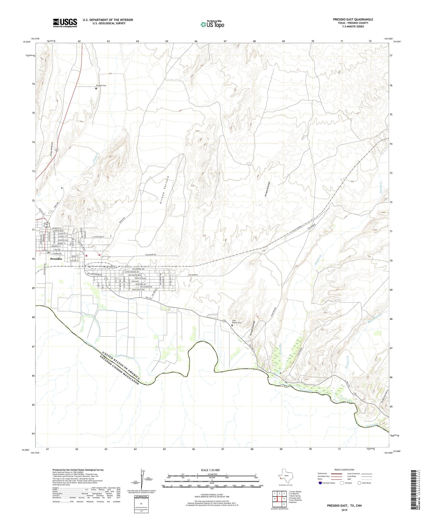
2019 topographic map quadrangle Presidio East in the state of Texas. Scale: 1:24000. Based on the newly updated USGS 7.5' US Topo map series, this map is in the following counties: Presidio. The map contains contour data, water features, and other items you are used to seeing on USGS maps, but also has updated roads and other features. This is the next generation of topographic maps. Printed on high-quality waterproof paper with UV fade-resistant inks.
Quads adjacent to this one:
West: Presidio West
Northwest: Arroyo Melado
North: La Boquilla
Northeast: Alamo Spring
East: Cerro Redondo
Southeast: Redford
Contains the following named places: Alamito Creek, Arroyo Arenoso, Arroyo Galindo, Arroyo Palo Blanco, Arroyo Tortola, Black Hills Creek, Campo Santo Estrada, Casa Blanca Cemetery, City of Presidio, Desert Hills Cemetery, Estrada Creek, Fort Leaton, Fort Leaton State Historic Site, Fort Leaton State Historic Site Nature Trail, Loma Pelona, Presidio, Presidio County Volunteer Fire Department, Presidio Emergency Medical Services, Presidio Police Department, Presidio Post Office, Terneros Creek, United States Border Patrol Station