
MyTopo
Sagunada Ranch Texas US Topo Map
Couldn't load pickup availability
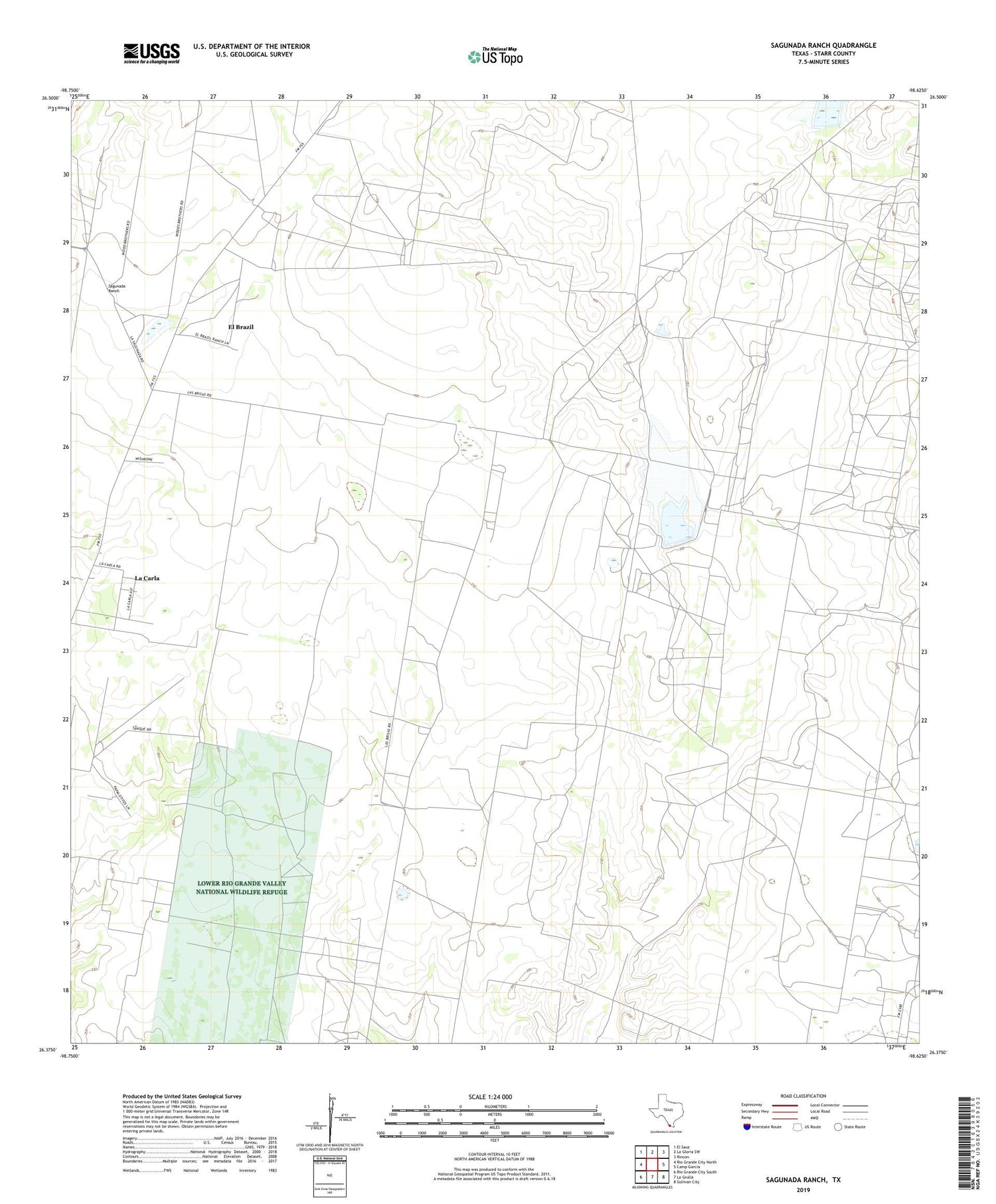
2019 topographic map quadrangle Sagunada Ranch in the state of Texas. Scale: 1:24000. Based on the newly updated USGS 7.5' US Topo map series, this map is in the following counties: Starr. The map contains contour data, water features, and other items you are used to seeing on USGS maps, but also has updated roads and other features. This is the next generation of topographic maps. Printed on high-quality waterproof paper with UV fade-resistant inks.
Quads adjacent to this one:
West: Rio Grande City North
Northwest: El Sauz
North: La Gloria SW
Northeast: Rincon
East: Camp Garcia
Southeast: Sullivan City
South: La Grulla
Southwest: Rio Grande City South
Contains the following named places: Barbacoas Oil Field, Boyle Oil Field, Dam Number 3, Dam Number 4, El Brazil Census Designated Place, Garcia Oil Field, Janal Gas Field, Kennard Oil Field, La Brisa Ranch, La Carla Census Designated Place, La Carla Colonia, Pease Middle School, Remco Oil Field, Ross Oil Field, Sagunada Ranch, Soil Conservation Service Site 3 Dam, Soil Conservation Service Site 3 Reservoir, Soil Conservation Service Site 4 Dam, Soil Conservation Service Site 4 Reservoir


