MyTopo
Seymour West Texas US Topo Map
Couldn't load pickup availability
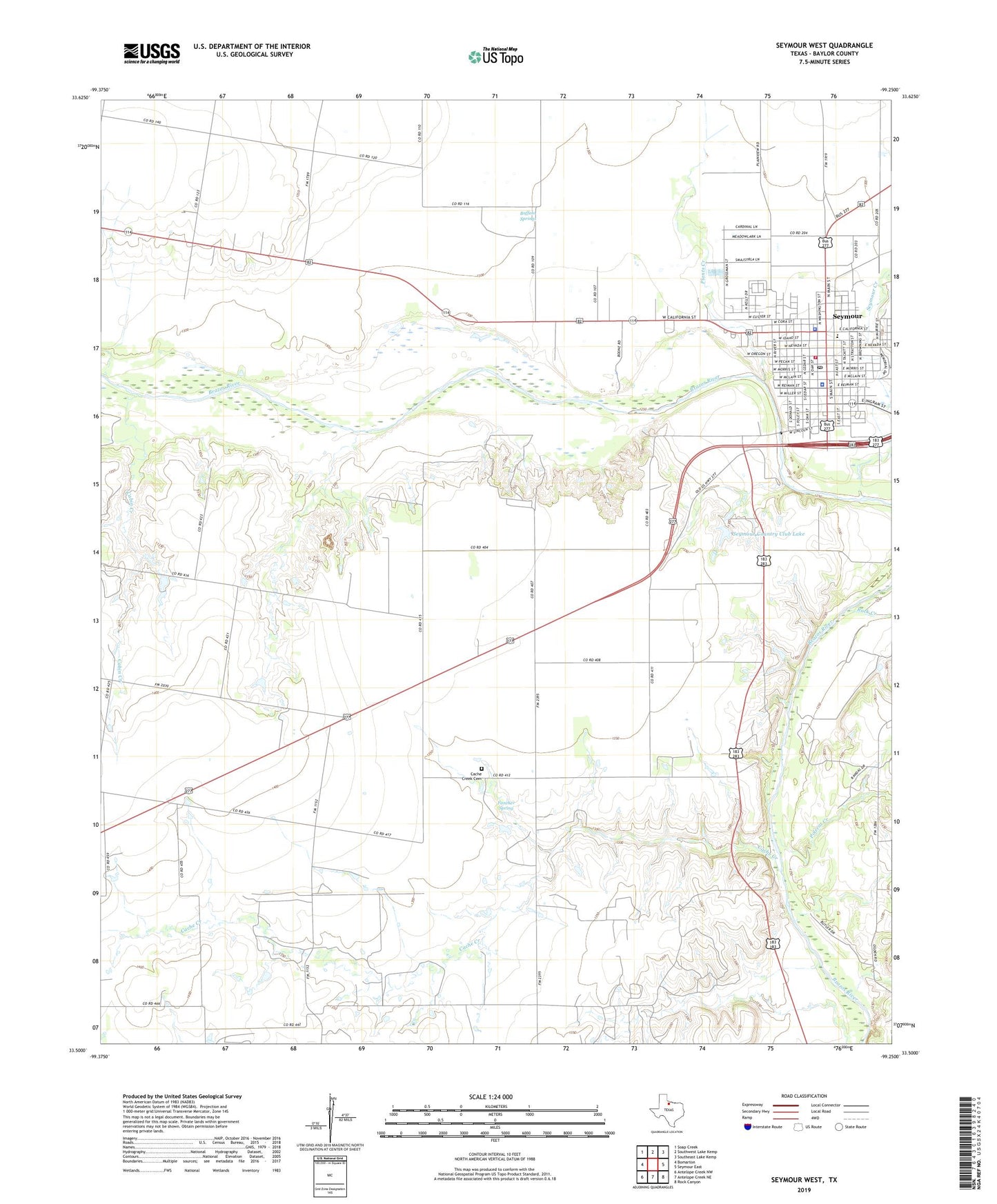
2019 topographic map quadrangle Seymour West in the state of Texas. Scale: 1:24000. Based on the newly updated USGS 7.5' US Topo map series, this map is in the following counties: Baylor. The map contains contour data, water features, and other items you are used to seeing on USGS maps, but also has updated roads and other features. This is the next generation of topographic maps. Printed on high-quality waterproof paper with UV fade-resistant inks.
Quads adjacent to this one:
West: Bomarton
Northwest: Soap Creek
North: Southwest Lake Kemp
Northeast: Southeast Lake Kemp
East: Seymour East
Southeast: Rock Canyon
South: Antelope Creek NE
Southwest: Antelope Creek NW
Contains the following named places: Baylor County Jail, Baylor County Regular Oil Field, Baylor County Sheriff's Office, Buffalo Springs, Cabin Creek, Cache Creek, Cache Creek Cemetery, Church of Christ, City of Seymour, Fancher Spring, First Baptist Church, KSEY-AM (Seymour), KSEY-FM (Seymour), New Covenant Church, New Mount Zion Baptist Church, Plants Creek, Polecat Creek, Rock Creek, Seymour, Seymour City Hall, Seymour Country Club, Seymour Country Club Dam, Seymour Country Club Lake, Seymour Creek, Seymour Downs Race Track, Seymour Elementary School, Seymour Police Department, Seymour Post Office, Seymour Volunteer Fire Department, Trinity Luthern Church