MyTopo
Shamrock East Texas US Topo Map
Couldn't load pickup availability
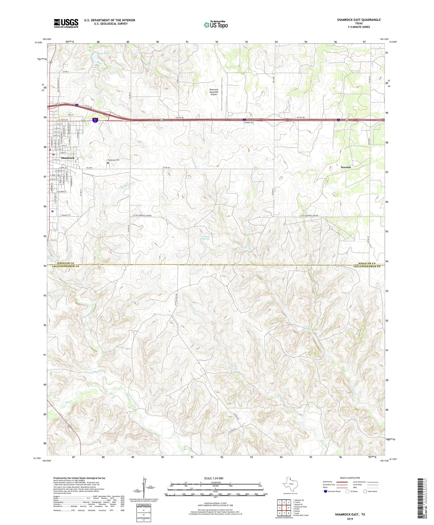
2019 topographic map quadrangle Shamrock East in the state of Texas. Scale: 1:24000. Based on the newly updated USGS 7.5' US Topo map series, this map is in the following counties: Wheeler, Collingsworth. The map contains contour data, water features, and other items you are used to seeing on USGS maps, but also has updated roads and other features. This is the next generation of topographic maps. Printed on high-quality waterproof paper with UV fade-resistant inks.
Quads adjacent to this one:
West: Shamrock West
Northwest: Wheeler SE
North: Twitty
Northeast: Kelton SE
East: Fuller
Southeast: Little Wolf Creek
South: Lutie
Southwest: Dozier
Contains the following named places: Bethel Church, Blakemore Dam, Central Park, Church of God, City of Shamrock, Elmore Park, First Baptist Church, Hackberry Creek, KJJI-FM (Shamrock), Lehman Springs, Norrick, North Ward School, Pioneer West Museum, Saint Michaels All Angels Episcopal Church, Saint Patricks Catholic Church, Samnorwood School, Shamrock, Shamrock Cemetery, Shamrock Elementary School, Shamrock General Hospital, Shamrock High School, Shamrock Middle School, Shamrock Municipal Airport, Shamrock Post Office, Shamrock Volunteer Fire Department, Stagg Lake, Texas Theater, Tower Station, Westside Church of Christ, ZIP Code: 79079