MyTopo
Shamrock West Texas US Topo Map
Couldn't load pickup availability
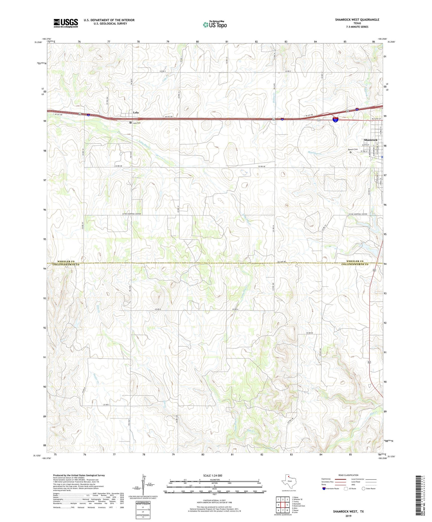
2019 topographic map quadrangle Shamrock West in the state of Texas. Scale: 1:24000. Based on the newly updated USGS 7.5' US Topo map series, this map is in the following counties: Wheeler, Collingsworth. The map contains contour data, water features, and other items you are used to seeing on USGS maps, but also has updated roads and other features. This is the next generation of topographic maps. Printed on high-quality waterproof paper with UV fade-resistant inks.
Quads adjacent to this one:
West: Ramsdell
Northwest: Pakan
North: Wheeler SE
Northeast: Twitty
East: Shamrock East
Southeast: Lutie
South: Dozier
Southwest: Abra
Contains the following named places: Bowers Cemetery, Lela, Lela Cemetery, Lone Mound Church, Long Dry Creek, North Long Dry Creek, Shamrock City Hall, Shamrock Police Department, South Long Dry Creek, South Ward School, Wheeler County Ambulance Service, Wheeler County Constable's Office Precinct 2