
MyTopo
Turtle Bay Texas US Topo Map
Couldn't load pickup availability
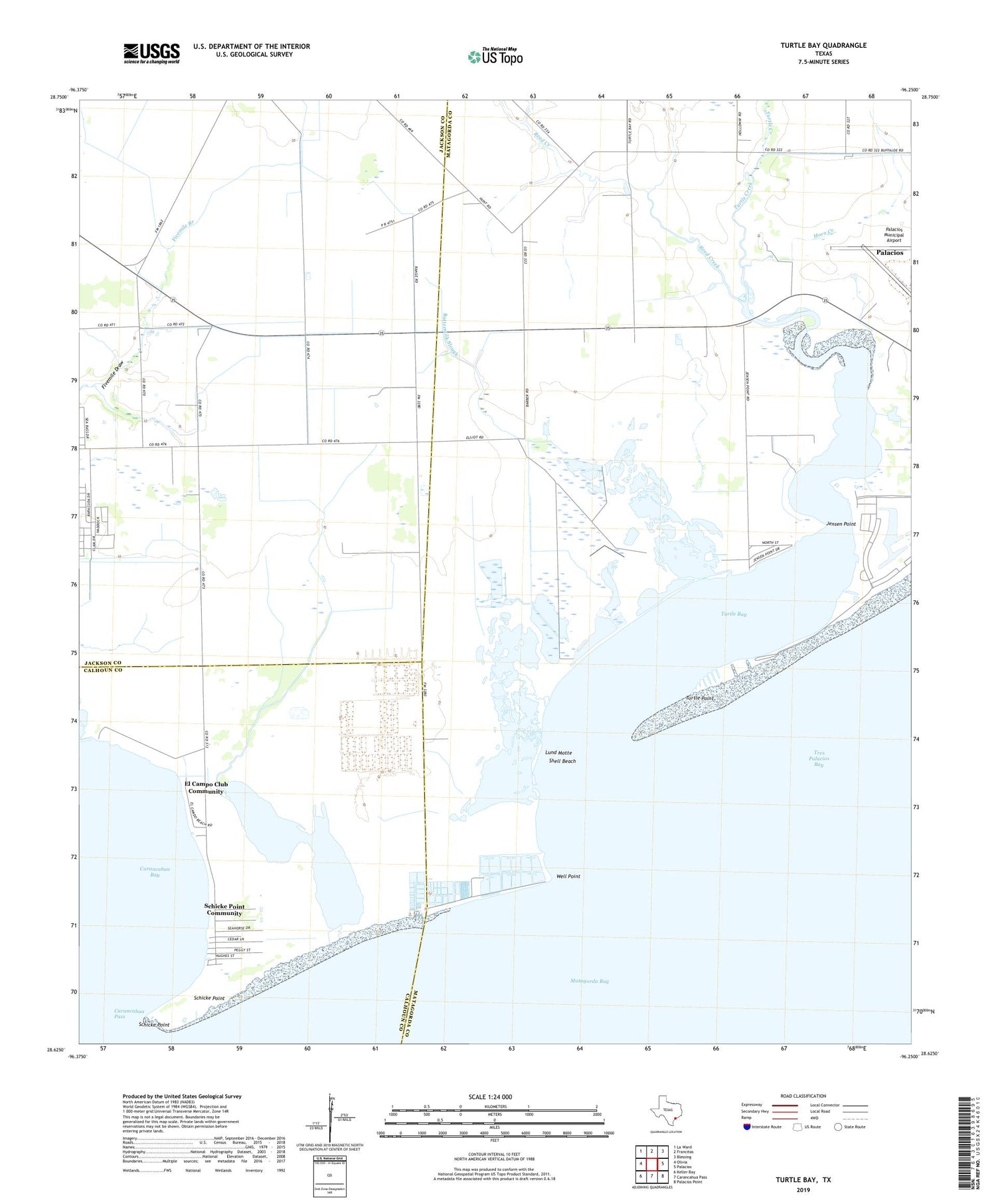
2019 topographic map quadrangle Turtle Bay in the state of Texas. Scale: 1:24000. Based on the newly updated USGS 7.5' US Topo map series, this map is in the following counties: Matagorda, Jackson, Calhoun. The map contains contour data, water features, and other items you are used to seeing on USGS maps, but also has updated roads and other features. This is the next generation of topographic maps. Printed on high-quality waterproof paper with UV fade-resistant inks.
Quads adjacent to this one:
West: Olivia
Northwest: La Ward
North: Francitas
Northeast: Blessing
East: Palacios
Southeast: Palacios Point
South: Carancahua Pass
Southwest: Keller Bay
Contains the following named places: At Last Marina, Buttermilk Slough, Carancahua Church, Carancahua Pass, El Campo Club, El Campo Club Community, Horn Creek, Jensen Point, Lund Motte, Palacios Army Air Field, Palacios Municipal Airport, Reed Creek, Sartwelle Lakes, Sartwelle Ranch Airport, Schicke Point, Schicke Point Community, Shell Beach, Turtle Bay, Turtle Creek, Turtle Point, Well Point


