MyTopo
Upper White Lake Texas US Topo Map
Couldn't load pickup availability
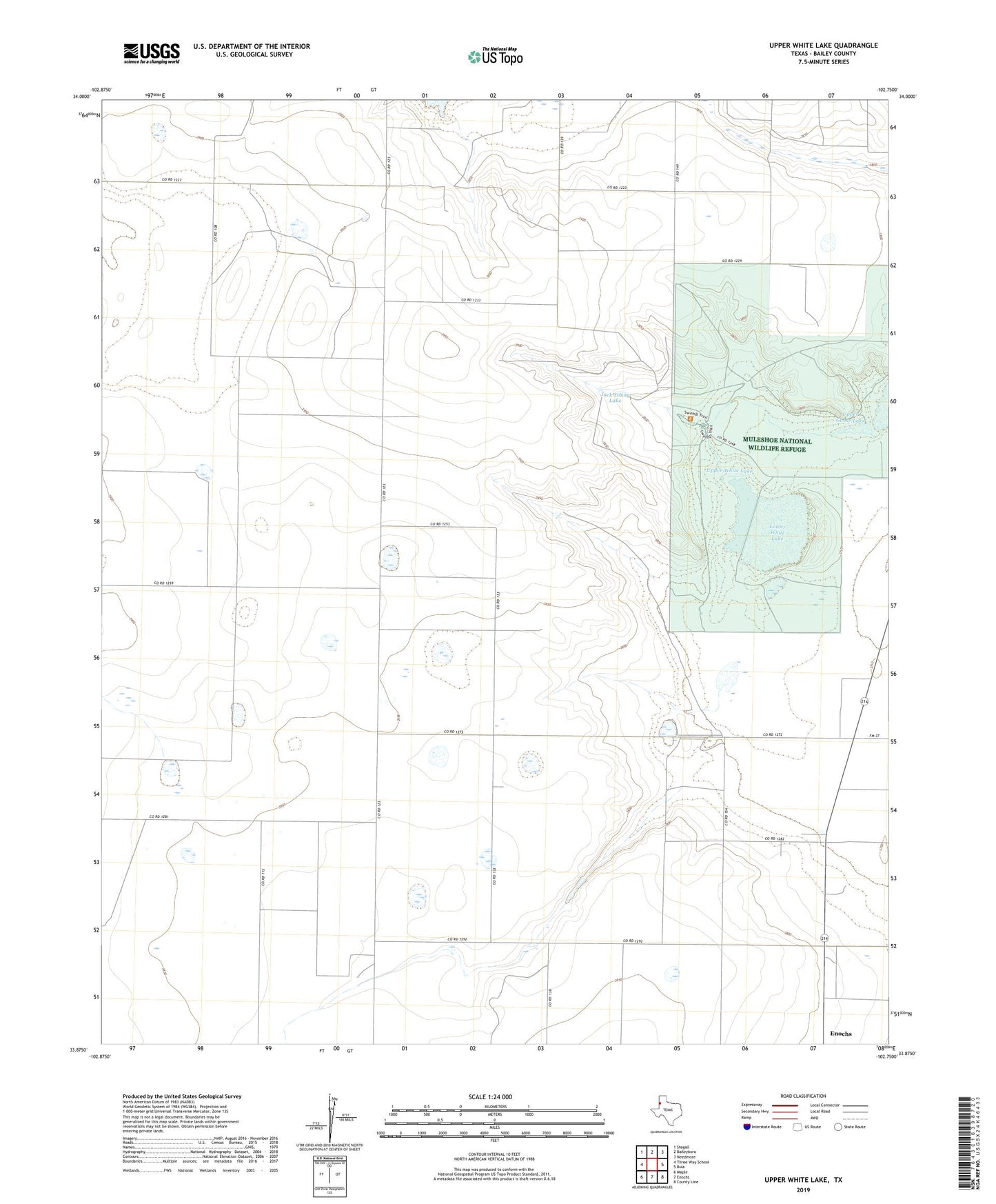
2019 topographic map quadrangle Upper White Lake in the state of Texas. Scale: 1:24000. Based on the newly updated USGS 7.5' US Topo map series, this map is in the following counties: Bailey. The map contains contour data, water features, and other items you are used to seeing on USGS maps, but also has updated roads and other features. This is the next generation of topographic maps. Printed on high-quality waterproof paper with UV fade-resistant inks.
Quads adjacent to this one:
West: Three Way School
Northwest: Stegall
North: Baileyboro
Northeast: Needmore
East: Bula
Southeast: County Line
South: Enochs
Southwest: Maple
Contains the following named places: Enochs Pond, Jack Young Dam, Jack Young Lake, Lower White Lake, Muleshoe National Wildlife Refuge, Refuge Headquarters, South Sand Hills Division, Upper Goose Lake, Upper White Lake