MyTopo
Zapata SE Texas US Topo Map
Couldn't load pickup availability
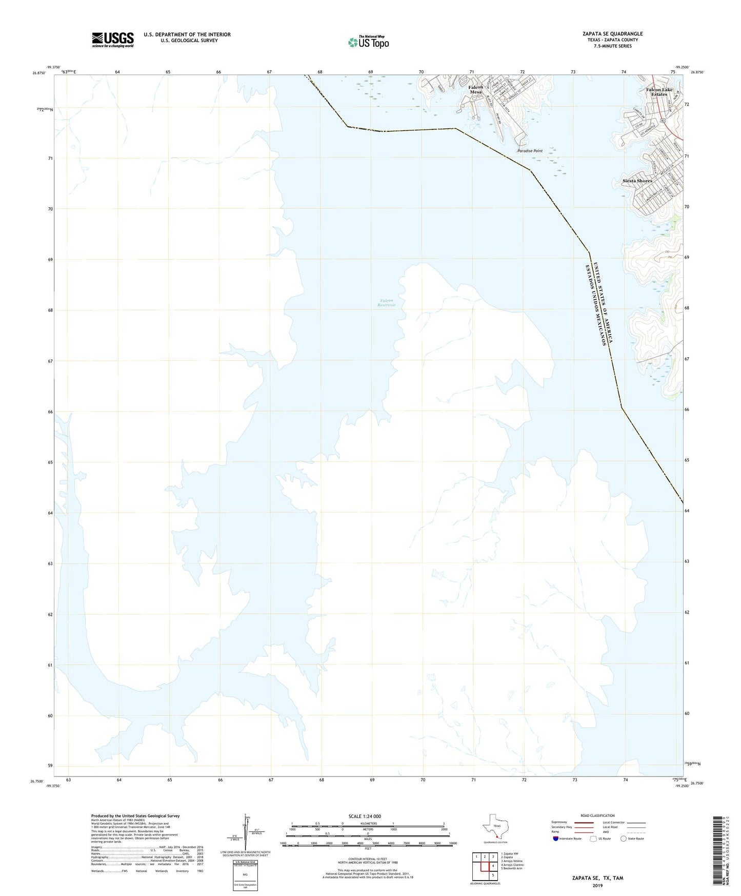
2019 topographic map quadrangle Zapata SE in the state of Texas. Scale: 1:24000. Based on the newly updated USGS 7.5' US Topo map series, this map is in the following counties: Zapata. The map contains contour data, water features, and other items you are used to seeing on USGS maps, but also has updated roads and other features. This is the next generation of topographic maps. Printed on high-quality waterproof paper with UV fade-resistant inks.
Quads adjacent to this one:
Northwest: Zapata NW
North: Zapata
Northeast: Arroyo Veleno
East: Arroyo Clareno
Southeast: Beckwith Arm
Contains the following named places: Buoy Number 1, Buoy Number 2, Falcon Lake, Falcon Lake Estates, Falcon Lake Estates Census Designated Place, Falcon Mesa, Falcon Mesa Census Designated Place, Four Seasons Colonia, Lago Halcon A Colonia, Lago Halcon B Colonia, Paradise Point, Siesta Shores, Siesta Shores 1 Colonia, Siesta Shores 3 Colonia, Siesta Shores Census Designated Place, Siesta Shores Section A Colonia, Sunset Villa Colonia