MyTopo
Duchesne Utah US Topo Map
Couldn't load pickup availability
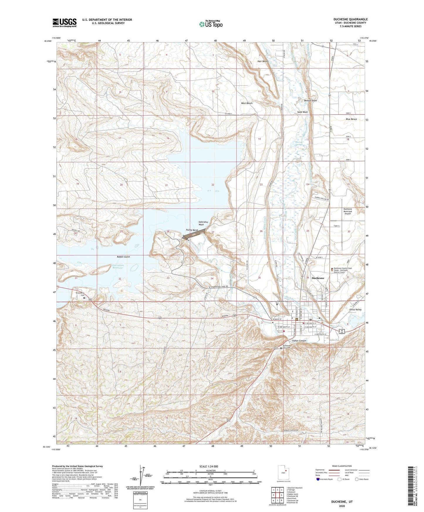
2020 topographic map quadrangle Duchesne in the state of Utah. Scale: 1:24000. Based on the newly updated USGS 7.5' US Topo map series, this map is in the following counties: Duchesne. The map contains contour data, water features, and other items you are used to seeing on USGS maps, but also has updated roads and other features. This is the next generation of topographic maps. Printed on high-quality waterproof paper with UV fade-resistant inks.
Quads adjacent to this one:
West: Rabbit Gulch
Northwest: Blacktail Mountain
North: Talmage
Northeast: Altamont
East: Duchesne NE
Southeast: Duchesne SE
South: Duchesne SW
Southwest: Buck Knoll
Contains the following named places: Benson Creek, Benson Draw, City Canal, City of Duchesne, Duchesne, Duchesne City Cemetery, Duchesne County Jail, Duchesne County Sheriff's Office, Duchesne Elementary School, Duchesne Fire Department, Duchesne High School, Duchesne Municipal Airport, Duchesne Post Office, First Baptist Church, Indian Canyon, Murray Springs, Murray White Canal, Pulley Bend, Rabbit Gulch, Rocky Point Canal, Saleratus Wash, Sand Wash, Starvation Campground, Starvation Dam, Starvation Reservoir, Starvation State Park, Strawberry Cemetery, Strawberry River, The Church of Jesus Christ of Latter Day Saints, Theodore Cemetery, United States Forest Service Fire Station - Office Duchesne, West Bench