MyTopo
Elephant Knoll Utah US Topo Map
Couldn't load pickup availability
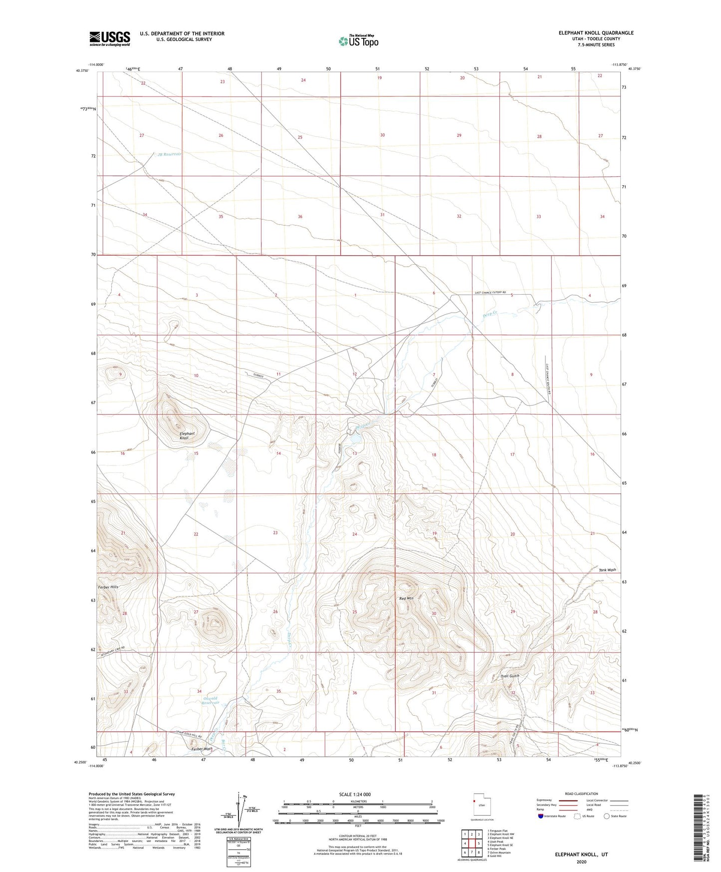
2020 topographic map quadrangle Elephant Knoll in the state of Utah. Scale: 1:24000. Based on the newly updated USGS 7.5' US Topo map series, this map is in the following counties: Tooele. The map contains contour data, water features, and other items you are used to seeing on USGS maps, but also has updated roads and other features. This is the next generation of topographic maps. Printed on high-quality waterproof paper with UV fade-resistant inks.
Quads adjacent to this one:
West: Utah Peak
Northwest: Ferguson Flat
North: Elephant Knoll NW
Northeast: Elephant Knoll NE
East: Elephant Knoll SE
Southeast: Gold Hill
South: Ochre Mountain
Southwest: Ferber Peak
Contains the following named places: Bar Creek, Deep Creek Dam, Deep Creek Reservoir, Elephant Knoll, Ferber Wash, JB Reservoir, Last Chance Ranch, Oswald Reservoir, Red Mountain, Trail Gulch