MyTopo
Lakeside Utah US Topo Map
Couldn't load pickup availability
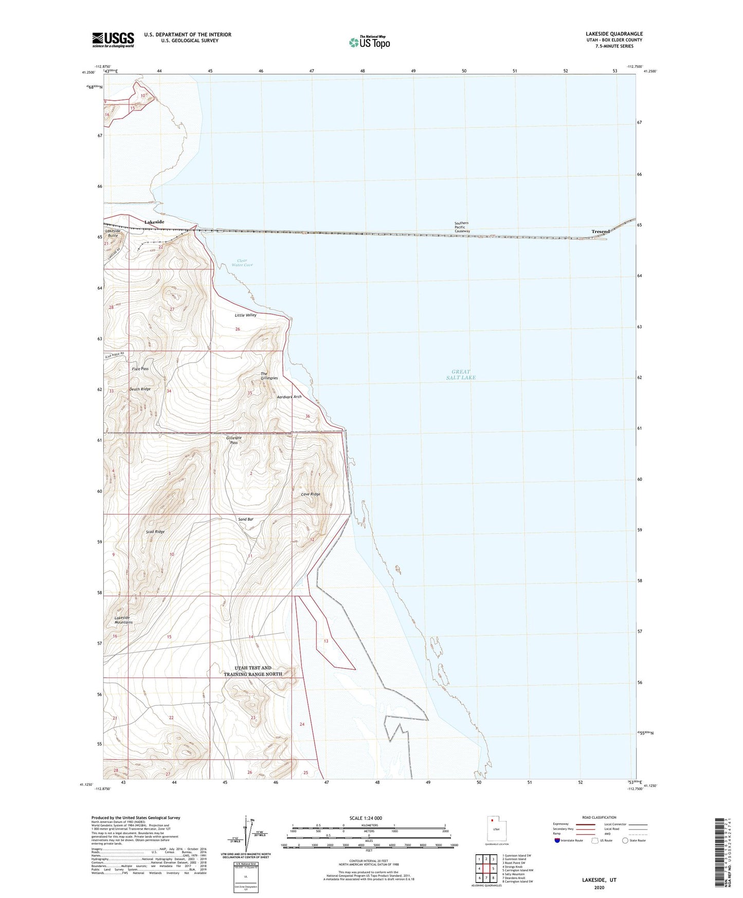
2020 topographic map quadrangle Lakeside in the state of Utah. Scale: 1:24000. Based on the newly updated USGS 7.5' US Topo map series, this map is in the following counties: Box Elder. The map contains contour data, water features, and other items you are used to seeing on USGS maps, but also has updated roads and other features. This is the next generation of topographic maps. Printed on high-quality waterproof paper with UV fade-resistant inks.
Quads adjacent to this one:
West: Strongs Knob
Northwest: Gunnison Island SW
North: Gunnison Island
Northeast: Rozel Point SW
East: Carrington Island NW
Southeast: Carrington Island SW
South: Deardens Knoll
Southwest: Sally Mountain
Contains the following named places: Aardvark Arch, Cave Ridge, Clear Water Cove, Fixit Pass, Gillespie Pass, Lakeside, Lakeside Butte, Lakeside Heliport, Little Valley, Sand Bar, Scad Ridge, The Gillespies, Tresend