MyTopo
Marjum Pass Utah US Topo Map
Couldn't load pickup availability
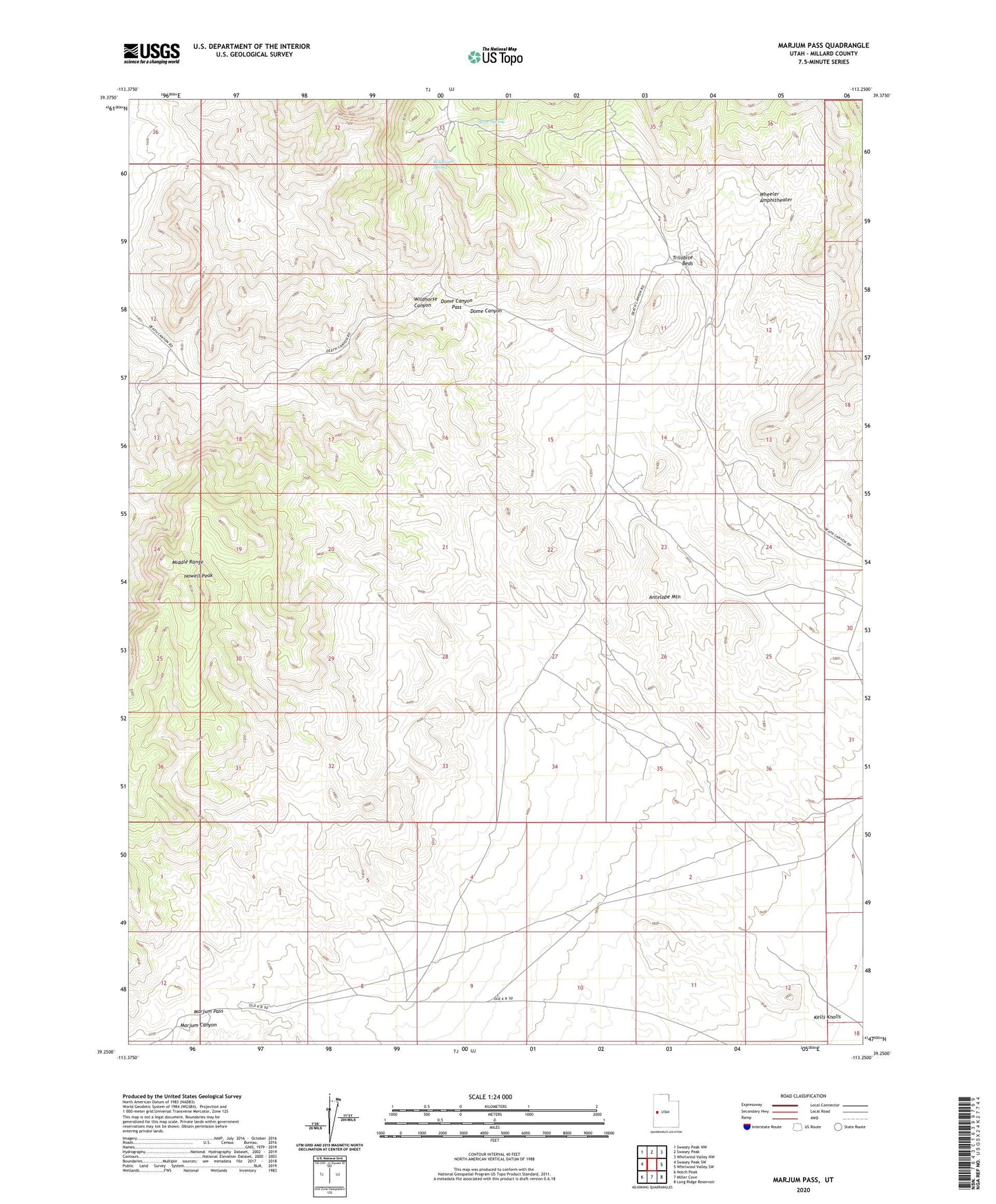
2020 topographic map quadrangle Marjum Pass in the state of Utah. Scale: 1:24000. Based on the newly updated USGS 7.5' US Topo map series, this map is in the following counties: Millard. The map contains contour data, water features, and other items you are used to seeing on USGS maps, but also has updated roads and other features. This is the next generation of topographic maps. Printed on high-quality waterproof paper with UV fade-resistant inks.
Quads adjacent to this one:
West: Swasey Peak SW
Northwest: Swasey Peak NW
North: Swasey Peak
Northeast: Whirlwind Valley NW
East: Whirlwind Valley SW
Southeast: Long Ridge Reservoir
South: Miller Cove
Southwest: Notch Peak
Contains the following named places: Antelope Mountain, CCC Camp Site, Dome Canyon Pass, Howell Peak, Kells Knolls, Marjum Pass, Sinbad Canyon, Stove Spring, Trilobite Beds, Wheeler Amphitheater, Wildhorse Canyon, Wildhorse Spring