MyTopo
The Barn Utah US Topo Map
Couldn't load pickup availability
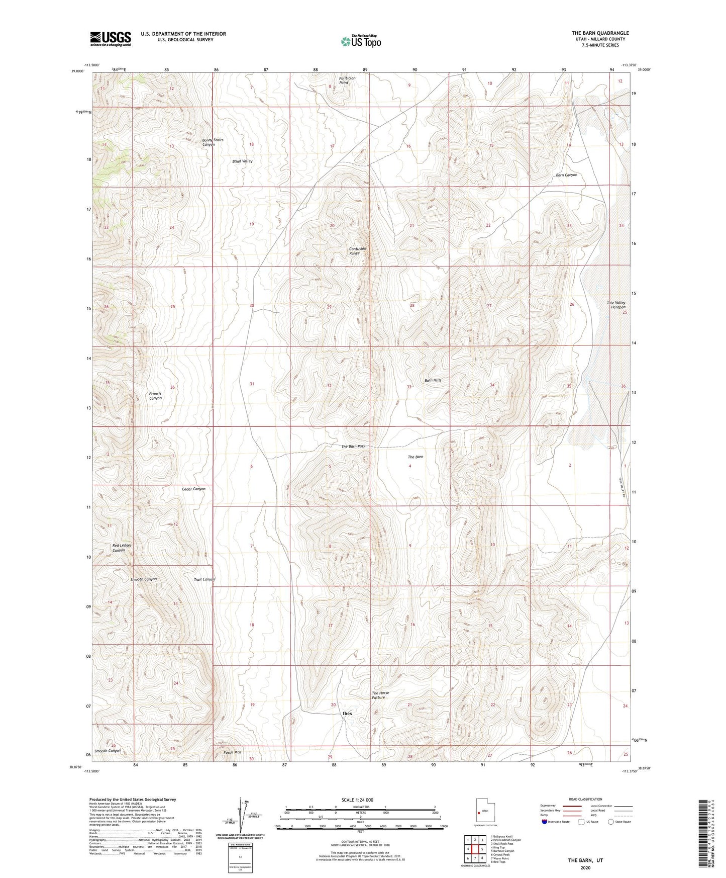
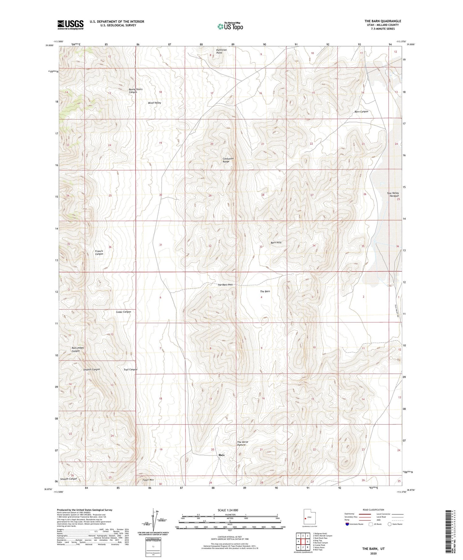
2020 topographic map quadrangle The Barn in the state of Utah. Scale: 1:24000. Based on the newly updated USGS 7.5' US Topo map series, this map is in the following counties: Millard. The map contains contour data, water features, and other items you are used to seeing on USGS maps, but also has updated roads and other features. This is the next generation of topographic maps. Printed on high-quality waterproof paper with UV fade-resistant inks.
Quads adjacent to this one:
West: King Top
Northwest: Bullgrass Knoll
Northeast: Skull Rock Pass
East: Burnout Canyon
Southeast: Red Tops
South: Warm Point
Southwest: Crystal Peak
Contains the following named places: Barn Canyon, Barn Hills, Bonny Stairs Canyon, Cedar Canyon, Fossil Mountain, Francis Canyon, Ibex, Ibex Post Office, Ibex Well, Politician Point, The Barn, The Barn Pass, The Horse Pasture, Trail Canyon, Tule Valley Hardpan