MyTopo
Looney Virginia US Topo Map
Couldn't load pickup availability
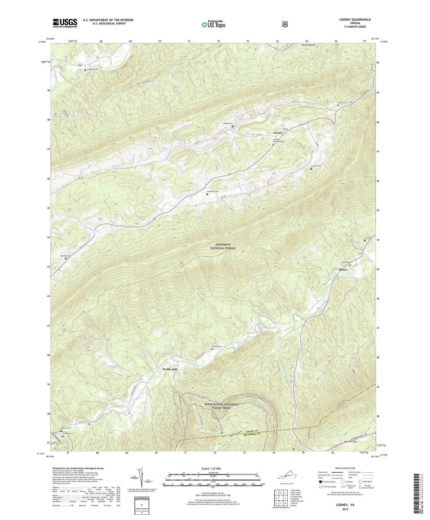
2019 topographic map quadrangle Looney in the state of Virginia. Scale: 1:24000. Based on the newly updated USGS 7.5' US Topo map series, this map is in the following counties: Craig, Roanoke. The map contains contour data, water features, and other items you are used to seeing on USGS maps, but also has updated roads and other features. This is the next generation of topographic maps. Printed on high-quality waterproof paper with UV fade-resistant inks.
Quads adjacent to this one:
West: Craig Springs
North: Potts Creek
Northeast: New Castle
East: Catawba
Southeast: Salem
South: Glenvar
Southwest: McDonalds Mill
Contains the following named places: Abbott, Aps Knob, Brickey Cemetery, Caldwell Cemetery, Catawba Church, Chestnut Grove Church, Chimney Rock, Craig County, Craig Creek District, Dragons Tooth Trailhead, Earn Knob, Furrow Cemetery, Grave Cemetery, Gunn, Harper Cemetery, Huffman Cemetery, Huffman Memorial Park, Lee Cemetery, Lee Hollow, Leffel Cemetery, Looney, Looney Cemetery, McAfee Gap, McAfee Run, Meadow Creek Falls, Mill Creek, Millers Cove, Murder Hole, New Castle District, New Hope Church, Paitsel Cemetery, Pickles Branch, Piney Ridge, Rocky Branch, Salem Church, Sarver Cemetery, Sinking Creek Mountain, Snodgrass Branch, Trout Creek, Trout Creek Appalachian Trail, Turnpike Creek, Upper Craig Creek Volunteer Fire Department, Webbs Mill, ZIP Code: 24127