MyTopo
Rice Virginia US Topo Map
Couldn't load pickup availability
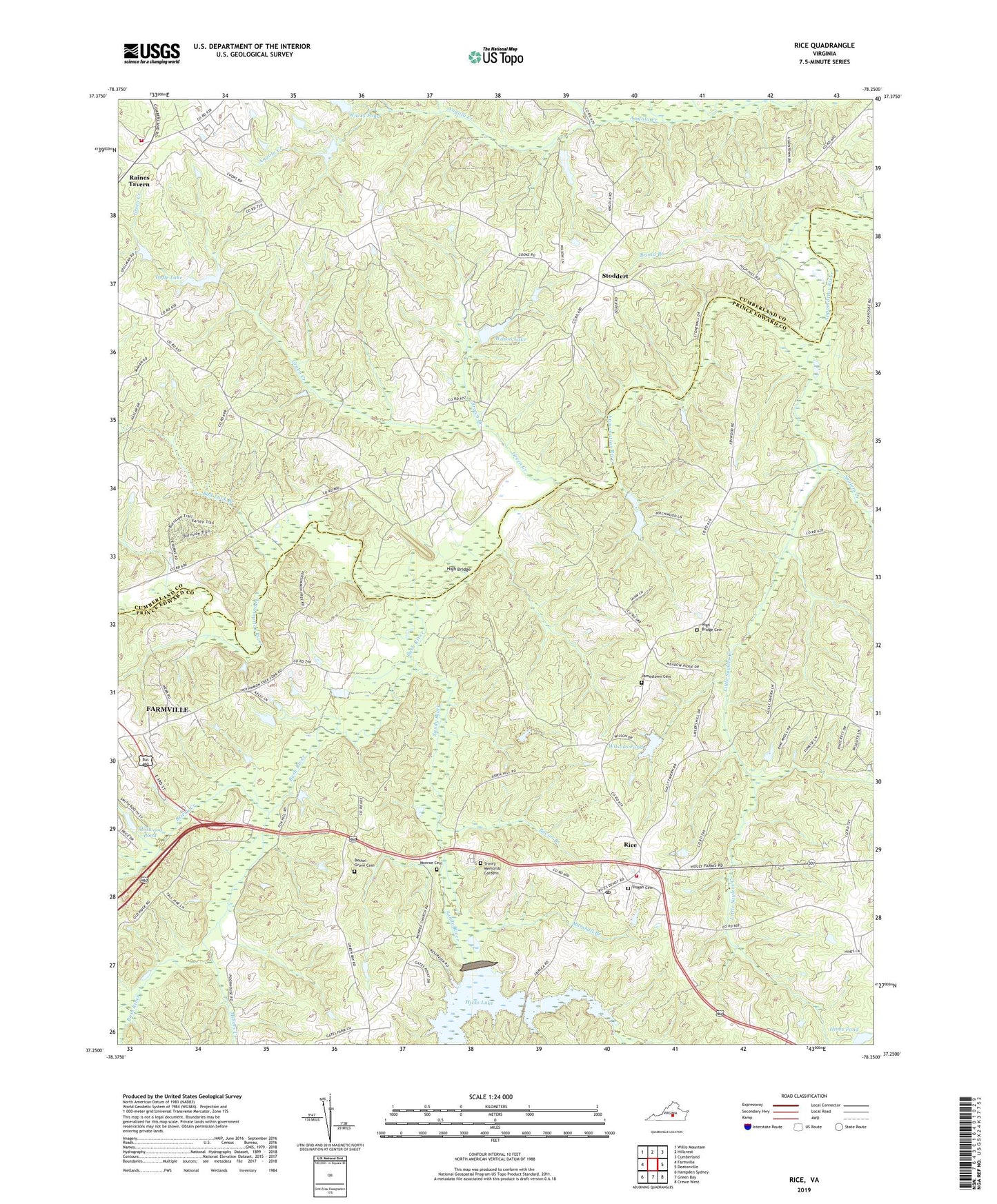
2019 topographic map quadrangle Rice in the state of Virginia. Scale: 1:24000. Based on the newly updated USGS 7.5' US Topo map series, this map is in the following counties: Prince Edward, Cumberland. The map contains contour data, water features, and other items you are used to seeing on USGS maps, but also has updated roads and other features. This is the next generation of topographic maps. Printed on high-quality waterproof paper with UV fade-resistant inks.
Quads adjacent to this one:
West: Farmville
Northwest: Willis Mountain
North: Hillcrest
Northeast: Cumberland
East: Deatonville
Southeast: Crewe West
South: Green Bay
Southwest: Hampden Sydney
Contains the following named places: Ancel Dam, Ancel Pond, Bacon Branch, Bad Luck Branch, Bethel Grove Cemetery, Bethel Grove Church, Briery Creek, Broad Branch, Brown Branch, Bush River, District 201, Double Bridge, Frost Dam, Green Creek, Green Creek Church, Green Creek School, High Bridge, High Bridge Cemetery, High Bridge Church, Hines Dam, Hines Pond, Ingle Dam, Ingle Lake, Jamestown, Jamestown Bridge, Jamestown Cemetery, Jamestown Church, Lafoon Watkins and Perry Dam, Lancaster Dam, Little Saylers Creek, Marrowbone Creek, Marshall Branch, Millers Creek, Millwood Pond, Millwood Pond Dam, Monroe Baptist Church Cemetery, Monroe Church, Mortons Ford, Old Green Creek Church, Perkinsons Mill, Pisgah Baptist Church Cemetery, Pisgah Church, Raines Tavern, Randolph District Volunteer Fire Department, Rice, Rice Post Office, Rice Volunteer Fire Department, Salem Church, Sandy River, Saylers Creek, Simpsons Mill, Stoddert, Stoddert School, Trinity Memorial Gardens, Union Church, Watson Dam, Wilck Dam, Wilcks Pond, Wilson Lake, Wilsons Dam, Wilsons Pond, ZIP Code: 23966