
MyTopo
Vernon Hill Virginia US Topo Map
Couldn't load pickup availability
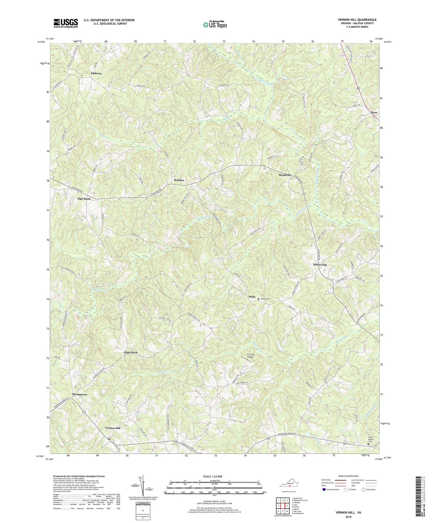
2019 topographic map quadrangle Vernon Hill in the state of Virginia. Scale: 1:24000. Based on the newly updated USGS 7.5' US Topo map series, this map is in the following counties: Halifax. The map contains contour data, water features, and other items you are used to seeing on USGS maps, but also has updated roads and other features. This is the next generation of topographic maps. Printed on high-quality waterproof paper with UV fade-resistant inks.
Quads adjacent to this one:
West: Java
Northwest: Mount Airy
North: Republican Grove
Northeast: Nathalie
East: Halifax
Southeast: South Boston
South: Oak Level
Southwest: Ingram
Contains the following named places: Asbury Cemetery, Asbury Church, Banister Hill Church, Blue Rock Church, Blue Rock School, Bradley Creek, Bye Creek, Chaneys Store, County Line Church, County Line School, District 3, Elkhorn, Elkhorn Baptist Church, Elkhorn School, Fox Fire Airport, Haskins School, High Rock, Meadville, Meadville Elementary School, Millstone Church, New Bethel Cemetery, New Bethel Church, New Zion Church, Pine Ridge Farm, Plato, Rodden, Rosa, Sandy Creek, Sign Rock, Thompsons, Vernon Hill, Vernon Hill Post Office, White Oak, Wilson Memorial Elementary School, ZIP Code: 24597


