MyTopo
Ephrata Washington US Topo Map
Couldn't load pickup availability
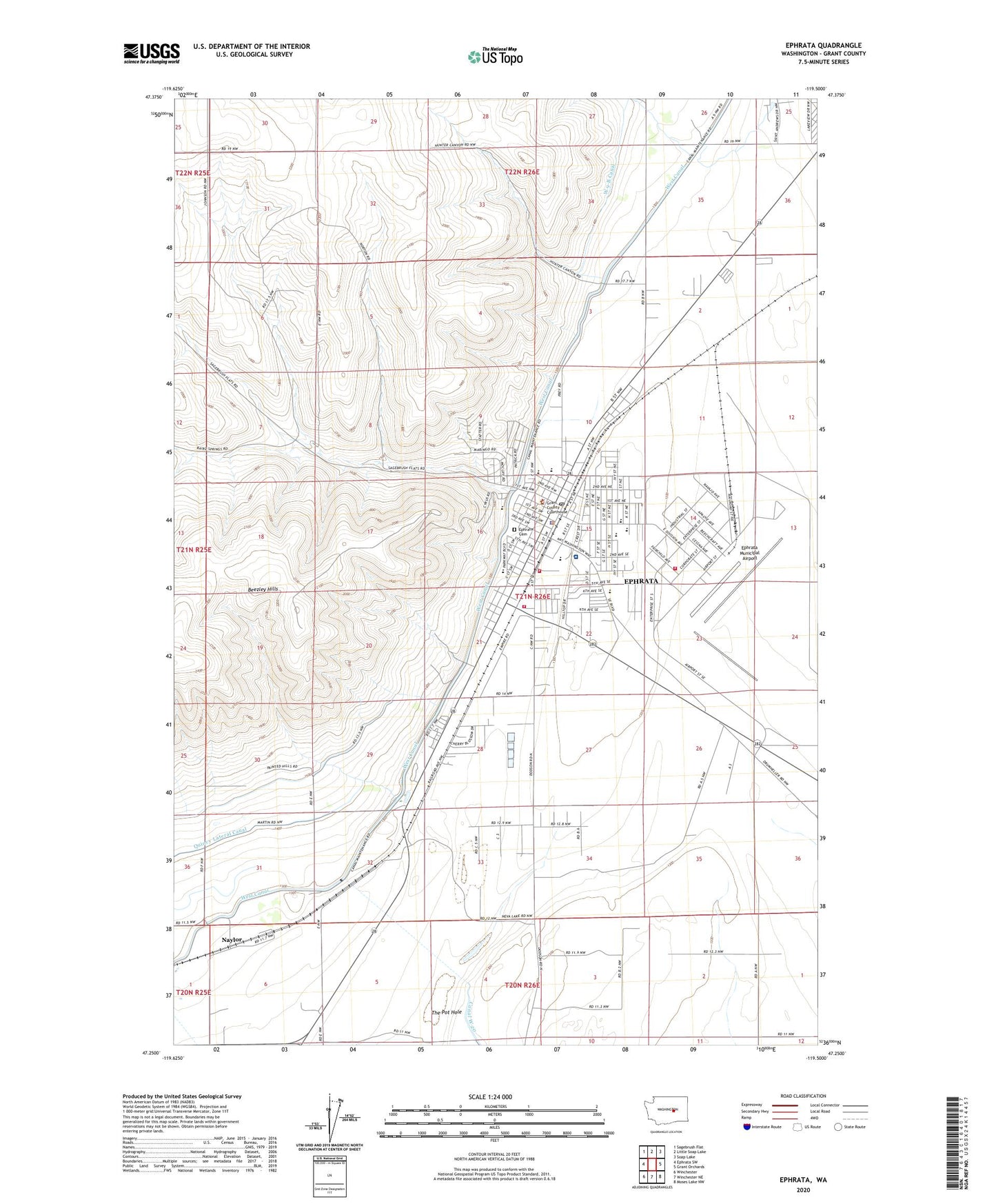
2020 topographic map quadrangle Ephrata in the state of Washington. Scale: 1:24000. Based on the newly updated USGS 7.5' US Topo map series, this map is in the following counties: Grant. The map contains contour data, water features, and other items you are used to seeing on USGS maps, but also has updated roads and other features. This is the next generation of topographic maps. Printed on high-quality waterproof paper with UV fade-resistant inks.
Quads adjacent to this one:
West: Ephrata SW
Northwest: Sagebrush Flat
North: Little Soap Lake
Northeast: Soap Lake
East: Grant Orchards
Southeast: Moses Lake NW
South: Winchester NE
Southwest: Winchester
Contains the following named places: Beasley Springs Elementary School, City of Ephrata, Columbia Basin Hospital, Columbia Basin Hospital Heliport, Columbia Ridge Elementary School, Davis Canyon, Drumheller Ranch, Ephrata, Ephrata Army Air Field, Ephrata Cemetery, Ephrata Fire Department, Ephrata Heights Park, Ephrata High School, Ephrata Middle School, Ephrata Municipal Airport, Ephrata Police Department, Ephrata Post Office, Ephrata Substation, Ephrata-Soap Lake Division, Grandview Elementary School, Grant County Courthouse, Grant County Fire District 13, Grant County Fire District 5 Station 14, Grant County Sheriff's Office, Grant Elementary School, Hunter Canyon, KULE-AM (Ephrata), KULE-FM (Ephrata), Lakeview, Lakeview Country Club, Maplewood Handicapped School, Naylor, New Life Christian School, Oasis Park, Olson Spur, Parkway Park, Parkway School, Saint Rose of Lima Catholic School, The Pot Hole