
MyTopo
Little Soap Lake Washington US Topo Map
Couldn't load pickup availability
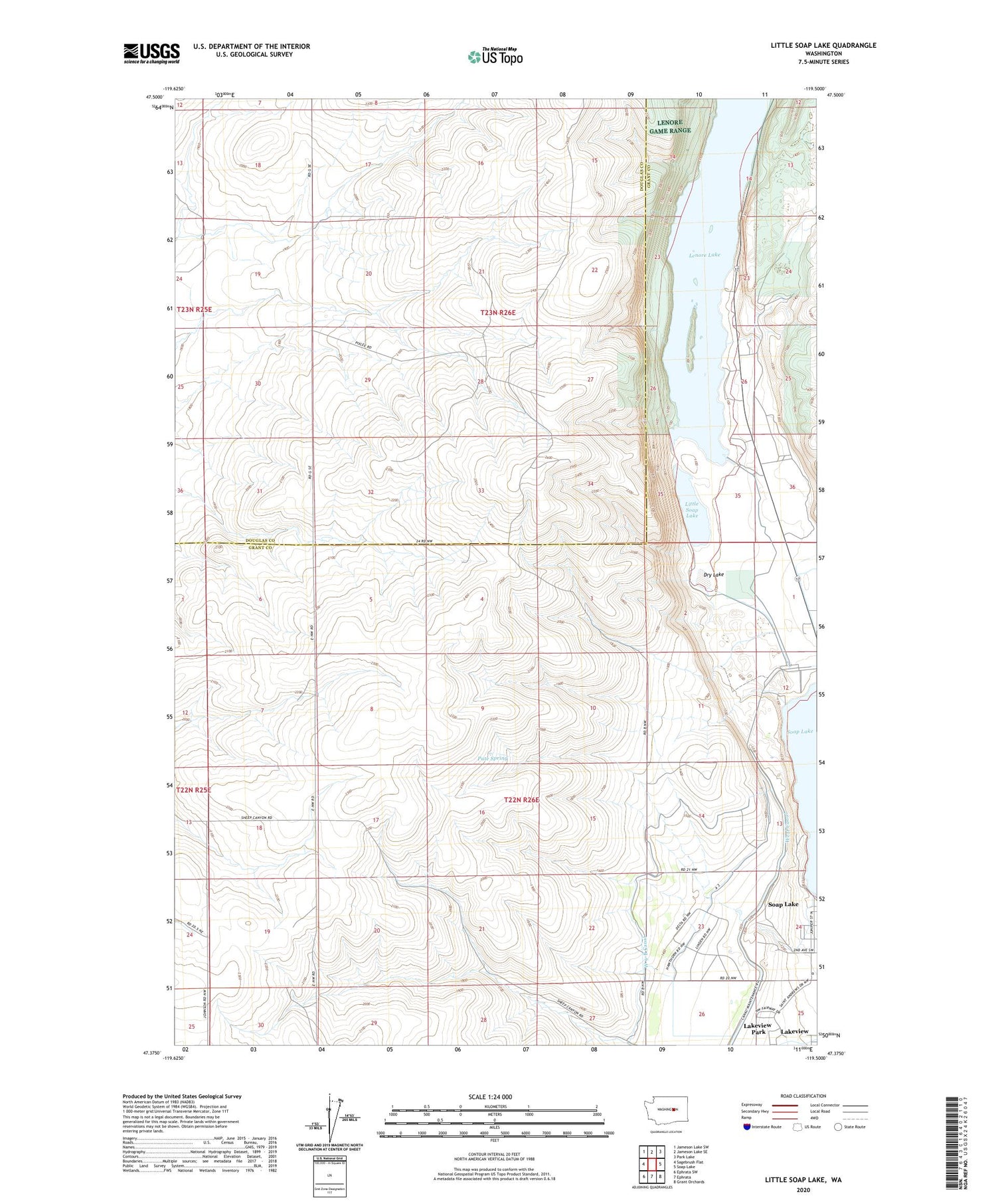
2020 topographic map quadrangle Little Soap Lake in the state of Washington. Scale: 1:24000. Based on the newly updated USGS 7.5' US Topo map series, this map is in the following counties: Grant, Douglas. The map contains contour data, water features, and other items you are used to seeing on USGS maps, but also has updated roads and other features. This is the next generation of topographic maps. Printed on high-quality waterproof paper with UV fade-resistant inks.
Quads adjacent to this one:
West: Sagebrush Flat
Northwest: Jameson Lake SW
North: Jameson Lake SE
Northeast: Park Lake
East: Soap Lake
Southeast: Grant Orchards
South: Ephrata
Southwest: Ephrata SW
Contains the following named places: Dry Lake, Lakeview Census Designated Place, Lakeview Park, Lenore Lake, Little Soap Lake, Main Canal, Pate Spring, Sheep Canyon, Sparks Canyon, Sunlake State Park, W 9-B Canal


