
MyTopo
Priest Rapids Washington US Topo Map
Couldn't load pickup availability
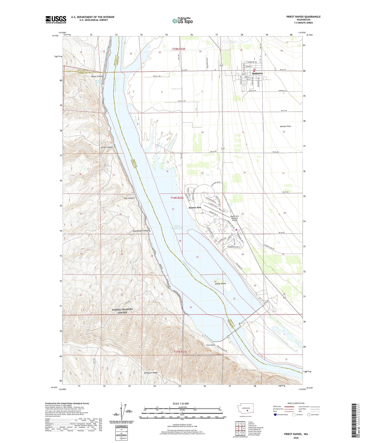
2020 topographic map quadrangle Priest Rapids in the state of Washington. Scale: 1:24000. Based on the newly updated USGS 7.5' US Topo map series, this map is in the following counties: Grant, Yakima, Kittitas. The map contains contour data, water features, and other items you are used to seeing on USGS maps, but also has updated roads and other features. This is the next generation of topographic maps. Printed on high-quality waterproof paper with UV fade-resistant inks.
Quads adjacent to this one:
West: Black Rock Spring NE
Northwest: Doris
North: Beverly
Northeast: Beverly SE
East: Priest Rapids NE
Southeast: Emerson Nipple
South: Cairn Hope Peak
Southwest: Black Rock Spring
Contains the following named places: Alkali Canyon, Borden Springs, City of Mattawa, Corral Canyon, Cow Canyon, Desert Aire, Desert Aire Census Designated Place, Desert Aire Regional Airport, Goose Island, Grant County Fire District 8, Grant County Fire District 8 Station 82, Mattawa, Mattawa Elementary School, Mattawa Police Department, Moran Slough, Moran Slough Dike Dam, Morris Schott Elementary School, Pozzuolana Mine, Priest Rapids, Priest Rapids Dam, Priest Rapids Lake, Priest Rapids Wildlife Recreation Area, Sourdough Canyon, Wahluke High School


