MyTopo
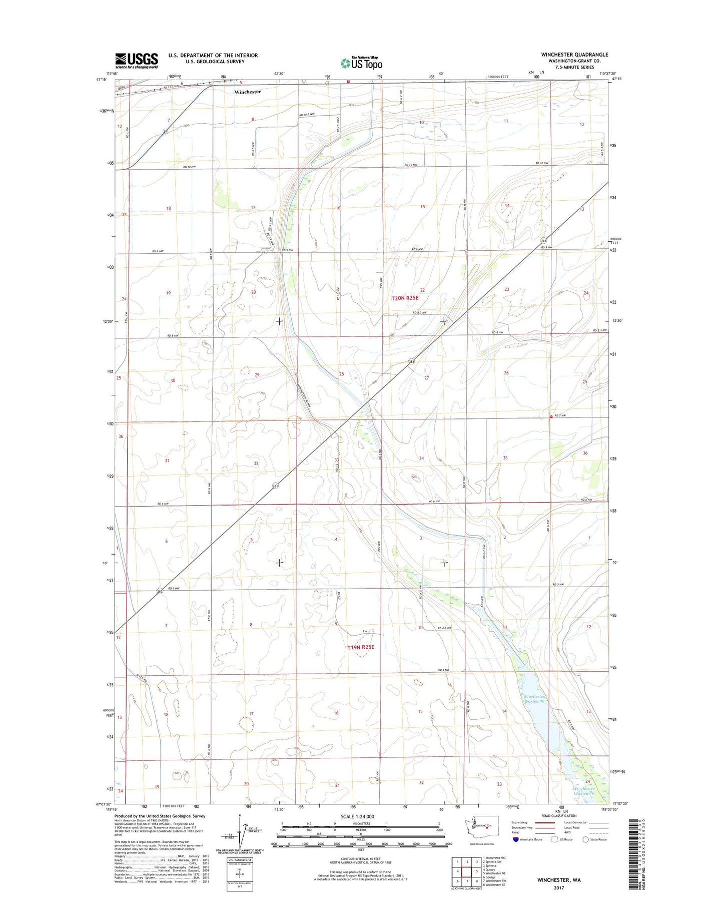
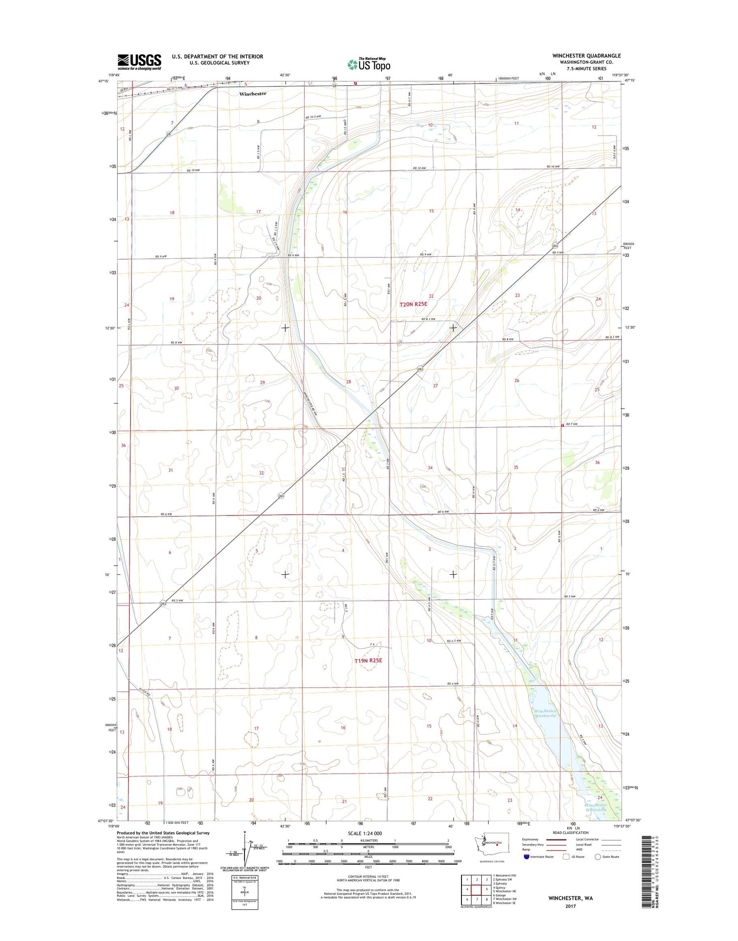
Winchester Washington US Topo Map
Couldn't load pickup availability
2020 topographic map quadrangle Winchester in the state of Washington. Scale: 1:24000. Based on the newly updated USGS 7.5' US Topo map series, this map is in the following counties: Grant. The map contains contour data, water features, and other items you are used to seeing on USGS maps, but also has updated roads and other features. This is the next generation of topographic maps. Printed on high-quality waterproof paper with UV fade-resistant inks.
Quads adjacent to this one:
West: Quincy
Northwest: Monument Hill
North: Ephrata SW
Northeast: Ephrata
East: Winchester NE
Southeast: Winchester SE
South: Winchester SW
Southwest: George
Contains the following named places: Grant County Fire District 3 Station 32, Grant County Fire District 3 Station 33, Grigg Farm Airport, North Columbia State Wildlife Recreation Area - Winchester Wasteway Unit, Winchester