MyTopo
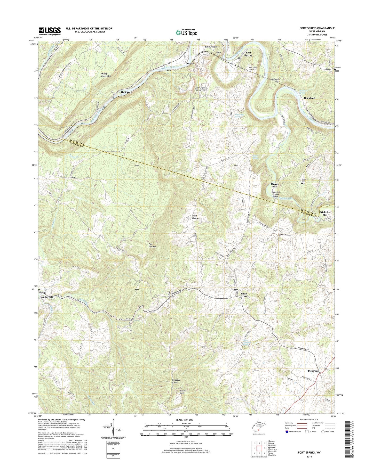
Fort Spring West Virginia US Topo Map
Couldn't load pickup availability
2019 topographic map quadrangle Fort Spring in the state of West Virginia. Scale: 1:24000. Based on the newly updated USGS 7.5' US Topo map series, this map is in the following counties: Monroe, Greenbrier. The map contains contour data, water features, and other items you are used to seeing on USGS maps, but also has updated roads and other features. This is the next generation of topographic maps. Printed on high-quality waterproof paper with UV fade-resistant inks.
Quads adjacent to this one:
West: Alderson
Northwest: Dawson
North: Asbury
Northeast: Lewisburg
East: Ronceverte
Southeast: Gap Mills
South: Union
Southwest: Greenville
Contains the following named places: Alderson Church, Bickett Knob, Broad Run, Broad Run Baptist Church, Cherry Row School, Chestnut Grove School, Ewing School, First Baptist Church, Flat Top Mountain, Fort Spring, Fort Spring Post Office, Fort Spring Tunnel, Frazier, Half Way, Hardy Run, Harry Campbell Spring, Hokes Mill, Hokes Mill Covered Bridge, James Memorial Church, John Kirby Spring, Lady Hall School, Lincoln Cemetery, Manns Tunnel, Miller Spring, Mount Vernon School, Mount Vernon United Methodist Church, Mount Vernon United Methodist Church Cemetery, Mount Zion Church, Nickells Mill, Patent School, Perry School, Pickaway, Pickaway Methodist Church, Rockland, Rockland Spring, Scott Hollow, Second Creek, Second Creek Tunnel, Sinks Grove, Sinks Grove Baptist Church, Sinks Grove Post Office, Snowflake, Spider Den School, Stephens Ferry, Sugar Tree School, Swoopes Knobs, WKCJ-FM (Lewisburg), Wolfcreek, Wolfcreek Post Office, ZIP Code: 24976