MyTopo
Hedgesville West Virginia US Topo Map
Couldn't load pickup availability
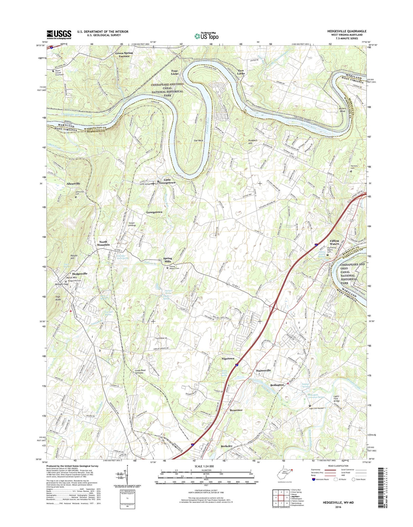
2019 topographic map quadrangle Hedgesville in the states of West Virginia, Maryland. Scale: 1:24000. Based on the newly updated USGS 7.5' US Topo map series, this map is in the following counties: Berkeley, Washington. The map contains contour data, water features, and other items you are used to seeing on USGS maps, but also has updated roads and other features. This is the next generation of topographic maps. Printed on high-quality waterproof paper with UV fade-resistant inks.
Quads adjacent to this one:
Northwest: Cherry Run
North: Clear Spring
Northeast: Mason and Dixon
East: Williamsport
Southeast: Shepherdstown
South: Martinsburg
Southwest: Tablers Station
Contains the following named places: Allensville, Allensville Cemetery, Back Creek, Beddington Methodist Church, Beddington School, Bedington, Bedington Elementary School, Bedington Post Office, Bedington Volunteer Fire Department, Berkeley, Berkeley County Emergency Ambulance Authority 40, Berkeley County Emergency Ambulance Authority North Station Unit 96, Bessemer, Bethany Church, Board of Child Care, Camp Spring Run, Cedar Grove School, Cranberry Branch Dam, Cumbo Yard, Dam Number 5, Dennis Farm Spring, Doctor N B Groves Workcenter, Eastern Panhandle Training Center, Falling Waters, Falling Waters Cemetery, Falling Waters Census Designated Place, Falling Waters Ferry, Falling Waters Presbyterian Church, Falling Waters School, Falling Waters Springs, Flying d Airport, Fort Hill Spring, Four Locks, Four Locks Picnic Area, Four Locks Ranger Station, Georgetown, Georgetown School, Grade Road Overpass, Green Landings, Green Spring Furnace, Green Spring Run, Greenspring Hill, Guard Lock Number 5, Hainesville, Harlan Run, Harlan Spring, Harlan Spring Historic District, Harmony Cemetery, Harmony Church, Hedgesville, Hedgesville Baptist Church, Hedgesville Cemetery, Hedgesville Elementary School, Hedgesville High School, Hedgesville Historic District, Hedgesville Middle School, Hedgesville Volunteer Fire Department, High Knob, Hoke Run, Honeywood Mills, Independent Church, James Rumsey Technical Institute, Light Cemetery, Lights Ford, Lights Ford Bridge, Little Conococheague Creek, Little Georgetown, Little Georgetown Cemetery, Little Georgetown Methodist Church, Lock Number 45, Lock Number 46, Lock Number 47, Lock Number 48, Lock Number 49, Lock Number 50, Martinsburg Christian Academy, McCoys Ferry, McCoys Ferry Campground, Millers Bend, Mount Carmel Evangelical Lutheran Church, Mount Carmel United Methodist Church Cemetery, Mount Zion Church, Myers Bridge, Nestles Quarry, Newkirks Mill, Nipetown, Nipetown School, North Mountain, Oak Grove School, Old Falling Waters Cemetery, Old Falling Waters Presbyterian Church, Porterfield Limestone Spring, Potato Hill, Potomac District, Potomack Intermediate School, Prospect Hill, Shenandoah Bible Church, Skinners Gap, Speck Farm Spring, Speck Spring, Spring Mill Spring, Spring Mills, Spring Mills Middle School, Stonewall Jackson Monument, Sulphur Springs, Sunnyside School, Tabb, Taylor Spring, The Neck, Toms Run, Town of Hedgesville, Town Spring, Tulissus Branch, Two Locks, Welltown School, Will Ellis Farm Spring, Woodbrier Country Club, Woodbrier Golf Course, ZIP Code: 25419